
Otjozondjupa is one of the fourteen regions of Namibia. Its capital is Otjiwarongo. The region further contains the municipalities of Okahandja and Grootfontein and the towns Okakarara and Otavi. As of 2020, Otjozondjupa had 97,945 registered voters.
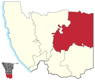
Keetmanshoop Rural is an electoral constituency in the ǁKaras Region of Namibia. It contains the Krönlein suburb of Keetmanshoop and the villages of Koës and Aroab, the settlements of Seeheim and Klein Karas, as well as several farming communities in the area. The constituency office is situated in Aroab. It had a populations of 7,219 in 2011, up from 6,399 in 2001. As of 2020 the constituency had 6,398 registered voters.

Katutura Central is a constituency in the Khomas Region of Namibia, comprising the extensions 2–5 and 7–11 of Windhoek's suburb Katutura. Katutura is a township that was founded by the then apartheid government of Namibia for black people in the 1950s, when the previous township, Old Location, was converted into the suburb Hochland Park.

Khomasdal North is a constituency in Windhoek in the Khomas Region of Namibia. As of December 2019 it had 25,550 registered voters. The constituency consists of parts of the suburbs Khomasdal, Katutura, and Otjomuise. It had a population of 43,921 in 2011, up from 27,950 in 2001.

Outjo is an electoral constituency in the Kunene Region of Namibia. Its district capital is the town of Outjo, its population was 8,947 in 2004. As of 2020, it has 9,197 registered voters.

Otjiwarongo is a city of 28,000 inhabitants in the Otjozondjupa Region of Namibia. It is the district capital of the Otjiwarongo electoral constituency and also the capital of Otjozondjupa.

Rehoboth Urban West is an electoral constituency in the Hardap region of Namibia, comprising the suburbs of Rehoboth that are situated to the west of the national road B1. It had a population of 11,197 in 2011, up from 9,238 in 2001. As of 2020 the constituency had 8,324 registered voters.

Omaruru is a constituency in the Erongo Region of central-eastern Namibia. Its district capital is the city of Omaruru. It had a population of 8,577 in 2011, up from 7,156 in 2001. As of 2020 the constituency had 6,672 registered voters.
Okakarara is a town in Otjozondjupa Region, Namibia, located 50 kilometres (31 mi) southeast of Waterberg National Park. It has an estimated population of 7,000 and is currently growing by 1,500 inhabitants annually.
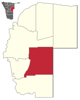
Kalahari Constituency is an electoral constituency in the Omaheke Region of eastern central Namibia. It had 9,234 inhabitants in 2004 and 5,294 registered voters in 2020. The constituency covers the rural area east of Gobabis as well as Gobabis' Nossobville suburb. The constituency office has been inaugurated in 2009 and is located at the Ben-Hur settlement. Kalahari constituency forms part of the border between Namibia and Botswana.
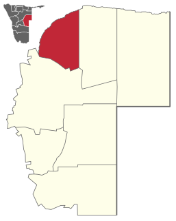
Otjinene Constituency is an electoral constituency in the Omaheke Region of Namibia. It had 7,400 inhabitants in 2011 and 5,619 registered voters in 2020. Its district capital is the village of Otjinene.
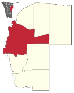
Okorukambe Constituency, until 2013 Steinhausen Constituency, is an electoral constituency in the Omaheke Region of Namibia. It had 9,066 inhabitants in 2004 and 5,818 registered voters in 2020. Its district capital is the settlement of Steinhausen. It further contains the settlements of Witvlei and Omitara.
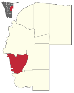
Gobabis Constituency is an electoral constituency in the Omaheke Region of Namibia. As of December 2019 it had 13,457 registered voters. The constituency covers the rural area southeast of Gobabis and the town itself, except its Nossobville suburb. Gobabis is also the administrative centre of the constituency.

Grootfontein Constituency is an electoral constituency in the Otjozondjupa Region of Namibia. It had 21,595 inhabitants in 2004 and 16,629 registered voters in 2020. The constituency consists of the town of Grootfontein and the surrounding rural area.

Okahandja Constituency is an electoral constituency in the Otjozondjupa Region of Namibia. It had 18,155 inhabitants in 2004 and 18,109 registered voters in 2020. The constituency consists of the town of Okahandja and the surrounding rural area.

Okakarara Constituency is an electoral constituency in the Otjozondjupa Region of Namibia. It had 21,336 inhabitants in 2004 and 16,221 registered voters in 2020. The constituency consists of the town of Okakarara and the surrounding rural area.

Omatako Constituency is an electoral constituency in the Otjozondjupa Region of Namibia. It had 11,998 inhabitants in 2004 and 7,372 registered voters in 2020. The constituency contains the settlements of Kalkfeld, Hochfeld and Ovitoto, as well as the Osire refugee camp and the Osona military base. Omatako Constituency is named after the Omatako Mountains, a prominent geological feature of the constituency.

Tsumkwe Constituency is an electoral constituency in the Otjozondjupa Region of Namibia. It had 8,823 inhabitants in 2004 and 7,075 registered voters in 2020. About 2,400 San people live in this constituency. The constituency consists of the settlement of Tsumkwe and the surrounding rural area.

Opuwo Rural is an electoral constituency in the Kunene Region of Namibia. The administrative centre of Opuwo Rural is the settlement of Otuani. As of 2020, it has 7,315 registered voters.

Opuwo Urban is a constituency in the Kunene Region of Namibia. It comprises the townlands of Opuwo, which is also its administrative centre. As of 2020, it has 10,590 registered voters.


