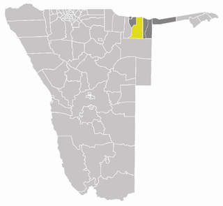
Katima Mulilo Urban is a constituency in the Zambezi Region of Namibia, covering the capital city of the region, Katima Mulilo. As of 2004, the Constituency had 10,778 registered voters.

Keetmanshoop Rural is an electoral constituency in the ǁKaras Region of Namibia. It contains the Krönlein suburb of Keetmanshoop and the villages of Koës and Aroab, the settlements of Seeheim and Klein Karas, as well as several farming communities in the area. The constituency office is situated in Aroab.
Rehoboth Urban West is an electoral constituency in the Hardap region of Namibia, comprising the suburbs of Rehoboth that are situated to the west of the national road B1. It has a population of 9201.

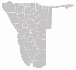
Otavi is a town of 4,000 inhabitants in the Otjozondjupa Region of central Namibia. It is the district capital of the Otavi electoral constituency. Most of the area is dolomitic (Precambrian) and the district was in the past renowned for its mineral wealth. Most of the deposits have now been exhausted.

Tobias Hainyeko constituency is the name of an electoral constituency in Windhoek, the capital of Namibia. It was created in 2003 under the name Eastern Hakahana at the recommendation of the Third Delimitation Commission which suggested that the constituency of Hakahana be split. Since then, the suburb of Hakahana falls into two different constituencies. In 2008 the constituency was named after the guerrilla war hero Tobias Hainyeko. The western part of Hakahana is now called Moses ǁGaroëb constituency, after politician Moses ǁGaroëb.

Mpungu is a constituency in the Kavango West region of Namibia. Its population is 18,332. Nkurenkuru, the capital of Kavango West, is situated in this constituency. The Mpungu settlement is also located here.
Mashare is a constituency in the Kavango East region of Namibia. It has 15,829 inhabitants, the district centre is the settlement of Mashare.

Kapako is a constituency in the Kavango West region of Namibia. It has 25,653 inhabitants, the district centre is the settlement of Kapako.

Ndiyona is a constituency in the Kavango East region of Namibia. As of 2004 it has 19,150 inhabitants, the district centre is the settlement of Ndiyona.

Eenhana is a constituency in the Ohangwena Region of Namibia, on the border to Angola. It has 24,193 inhabitants, the district centre is the town of Eenhana.

Aminuis Constituency is a electoral constituency in the Omaheke Region of Namibia. It has 12,343 inhabitants, its district capital is the settlement of Aminuis. The constituency forms part of the border between Namibia and Botswana.

Otjombinde Constituency is an electoral constituency in the Omaheke Region of Namibia. It had 6,378 inhabitants in 2004. The district capital of the constituency is the settlement of Otjombinde, its main economic hub is Talismanus. The constituency forms part of the border between Namibia and Botswana, it contains the settlements of Eiseb, Helena, and Rietfontein.

Okalongo Constituency is an electoral constituency in the Omusati Region of Namibia on the border to Angola. It has 28,657 inhabitants. The constituency's capital is the settlement of Okalongo. It further contains villages such as: Onandjaba, Omatwadiva, Onaidjimba, Okafitu Kauvale, Olwiili, Ongolo, Ondudu, Onembaba, Ondobe Yehumba, Ondobe Yefidi, Ohakapeke, Olupandu, Epoko, Olupito, Onambome and many more.

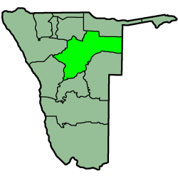
Grootfontein Constituency is an electoral constituency in the Otjozondjupa Region of Namibia. It has 21,595 inhabitants as of 2004 and consists of the town of Grootfontein and the surrounding rural area.

Okakarara Constituency is an electoral constituency in the Otjozondjupa Region of Namibia. It has 21,336 inhabitants and consists of the town of Okakarara and the surrounding rural area.

Omatako Constituency is an electoral constituency in the Otjozondjupa Region of Namibia. It has 11,998 inhabitants and contains the settlements of Kalkfeld, Hochfeld and Ovitoto, as well as the Osire refugee camp and the Osona military base.

Otjiwarongo Constituency is an electoral constituency in the Otjozondjupa Region of Namibia. It has 22,614 inhabitants and consists of the town of Otjiwarongo and the surrounding rural area.

Tsumkwe Constituency is an electoral constituency in the Otjozondjupa Region of Namibia. It has 8,823 inhabitants and consists of the settlement of Tsumkwe and the surrounding rural area.
Rundu Urban is a political constituency in the Kavango East region of Namibia. It covers the urban area of Rundu, one of Namibia's largest cities. The constituency also covers parts of the Sauyemwa, Safari, Tutungeni, Katutura, Donkerhoek and Kehemu neighborhoods.