Constituencies of Namibia

Last updated
The 121 Constituencies of Namibia Wahlkreise in Namibia (2014).svg
The 121 Constituencies of Namibia

Each of the 14 regions of Namibia is further subdivided into electoral constituencies. The size of the constituencies varies with the size and population of each region. There are currently 121 constituencies in Namibia. The most populous constituency according to the 2011 census was Rundu Urban in the Kavango West region with 63,431 people; the least populous was Okatyali in the Oshana region with 3,187 people. [1] The administrative division of Namibia is tabled by Delimitation Commissions and accepted or declined by the National Assembly. In 1992, the First Delimitation Commission chaired by Judge President Johan Strydom determined the number of constituencies to be 95. Since then, every Delimitation Commission has increased this number to accommodate population growth. [2] The fourth Delimitation Commission increased the number of constituencies to its present number in 2013. [3]

Local councillors are directly elected through secret ballots (regional elections) by the inhabitants of their constituencies. [4] They occupy a constituency office in the main settlement of their district. However, once elected they keep their full-time job and are expected to run their constituencies after hours. [5] Consequently, they receive allowances rather than salaries, although the remuneration does compare to a mid-range salaried position. [6]

Regional councillors are indirectly elected from and by the constituency councillors in each region. Each region sends three of their local councillors to represent their region in the National Council of Namibia. [4]

List of constituencies

ConstituencyCapitalRegistered Voters (2020) [7] Region
Arandis Arandis 8,888 Erongo Region

Erongo in Namibia.svg

Dâures 7,882
Karibib Karibib 9,617
Omaruru Omaruru 6,672
Swakopmund Swakopmund 35,668
Walvis Bay Rural Walvis Bay 25,746
Walvis Bay Urban Walvis Bay 25,311
Aranos Aranos 5,604 Hardap Region

Hardap in Namibia.svg

Daweb Maltahöhe 3,297
Gibeon Gibeon 3,951
Mariental Rural Mariental 4,065
Mariental Urban Mariental 10,480
Rehoboth Rural 4,701
Rehoboth Urban East Rehoboth 12,112
Rehoboth Urban West Rehoboth 8,324
Mashare Mashare 9,165 Kavango East Region

Kavango East in Namibia.svg

Mukwe Mukwe 16,678
Ndiyona Ndiyona 6,210
Ndonga Linena Ndonga Linena 6,597
Rundu Rural 6,060
Rundu Urban Rundu 35,740
Kapako Kapako Kavango West Region

Kavango West in Namibia.svg

Mankumpi Satotwa
Mpungu 9,121
Musese Rupara 6,494
Ncamangoro Ncamagoro 6,494
Ncuncuni 4,554
Nkurenkuru Nkurenkuru
Tondoro Mburuuru
John Pandeni 14,758 Khomas Region

Khomas in Namibia.svg

Katutura Central 19,340
Katutura East 15,878
Khomasdal North 43,921
Moses ǁGaroëb 41,550
Samora Machel 45,962
Tobias Hainyeko 36,530
Windhoek East 17,308
Windhoek Rural Groot Aub 13,625
Windhoek West 33,556
Epupa 12,182 Kunene Region

Kunene in Namibia.svg

Kamanjab Kamanjab 4,862
Khorixas Khorixas 8,788
Opuwo Rural Otuani 7,315
Opuwo Urban Opuwo 10,590
Outjo Outjo 9,197
Sesfontein Sesfontein 5,614
Eenhana Eenhana 15,912 Ohangwena Region

Ohangwena in Namibia.svg

Endola Endola 14,100
Engela 13,743
Epembe Epembe 6,489
Ohangwena Onhuno 13,181
Okongo Okongo 12,562
Omulonga Onamukulo 13,585
Omundaungilo 6,642
Ondobe Oshandi 16,286
Ongenga Ongenga 12,682
Oshikango 17,480
Oshikunde Omutwewomunu 8,062
Aminuis Aminuis 7,847 Omaheke Region

Omaheke in Namibia.svg

Epukiro Epukiro 4,646
Gobabis Gobabis 13,457
Kalahari Ben-Hur 5,294
Otjinene Otjinene 5,619
Otjombinde Otjombinde 4,879
Okorukambe Steinhausen 5,818
Anamulenge Anamulenge 11,186 Omusati Region

Omusati in Namibia.svg

Elim Elim 7,883
Etayi Etayi 16,716
Ogongo Ogongo 9,140
Okahao Okahao 12,390
Okalongo Okalongo 16,031
Onesi Onesi 9,941
Oshikuku Oshikuku 9,701
Otamanzi Otamanzi 7,427
Outapi Outapi 23,516
Ruacana Ruacana 9,285
Tsandi Tsandi 15,618
Okaku Okaku 10,384 Oshana Region

Oshana in Namibia.svg

Okatana Okatana 9,111
Okatyali Okatyali 2,051
Ompundja Enguwantale 2,520
Ondangwa Rural Eheke 7,682
Ondangwa Urban Ondangwa 17,967
Ongwediva Ongwediva 22,061
Oshakati East 19,606
Oshakati West 15,120
Uukwiyu Uukwiyu 6,620
Uuvudhiya Uuvudhiya 2,869
Eengodi 7,740 Oshikoto Region

Oshikoto in Namibia.svg

Guinas 4,210
Nehale lyaMpingana Okoloti 5,879
Okankolo Okankolo 8,487
Olukonda Olukonda 7,495
Omuntele Omuntele 9,854
Omuthiyagwiipundi 15,220
Onayena Onayena 8,550
Oniipa Oniipa 14,236
Onyaanya Onyaanya 11,434
Tsumeb 19,065
Grootfontein 16,629 Otjozondjupa Region

Otjozondjupa in Namibia.svg

Okahandja 18,109
Okakarara 16,221
Omatako 7,372
Otavi 9,608
Otjiwarongo 22,931
Tsumkwe 7,075
Judea Lyaboloma Sangwali 3,339 Zambezi Region

Zambezi in Namibia.svg

Kabbe North 3,916
Kabbe South Nakabolelwa 3,751
Katima Mulilo Rural 6,712
Katima Mulilo Urban Katima Mulilo 13,860
Kongola Kongola 5,565
Linyanti 4,493
Sibbinda Sibbinda 6,248
Berseba Berseba 6,659 ǁKaras Region

||Karas in Namibia.svg

Karasburg East Karasburg 6,553
Karasburg West Noordoewer 6,609
Keetmanshoop Rural Aroab 6,398
Keetmanshoop Urban Keetmanshoop 12,569
ǃNamiǂNûs Lüderitz 9,670
Oranjemund Oranjemund 7,894

Related Research Articles

<span class="mw-page-title-main">Khomas Region</span> Region in Namibia

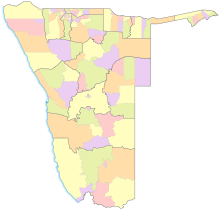
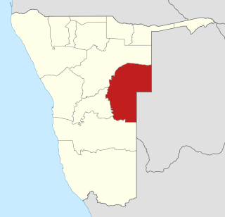
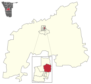
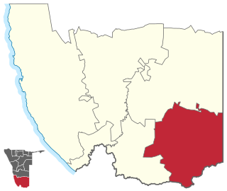
Khomas is one of the fourteen regions of Namibia. Its name refers to the Khomas Highland, a high plateau landscape that dominates this administrative unit. Khomas is centered on the capital city Windhoek and provides for this reason superior transportation infrastructure. It is located in the central highlands of the country and is bordered by the Erongo region to the west and the northwest and by the Otjozondjupa region to the north. To the east is the Omaheke region, while in the south is the Hardap region. The region is characterized by its hilly countrysize and many valleys. It has well-developed economical, financial, and trade sectors. Khomas Region occupies 4.5% of the land area of Namibia but has the highest population of any of its regions (16.2%). Khomas is one of only three Namibian regions to have neither shoreline nor a foreign border.

<span class="mw-page-title-main">Omaheke Region</span> Region in Namibia

Omaheke is one of the fourteen regions of Namibia, the least populous region. Its capital is Gobabis. It lies in eastern Namibia on the border with Botswana and is the western extension of the Kalahari desert. The self-governed villages of Otjinene, Leonardville and Witvlei are situated in the region. As of 2020, Omaheke had 48,594 registered voters.

<span class="mw-page-title-main">Katutura Central</span> Electoral constituency in the Khomas region of central Namibia

Katutura Central is a constituency in the Khomas Region of Namibia, comprising the extensions 2–5 and 7–11 of Windhoek's suburb Katutura. Katutura is a township that was founded by the then apartheid government of Namibia for black people in the 1950s, when the previous township, Old Location, was converted into the suburb Hochland Park.

<span class="mw-page-title-main">Khomasdal North</span> Electoral constituency in the Khomas region of central Namibia

Khomasdal North is a constituency in Windhoek in the Khomas Region of Namibia. As of December 2019 it had 25,550 registered voters. The constituency consists of parts of the suburbs Khomasdal, Katutura, and Otjomuise. It had a population of 43,921 in 2011, up from 27,950 in 2001.

<span class="mw-page-title-main">John Pandeni Constituency</span> Electoral constituency in the Khomas region of central Namibia

John Pandeni constituency, formerly known as Soweto is a constituency in the Khomas Region of Namibia. In 2008, it was renamed after John Pandeni, a member of the South West Africa People's Organization (SWAPO) and its militant wing, the People's Liberation Army of Namibia (PLAN). Pandeni was the first regional councilor for the former Soweto constituency and the first governor of Khomas. This constituency is inside the city of Windhoek in the formerly all-Black suburb of Katutura. It had a population of 15,121 in 2011, up from 13,865 in 2001. As of 2020, it has 14,758 registered voters.

<span class="mw-page-title-main">Tobias Hainyeko constituency</span> Electoral constituency in the Khomas region of central Namibia

Tobias Hainyeko constituency is an electoral constituency in Windhoek, the capital of Namibia. It had a population of 45,912 in 2011, up from 34,348 in 2001. As of 2020 it had 36,530 registered voters.

<span class="mw-page-title-main">Mpungu Constituency</span> Electoral constituency in the Kavango West region of northern Namibia

Mpungu is a constituency in the Kavango West region of Namibia. It had a population of 20,787 in 2011, up from 18,660 in 2001, and 9,121 registered voters in 2020, up from 8,924 in 2004.

<span class="mw-page-title-main">Kapako Constituency</span> Electoral constituency in the Kavango West region of northern Namibia

Kapako is a constituency in the Kavango West region of Namibia. The district centre is the settlement of Kapako. It had a population of 26,983 in 2011, up from 26,263 in 2001.

<span class="mw-page-title-main">Windhoek West Constituency</span> Electoral constituency in Windhoek, Namibia

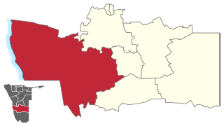
Windhoek West Constituency is an electoral constituency in the Khomas Region of Namibia. It contains the affluent suburbs of Hochland Park, Pioneers Park, Academia, Cimbebasia, Rocky Crest, Windhoek North and Windhoek West. It had a population of 53,438 in 2011, up from 42,201 in 2001. As of 2020, it has 33,556 registered voters.

<span class="mw-page-title-main">Moses ǁGaroëb Constituency</span> Electoral constituency in the Khomas region of central Namibia

Moses ǁGaroëb Constituency is an electoral constituency in Windhoek, the capital of Namibia. It had a population of 45,564 in 2011, up from 25,642 in 2001. As of 2020 it had 41,550 registered voters.

<span class="mw-page-title-main">Rundu Urban</span> Electoral constituency in the Kavango East region of north-eastern Namibia

Rundu Urban is an electoral constituency in the Kavango East region of Namibia. It covers the urban area of Rundu, the region's capital and one of Namibia's largest cities. The constituency also covers parts of the Sauyemwa, Safari, Tutungeni, Katutura, Donkerhoek and Kehemu neighborhoods. It had a population of 20,953 in 2011, up from 19,173 in 2001. As of 2020 the constituency had 35,740 registered voters.

<span class="mw-page-title-main">Opuwo Rural</span> Electoral constituency in the Kunene region of north-western Namibia

Opuwo Rural is an electoral constituency in the Kunene Region of Namibia. The administrative centre of Opuwo Rural is the settlement of Otuani. As of 2020, it has 7,315 registered voters.

<span class="mw-page-title-main">Oshikunde Constituency</span> Electoral constituency in the Ohangwena region of northern Namibia

Oshikunde Constituency is an electoral constituency in the Ohangwena Region of Namibia. As of 2020, it has 8,062 registered voters.

<span class="mw-page-title-main">Judea Lyaboloma Constituency</span> Electoral constituency in Zambezi region, Namibia

Judea Lyaboloma Constituency is an Electoral district in Namibia. It is situated in the Zambezi Region. Its centre is Sangwali which is a settlement 129.3 kilometres out of Katima Mulilo. The constituency has a population of 5,511 people. In the 2020 Regional Council Elections, there were 3,339 registered voters.

<span class="mw-page-title-main">Daweb Constituency</span> Electoral constituency in the Hardap region of central Namibia

Daweb Constituency is an electoral constituency in the Hardap Region of Namibia. It was created in August 2013, following a recommendation of the Fourth Delimitation Commission of Namibia, and in preparation of the 2014 general election. Daweb constituency was formed from the western part of Gibeon Constituency.

<span class="mw-page-title-main">Mankumpi Constituency</span> Electoral constituency in the Kavango West region of northern Namibia

Mankumpi Constituency is an electoral constituency in the Kavango West Region of Namibia. The administrative centre is the village of Satotwa. Mankumpi was created in August 2013, following a recommendation of the Fourth Delimitation Commission of Namibia, and in preparation of the 2014 general election. It was formed from the south-eastern part of the former Kahenge Constituency.

<span class="mw-page-title-main">Ncamagoro Constituency</span> Electoral constituency in the Kavango West region of northern Namibia

Ncamagoro Constituency is an electoral constituency in the Kavango West Region of Namibia. As of 2020 the constituency had 6,494 registered voters.

<span class="mw-page-title-main">Karasburg East</span> Electoral constituency in the ǁKaras region of southern Namibia

Karasburg East is an electoral constituency in the ǁKaras Region of Namibia. As of 2020 the constituency had 6,553 registered voters.

<span class="mw-page-title-main">Ncuncuni Constituency</span> Electoral constituency in the Kavango West region of northern Namibia

Ncuncuni is a constituency in the Kavango West region of Namibia. It is located west of Rundu, one of Namibia's largest cities. It had a population of 38,281 in 2011, up from 26,623 in 2001. As of 2020 the constituency had 4,554 registered voters.

<span class="mw-page-title-main">Opuwo Urban</span> Electoral constituency in the Kunene region of north-western Namibia

Opuwo Urban is a constituency in the Kunene Region of Namibia. It comprises the townlands of Opuwo, which is also its administrative centre. As of 2020, it has 10,590 registered voters.

References

  1. "Namibia: Division (Regions and Constituencies) - Population Statistics, Charts and Map".
  2. Matundu-Tjiparuro, Mae (28 February 2011). "Khomas Region, a constitutional, political and geographical hybrid". Focus on: Khomas Region. supplement to New Era. p. 3.
  3. Shinovene Immanuel. "Caprivi is no more" Archived 13 August 2013 at the Wayback Machine . The Namibian. 9 August 2013. Retrieved 1 September 2013.
  4. 1 2 "Namibia National Council". Inter-Parliamentary Union . Retrieved 14 July 2010.
  5. Ndeyanale, Eliaser (28 January 2016). "Councillors should be fully recognised politicians". Confidente . p. 5.
  6. Mbathera, Ester; Iikela, Sakeus (24 February 2021). "Councillor pay hike proposal not sinister – Daniel". The Namibian . p. 3.
  7. "Regional Council 2020 Election Results". Interactive map. Electoral Commission of Namibia. 18 January 2021. Retrieved 15 March 2021.