
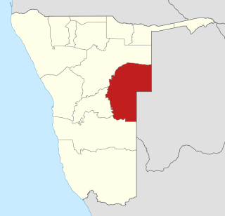
Otjozondjupa is one of the fourteen regions of Namibia. Its capital is Otjiwarongo. The region further contains the municipalities of Okahandja and Grootfontein and the towns Okakarara and Otavi. As of 2020, Otjozondjupa had 97,945 registered voters.
Omaheke is one of the fourteen regions of Namibia, the least populous region. Its capital is Gobabis. It lies in eastern Namibia on the border with Botswana and is the western extension of the Kalahari desert. The self-governed villages of Otjinene, Leonardville and Witvlei are situated in the region. As of 2020, Omaheke had 48,594 registered voters.

Katima Mulilo Rural is a constituency in the Zambezi Region of Namibia. It comprises the area south of the town of Katima Mulilo, the regional capital. As of 2020, the constituency had 6,712 registered voters.

Omaruru is a town in the Erongo Region of central Namibia. The town has 14,000 inhabitants and encompasses 352 square kilometres (136 sq mi) of land. It is situated near Mount Erongo, on the usually dry Omaruru River. It is located on the main paved road from Swakopmund to Otjiwarongo. The name in the Otjiherero language means 'bitter milk', as Herero cattle herds used to graze on the local bush that turned their milk bitter.

Samora Machel Constituency is a constituency in Windhoek in the Khomas Region of central Namibia. The constituency is located across four northern suburbs of Windhoek: Wanaheda, Greenwell Matongo, Goreangab, and part of Havana. It had a population of 50,110 in 2011, up from 29,382 in 2001. As of 2020 it had 45,962 registered voters.

Khomasdal Constituency is a constituency in Windhoek in the Khomas Region of Namibia. As of December 2019 it had 25,550 registered voters. The constituency consists of parts of the suburbs Khomasdal, Katutura, and Otjomuise. It had a population of 43,921 in 2011, up from 27,950 in 2001.

Omaruru is a constituency in the Erongo Region of central-eastern Namibia. Its district capital is the city of Omaruru. It had a population of 8,577 in 2011, up from 7,156 in 2001. As of 2020 the constituency had 6,672 registered voters.
Okakarara is a town in Otjozondjupa Region, Namibia, located 50 kilometres (31 mi) southeast of Waterberg National Park. It has an estimated population of 7,000 and is currently growing by 1,500 inhabitants annually.

Kalahari Constituency is an electoral constituency in the Omaheke Region of eastern central Namibia. It had 9,234 inhabitants in 2004 and 5,294 registered voters in 2020. The constituency covers the rural area east of Gobabis as well as Gobabis' Nossobville suburb. The constituency office has been inaugurated in 2009 and is located at the Ben-Hur settlement. Kalahari constituency forms part of the border between Namibia and Botswana.

Otjombinde Constituency is an electoral constituency in the Omaheke Region of Namibia. It had 6,378 inhabitants in 2004 and 4,879 registered voters in 2020. The district capital of the constituency is the settlement of Otjombinde, and its main economic hub is Talismanus. The constituency forms part of the border between Namibia and Botswana. It contains the settlements of Eiseb, Helena, and Rietfontein.

Otjinene Constituency is an electoral constituency in the Omaheke Region of Namibia. It had 7,400 inhabitants in 2011 and 5,619 registered voters in 2020. Its district capital is the village of Otjinene.

Ruacana Constituency is an electoral constituency in the Omusati Region of Namibia on the border to Angola. It had 10,722 inhabitants in 2004 and 9,285 registered voters in 2020. Its district capital is the town of Ruacana.

Oshakati East is an electoral constituency in the Oshana Region of Namibia. It comprises the eastern parts of the town of Oshakati. The constituency had 22,634 inhabitants in 2004 and 19,606 registered voters in 2020.

Oshakati West is an electoral constituency in the Oshana Region of Namibia. It contains the western parts of the town of Oshakati. The constituency had 20,015 inhabitants in 2004 and 15,120 registered voters in 2020.

Grootfontein Constituency is an electoral constituency in the Otjozondjupa Region of Namibia. It had 21,595 inhabitants in 2004 and 16,629 registered voters in 2020. The constituency consists of the town of Grootfontein and the surrounding rural area. Until 1998 it also contained the area that today is Tsumkwe Constituency. It was split off following a recommendation of the Second Delimitation Commission of Namibia, and in preparation of the 1998 general election.

Okakarara Constituency is an electoral constituency in the Otjozondjupa Region of Namibia. It had 21,336 inhabitants in 2004 and 16,221 registered voters in 2020. The constituency consists of the town of Okakarara and the surrounding rural area.

Omatako Constituency is an electoral constituency in the Otjozondjupa Region of Namibia. It had 11,998 inhabitants in 2004 and 7,372 registered voters in 2020. The constituency is entirely rural with commercial farms accounting for 95% of its 24,879 square kilometres (9,606 sq mi) area. The constituency office is situated at Okandjira, the constituency's only proclaimed settlement. Other populated places are Kalkfeld, Hochfeld and Ovitoto, as well as the Osire refugee camp and the Osona military base. Omatako Constituency is named after the Omatako Mountains, a prominent geological feature of the constituency.

Otjiwarongo Constituency is an electoral constituency in the Otjozondjupa Region of Namibia. It had 22,614 inhabitants in 2004 and 22,931 registered voters in 2020. The constituency consists of the town of Otjiwarongo and the surrounding rural area.

Otjinene is a village in the Omaheke Region of Namibia. It is the district capital of the Otjinene Constituency. Otjinene is connected via a 157 kilometres (98 mi) tarred road to the regional capital Gobabis, and via a 227 kilometres (141 mi) road which was tarred in 2017, to Grootfontein.

Opuwo Rural is an electoral constituency in the Kunene Region of Namibia. The administrative centre of Opuwo Rural is the settlement of Otuani. As of 2020, it has 7,315 registered voters.
