Oudebaaskraal Dam

Last updated
Oudebaaskraal Dam
South Africa relief location map.svg
Red pog.svg
Location of Oudebaaskraal Dam in South Africa
Official nameOudebaaskraal Dam
Country South Africa
Location Ceres, Western Cape
Coordinates 32°23′27.25″S19°53′32.65″E / 32.3909028°S 19.8924028°E / -32.3909028; 19.8924028 Coordinates: 32°23′27.25″S19°53′32.65″E / 32.3909028°S 19.8924028°E / -32.3909028; 19.8924028
Purpose Irrigation
Opening date1969
Owner(s) Department of Water Affairs
Dam and spillways
Type of dam Earth fill dam
Impounds Tankwa River
Height21 metres (69 ft)
Length1,200 metres (3,900 ft)
Reservoir
CreatesOudebaaskraal Dam Reservoir
Total capacity34,000,000 cubic metres (1.2×10⁹ cu ft)
Catchment area 800 hectares (2,000 acres)

Oudebaaskraal Dam is an earth-fill type dam located on the Tankwa River near Ceres, Western Cape, South Africa. It was established in 1969 and serves mainly for irrigation purposes. The hazard potential of the dam has been ranked significant (2).

Ceres, Western Cape Place in Western Cape, South Africa

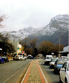
Ceres is the administrative centre and largest town of the Witzenberg Local Municipality in the Western Cape Province of South Africa. Ceres serves as a regional centre for the surrounding towns of Wolseley, Tulbagh, Op-die-Berg and Prince Alfred Hamlet. It is situated in the Warmbokkeveld Valley about 170 km north-east of Cape Town. Ceres is located at the north-eastern entrance to Michell's Pass and was the old route north between Cape Town and Johannesburg, which was later replaced by the N1 highway, which traverses the Breede River Valley to the south.

Western Cape Province of South Africa on the south-western coast

The Western Cape is a province of South Africa, situated on the south-western coast of the country. It is the fourth largest of the nine provinces with an area of 129,449 square kilometres (49,981 sq mi), and the third most populous, with an estimated 6.6 million inhabitants in 2018. About two-thirds of these inhabitants live in the metropolitan area of Cape Town, which is also the provincial capital. The Western Cape was created in 1994 from part of the former Cape Province.

South Africa Republic in the southernmost part of Africa

South Africa, officially the Republic of South Africa (RSA), is the southernmost country in Africa. It is bounded to the south by 2,798 kilometres (1,739 mi) of coastline of Southern Africa stretching along the South Atlantic and Indian Oceans; to the north by the neighbouring countries of Namibia, Botswana, and Zimbabwe; and to the east and northeast by Mozambique and Eswatini (Swaziland); and it surrounds the enclaved country of Lesotho. South Africa is the largest country in Southern Africa and the 25th-largest country in the world by land area and, with over 57 million people, is the world's 24th-most populous nation. It is the southernmost country on the mainland of the Old World or the Eastern Hemisphere. About 80 percent of South Africans are of Sub-Saharan African ancestry, divided among a variety of ethnic groups speaking different African languages, nine of which have official status. The remaining population consists of Africa's largest communities of European (White), Asian (Indian), and multiracial (Coloured) ancestry.

Oudebaaskraal Dam is next to Wadrif and is located in Cape Winelands District Municipality, Western Cape, South Africa. Oudebaaskraal Dam has a length of 14.34 kilometres. [1]

A game drive in the stony desert area around the Oudebaaskraal Dam is probably the best chance of spotting some of the animals that have been reintroduced into the Tankwa Karoo National Park, like gemsbok, springbok, hartebeest and Cape mountain zebra. Perhaps even a bat-eared fox and a tortoise or two. [2] Hundreds of Pink Flamingos can be spotted there at certain times, and the areas of the dam which are covered in algae have a kelp type smell similar to the ocean.

Tankwa Karoo National Park A conservation area west of Sutherland in the Western and Northern Cape

Tankwa Karoo National Park is a national park in South Africa. The park lies about 70 km due west of Sutherland near the border of the Northern Cape and Western Cape, in one of the most arid regions of South Africa, with areas receiving less than 100 mm of average annual precipitation, moisture-bearing clouds from the Atlantic Ocean being largely stopped by the Cederberg mountains. Other low areas receive little more, as the Roodewerf station with 180 mm of mean annual rainfall. In the hottest areas of the park, the mean maximum temperature in January is 38.9 °C, and in July the mean minimum temperature ranges from about 5 to 7 °C. Before this Park's proclamation, the only protected area of Succulent Karoo was the 2 square kilometre patch of the Gamkaberg Nature Reserve. Succulent Karoo has, together with the Cape Floral Kingdom, been declared a Biodiversity Hotspot by Conservation International.

Gemsbok species of mammal

The gemsbok, gemsbuck or South African oryx is a large antelope in the genus Oryx. It is native to the arid regions of Southern Africa, such as the Kalahari Desert. Some authorities formerly included the East African oryx as a subspecies.

See also

Related Research Articles

The protected areas of South Africa include national parks and marine protected areas managed by the national government, public nature reserves managed by provincial and local governments, and private nature reserves managed by private landowners. Most protected areas are intended for the conservation of flora and fauna. National parks are maintained by South African National Parks (SANParks). A number of national parks have been incorporated in transfrontier conservation areas.

Geography of South Africa geography of South Africa

South Africa occupies the southern tip of Africa, its coastline stretching more than 2,850 kilometres from the desert border with Namibia on the Atlantic (western) coast southwards around the tip of Africa and then northeast to the border with Mozambique on the Indian Ocean. The low-lying coastal zone is narrow for much of that distance, soon giving way to a mountainous escarpment that separates the coast from the high inland plateau. In some places, notably the province of KwaZulu-Natal in the east, a greater distance separates the coast from the escarpment. Although most of the country is classified as semi-arid, it has considerable variation in climate as well as topography.

Fynbos shrubland and heathland vegetation of southwestern South Africa

Fynbos is a small belt of natural shrubland or heathland vegetation located in the Western Cape and Eastern Cape provinces of South Africa. This area is predominantly winter rainfall coastal and mountainous areas with a Mediterranean climate. The fynbos ecoregion is within the Mediterranean forests, woodlands, and scrub biome. In fields related to biogeography, fynbos is known for its exceptional degree of biodiversity and endemism, consisting about 80% species of the Cape floral kingdom where nearly 6,000 of them are endemic. This land has faced severe threats and still does, but due to the many economic uses conservation efforts are being made to help restore it.

Northern Cape Province of South Africa

The Northern Cape is the largest and most sparsely populated province of South Africa. It was created in 1994 when the Cape Province was split up. Its capital is Kimberley. It includes the Kalahari Gemsbok National Park, part of the Kgalagadi Transfrontier Park, an international park shared with Botswana. It also includes the Augrabies Falls and the diamond mining regions in Kimberley and Alexander Bay. The Namaqualand region in the west is famous for its Namaqualand daisies. The southern towns of De Aar and Colesberg, in the Great Karoo, are major transport nodes between Johannesburg, Cape Town and Port Elizabeth. In the northeast, Kuruman is known as a mission station and also for its artesian spring, the Eye of Kuruman. The Orange River flows through the province, forming the borders with the Free State in the southeast and with Namibia to the northwest. The river is also used to irrigate the many vineyards in the arid region near Upington.

Karoo Natural region in South Africa

The Karoo is a semi desert natural region of South Africa. No exact definition of what constitutes the Karoo is available, so its extent is also not precisely defined. The Karoo is partly defined by its topography, geology and climate, and above all, its low rainfall, arid air, cloudless skies, and extremes of heat and cold. The Karoo also hosted a well-preserved ecosystem hundreds of million years ago which is now represented by many fossils.

Highveld Natural region in South Africa

The Highveld is the portion of the South African inland plateau which has an altitude above roughly 1500 m, but below 2100 m, thus excluding the Lesotho mountain regions to the south-east of the Highveld. It is home to some of the country's most important commercial farming areas, as well as its largest concentration of metropolitan centres, especially the Gauteng conurbation, which accommodates one-third of South Africa's population.

Nelspoort Place in Western Cape, South Africa

Nelspoort is a town located in Beaufort West Local Municipality in the Western Cape, South Africa.

The R355 is a Regional Route in South Africa that connects the R46 near Ceres with Springbok via Calvinia.

Karoo National Park A wildlife reserve in the Great Karoo area of the Western Cape, South Africa near Beaufort West

The Karoo National Park, founded in 1979, is a wildlife reserve in the Great Karoo area of the Western Cape, South Africa near Beaufort West. This semi-desert area covers an area of 750 square kilometres (290 sq mi). The Nuweveld portion of the Great Escarpment runs through the Park. It is therefore partly in the Lower Karoo, at about 850 m above sea level, and partly in the Upper Karoo at over 1300 m altitude.

Williston, Northern Cape Place in Northern Cape, South Africa

Williston is a town in Northern Cape, South Africa. Town 103 km north-east of Calvinia and 140 km south-west of Carnarvon.

Wildlife of South Africa

South Africa has a large variety of wildlife, which includes snakes, birds, plains animals, and predators. The country has 299 species of mammals, and 858 species of birds.

Breede River Valley is a region of Western Cape Province, South Africa known for being the largest fruit and wine producing valley in the Western Cape, as well as South Africa's leading race-horse breeding area. It is part of the Boland bordering on becoming Little Karoo towards the east.

Renosterveld

Renosterveld is a term used for one of the major plant communities and vegetation types of the Cape Floristic Region which is located in southwestern and southeastern South Africa, in southernmost Africa. It is an ecoregion of the Mediterranean forests, woodlands, and scrub biome.

Molteno, Eastern Cape Place in Eastern Cape, South Africa

Molteno is a town in the Eastern Cape province of South Africa.

Theewaterskloof Dam dam on the Sonderend River in the Western Cape, South Africa

Theewaterskloof Dam is an earth-fill type dam located on the Sonderend River near Villiersdorp, Western Cape, South Africa. Administratively it is located within Theewaterskloof Local Municipality. It was established in 1978 and is the largest dam in the Western Cape Water Supply System with a capacity of 480 million cubic metres, about 41% of the water storage capacity available to Cape Town, which has a population of over 4 million people. The dam mainly serves for municipal and industrial use as well as for irrigation purposes. The hazard potential of the dam has been ranked high (3).

Doring River river in the Western Cape Province, South Africa

The Doring River is a river in the Western Cape Province, South Africa. It is part of the Olifants/Doring River system.

Steenbras Dam – Upper is an earth-fill type dam located on the Steenbras River near Gordons Bay, Western Cape, South Africa. It was established in 1977 and serves mainly for municipal and industrial use. The hazard potential of the dam has been ranked high (3).

Groot River (Southern Cape) river in South Africa

The Groot River is a river in the southern area of the Western Cape province of South Africa. It is a right hand tributary of the Gourits River.

References