Related Research Articles

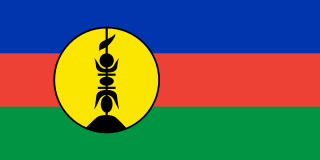
New Caledonia is a special collectivity of France in the southwest Pacific Ocean, south of Vanuatu, about 1,210 km (750 mi) east of Australia and 17,000 km (11,000 mi) from Metropolitan France. The archipelago, part of the Melanesia subregion, includes the main island of Grande Terre, the Loyalty Islands, the Chesterfield Islands, the Belep archipelago, the Isle of Pines, and a few remote islets. The Chesterfield Islands are in the Coral Sea. French people, especially locals, call Grande Terre Le Caillou.

Houston County is a county in the U.S. state of Minnesota. At the 2010 United States Census, the population was 19,027. Its county seat is Caledonia.

Constable is a town in Franklin County, New York, United States. The population was 1,566 at the 2010 census. The town is named after William Constable, a member of the syndicate of original land owners.
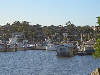
Blakehurst is a suburb in southern Sydney, in the state of New South Wales, Australia 18 kilometres south of the Sydney central business district, in the local government area of the Georges River Council. It is part of the St George area.
Mosquito Creek is a 21.8-mile-long (35.1 km) tributary of the West Branch Susquehanna River in central Pennsylvania in the United States.
Plum River is a river of southwestern New Caledonia. It flows into the sea to the west of the Plum village. It is a short river, little more than an incised stream. The Plum Swamp lies in the river system.
Pirogues River is a major river of southwestern New Caledonia. It flows into the sea at Pirogues Bay. It is noted for its ophiolite reserves.
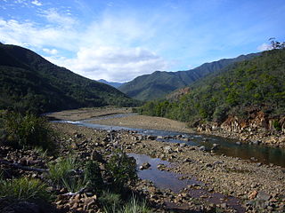
The Tontouta River is a river of New Caledonia. It has a catchment area of 476 square kilometres.
The La Coulée River is a river of New Caledonia. It has a catchment area of 92 square kilometres.
The Dumbéa River is a river of New Caledonia. It has a catchment area of 233 square kilometres. It is a beautiful river, and flows from the Diahot River.
The Yaté River is a river of New Caledonia. It has a catchment area of 450 square kilometres. A major mining area, the Yaté Dam lies near the mouth and the town of Yaté.
The Pourina River is a river of New Caledonia. It has a catchment area of 98 square kilometres.
The Ouinné River is a river of New Caledonia. It has a catchment area of 146 square kilometres.
The Kouakoué River is a river of New Caledonia. It has a catchment area of 77 square kilometres.
The Nimbo (Mba) River is a river of New Caledonia. It has a catchment area of 85 square kilometres.
The Thio River is a river of New Caledonia. It has a catchment area of 404 square kilometres.
The Nakéty River is a river of New Caledonia. It has a catchment area of 106 square kilometres.
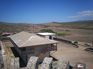
Fort Teremba is a former fort and a prison located near Moindou in New Caledonia, which came to be set up to house prisoners and the supervisory staff. The prisoners were brought to build road network Canala-Bourail-Boulouparis. It overlooks Teremba Bay, opposite the mouth of the La Foa River, 124 kilometres north of Noumea.
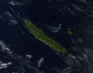
Grande Terre is the largest and principal island of New Caledonia, which is a territory of France.
Kanak are the indigenous Melanesian inhabitants of New Caledonia, an overseas collectivity of France in the southwest Pacific. According to the 2019 census, they make up 41.2% of the total population with around 112,000 people.
References
- ↑ "The impacts of opencast mining in New Caledonia". The United Nations University. Archived from the original on 27 July 2011. Retrieved 9 June 2011.CS1 maint: discouraged parameter (link)
- ↑ Stanley, David (15 November 2004). Moon Handbooks South Pacific. David Stanley. p. 852. ISBN 978-1-56691-411-6 . Retrieved 9 June 2011.CS1 maint: discouraged parameter (link)
Coordinates: 21°55′45″S166°6′35″E / 21.92917°S 166.10972°E