Höfe District is a district of the canton of Schwyz, Switzerland. The coat of arms of the Höfe is per pale: gules, two lions rampant contourny or; and or, three lions passant gules. It has a population of 28,642.

Stejanovci is a village in Serbia. It is situated in the Ruma municipality, in the Srem District, Vojvodina province. The village has a Serb ethnic majority and its population numbering 1,020 people.
Vašica is a village in Serbia. It is situated in the Šid municipality, in the Syrmia District, Vojvodina province. The village has a Serb ethnic majority and its population numbering 1,717 people.

Kaszówka is a village in the administrative district of Gmina Przeworno, within Strzelin County, Lower Silesian Voivodeship, in south-western Poland. Prior to 1945 it was in Germany. It lies approximately 13 kilometres (8 mi) east of Przeworno, 12 km (7 mi) south-east of Strzelin, and 47 km (29 mi) south of the regional capital Wrocław.

Valea Iașului is a commune in Argeș County, in southern central Romania. It is composed of nine villages: Bădila, Bărbălătești, Borovinești, Cerbureni, Mustățești, Ruginoasa, Ungureni, Valea Iașului and Valea Uleiului.
Moșnița Nouă is a commune in Timiș County, Romania, founded in 1902 by ethnic Hungarian settlers from Békés County and Szentes. It is composed of five villages: Albina (Bródpuszta), Moșnița Nouă, Moșnița Veche (Mosnica), Rudicica (Ruzicskatelep) and Urseni (Magyarmedves).
Mala is a village and Village Development Committee in Kaski District in the Gandaki Zone of northern-central Nepal. At the time of the 1991 Nepal census it had a population of 2,704 persons living in 510 individual households.
Pętkowo Wielkie is a village in the administrative district of Gmina Zaręby Kościelne, within Ostrów Mazowiecka County, Masovian Voivodeship, in east-central Poland. It lies approximately 6 kilometres (4 mi) south-east of Zaręby Kościelne, 22 km (14 mi) south-east of Ostrów Mazowiecka, and 98 km (61 mi) north-east of Warsaw.
Zakrzewo-Kopijki is a village in the administrative district of Gmina Zaręby Kościelne, within Ostrów Mazowiecka County, Masovian Voivodeship, in east-central Poland. It lies approximately 6 kilometres (4 mi) south-east of Zaręby Kościelne, 22 km (14 mi) south-east of Ostrów Mazowiecka, and 98 km (61 mi) north-east of Warsaw.
Majdanki is a village in the administrative district of Gmina Chlewiska, within Szydłowiec County, Masovian Voivodeship, in east-central Poland. It lies approximately 8 kilometres (5 mi) south-west of Chlewiska, 11 km (7 mi) south-west of Szydłowiec, and 117 km (73 mi) south of Warsaw.
Rębiechów is a village in the administrative district of Gmina Kobylin, within Krotoszyn County, Greater Poland Voivodeship, in west-central Poland. It lies approximately 4 kilometres (2 mi) north-west of Kobylin, 18 km (11 mi) west of Krotoszyn, and 78 km (48 mi) south of the regional capital Poznań.
Rataje is a village in the administrative district of Gmina Pyzdry, within Września County, Greater Poland Voivodeship, in west-central Poland. It lies approximately 3 kilometres (2 mi) north-east of Pyzdry, 19 km (12 mi) south-east of Września, and 60 km (37 mi) south-east of the regional capital Poznań.

Nový Vestec is a village and municipality in Prague-East District in the Central Bohemian Region of the Czech Republic.
Bayt al-Mushriqi is a village in west-central Yemen. It is located in the San‘a’ Governorate.
Bermo, Niger is a village and rural commune in Niger.
Candói is a municipality in the state of Paraná in the Southern Region of Brazil.
Mae Thalop is a tambon (subdistrict) of Chai Prakan District, in Chiang Mai Province, Thailand. In 2005 it had a population of 7,415 people. The tambon contains six villages.

Masti is a village in Kohila Parish, Rapla County in northwestern Estonia.
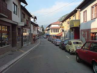
Brodarevo is a village in the municipality of Prijepolje, Serbia. According to the 2002 census, the village has a population of 6,500.
Strazhnitsa is a village in Chernoochene Municipality, in Kardzhali Province, in southern-central Bulgaria. It covers an area of 2.155 square kilometres and as of 2007 it had a population of 183 people.