Related Research Articles
Fulton County is located in the north-central portion of the U.S. state of Georgia. As of the 2020 United States census, the population was 1,066,710, making it the state's most-populous county and its only one with over one million inhabitants. Its county seat and largest city is Atlanta, the state capital. Approximately 90% of the City of Atlanta is within Fulton County; the other 10% lies within DeKalb County. Fulton County is part of the Atlanta-Sandy Springs-Roswell, GA Metropolitan Statistical Area.

Chamblee is a city in northern DeKalb County, Georgia, United States, northeast of Atlanta. The population was 30,164 at the 2020 census.
Dunwoody is a city located in DeKalb County, Georgia, United States. As a northern suburb of Atlanta, Dunwoody was incorporated as a city on December 1, 2008 but its area establishment dates back to the early 1830s. As of 2019, the city has a population of 49,356, up from 46,267 in the 2010 Census.

Sandy Springs is a city in northern Fulton County, Georgia and an inner ring suburb of Atlanta. The city’s population was 108,080 at the 2020 census, making it Georgia's seventh-largest city. It is the site of several corporate headquarters, including UPS, Newell Brands, Inspire Brands, Focus Brands, Cox Enterprises, and Mercedes-Benz USA's corporate offices.
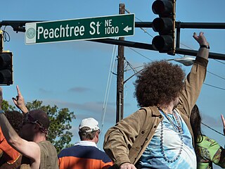
Peachtree Street is one of several major streets running through the city of Atlanta. Beginning at Five Points in downtown Atlanta, it runs North through Midtown; a few blocks after entering into Buckhead, the name changes to Peachtree Road at Deering Road. Much of the city's historic and noteworthy architecture is located along the street, and it is often used for annual parades,, as well as one-time parades celebrating events such as the 100th anniversary of Coca-Cola in 1986 and the Atlanta Braves' 1995 World Series victory.
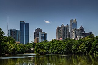
Midtown Atlanta, or Midtown, is a high-density commercial and residential neighborhood of Atlanta, Georgia. The exact geographical extent of the area is ill-defined due to differing definitions used by the city, residents, and local business groups. However, the commercial core of the area is anchored by a series of high-rise office buildings, condominiums, hotels, and high-end retail along Peachtree Street between North Avenue and 17th Street. Midtown, situated between Downtown to the south and Buckhead to the north, is the second-largest business district in Metro Atlanta. In 2011, Midtown had a resident population of 41,681 and a business population of 81,418.

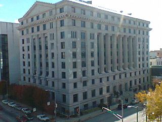
Buckhead is the uptown commercial and residential district of the city of Atlanta, Georgia, comprising approximately the northernmost fifth of the city. Buckhead is the third largest business district within the Atlanta city limits, behind Downtown and Midtown, a major commercial and financial center of the Southeast.
The Atlanta BeltLine is a former railway corridor around the core of Atlanta, Georgia, under development in stages as a multi-use trail. Some portions are already complete, while others are still in a rough state but hikeable. Using existing rail track easements, the BeltLine is designed to improve transportation, add green space, and promote redevelopment. There are longer-term visions for streetcar or light-rail lines along all or part of the corridor.
Historic ferries operated on rivers around Atlanta, Georgia area, and became namesakes for numerous current-day roads in north Georgia. Most of the ferries date to the early years of European-American settlement in the 1820s and 1830s, when Cherokee and other Native Americans still occupied part of what became Georgia.
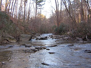
Nancy Creek is a 16.3-mile-long (26.2 km) stream in northern Atlanta, Georgia, United States. It begins in far northern DeKalb County, just north of Chamblee, and flows southwestward into Fulton County, through the far southeast corner of Sandy Springs, then through the Buckhead area of Atlanta. It empties into Peachtree Creek, which then flows into the Chattahoochee River, south of Vinings and Paces. The Chattahoochee eventually joins with the Flint River to create the Apalachicola River, which flows into the Gulf of Mexico. The North Fork Nancy Creek is a major tributary, while Little Nancy Creek tends to run low or dry. Other tributaries include Bubbling Creek which originates in Chamblee, Perimeter Creek which originates in Dunwoody and Silver Creek which includes the 38-acre Silver Lake and Little Silver Lake.
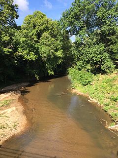
Peachtree Creek is a major stream in Atlanta. It flows for 7.5 miles (12.1 km) almost due west into the Chattahoochee River just south of Vinings.

Brookhaven is a city in the northeastern suburbs of Atlanta that is located in western DeKalb County, Georgia, United States, directly northeast of Atlanta. On July 31, 2012, Brookhaven was approved in a referendum to become DeKalb County's 11th city. Incorporation officially took place on December 17, 2012, on which date municipal operations commenced. With a population of around 55,554 as of 2019, it is the largest city in DeKalb County. The new city stretches over 12 square miles (31 km2).

North Springs is an elevated metro station in Sandy Springs, Georgia, and the northern terminus for the Red Line of the Metropolitan Atlanta Rapid Transit Authority (MARTA) rail system. North Springs is primarily a commuter station for Atlanta workers and university students, featuring a large parking deck and direct access on and off State Route 400, a major highway for commuters, so that drivers can avoid surface roads. North Springs attracts commuters from Roswell, Alpharetta and other towns north on State Route 400. As the northern terminus, this station is a hub for buses that continue on north, with connecting bus services to Sandy Springs, the city of Alpharetta, North Point Mall, the city of Roswell, the Ameris Bank Amphitheatre at Encore Park, the Mansell Road and Windward Parkway park-and-rides, and even as far north as the city of Milton. This station also provides bus assistance from North Springs High School via Route 87.

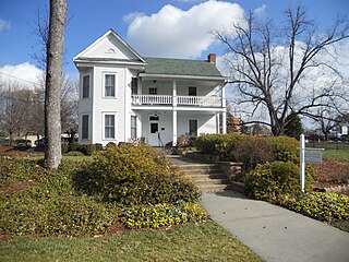
Historic Brookhaven is a historic neighborhood, part of which lies in Atlanta's Buckhead Community, part of which lies in Sandy Springs, Georgia, and part of which lies in city of Brookhaven, Georgia, to which it lends its name. Capital City Club country club is at the center of the neighborhood, and it is surrounded by valuable homes, many of which were designed by a number of well-known Atlanta architects of the pre-war period. The neighborhood boundaries are well defined, and it stretches from Peachtree Dunwoody Road to the west, Windsor Parkway to the north, Mabry Drive to the east, and Peachtree Road to the south.
Perimeter Center is a major edge city in metro Atlanta, Georgia, United States. It is centered on Perimeter Mall, the nucleus around which it has formed. Perimeter Center is located north of Atlanta proper, and lies within three cities: Dunwoody, Sandy Springs, and Brookhaven. It is one of metro Atlanta's largest business districts, and one of the largest edge cities in the United States, comprising over 29 million square feet (2,700,000 m2) of office space, 6 million square feet (560,000 m2) of retail space, and 40,000 residents.
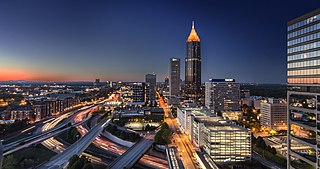
Metro Atlanta, designated by the United States Office of Management and Budget as the Atlanta–Sandy Springs–Alpharetta, GA Metropolitan Statistical Area, is the most populous metro area in the US state of Georgia and the ninth-largest metropolitan statistical area (MSA) in the United States. Its economic, cultural and demographic center is Atlanta, and has a total population of 6,089,815 according to the 2020 census. The metro area forms the core of a broader trading area, the Atlanta–Athens-Clarke–Sandy Springs Combined Statistical Area. The Combined Statistical Area spans up to 39 counties in north Georgia and has a total 2020 census population of 6,930,423. Atlanta is considered a "beta(+) world city." It is the third-largest metropolitan region in the Census Bureau's Southeast region behind Greater Washington and Greater Miami.
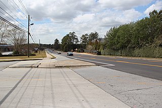
Spalding Drive is an approximately 12-mile east–west road connecting four suburban cities in north Atlanta: Sandy Springs, Dunwoody, Peachtree Corners, and Norcross. For most of its length, which roughly parallels the Chattahoochee River, it is lined on both sides with residential neighborhoods and private homes. Spalding Drive traverses a hilly topography and is subject to dangerous curves at many points. However, after crossing Peachtree Corners Circle, the road becomes flatter and more commercialized, passing by many office parks, and the Peachtree Corners post office and library. Norcross High School is located just before the road's eastern terminus within the Norcross city limits.
North Buckhead is a neighborhood in the Buckhead district, at the northern edge of the city of Atlanta, Georgia, and is one of Atlanta's most affluent neighborhoods.
The Peachtree Creek Greenway trail is a multi-use trail under construction along the North Fork Peachtree Creek in and near Atlanta, Georgia, United States, which will traverse the cities of Atlanta, Brookhaven, Chamblee, Doraville and parts of Unincorporated Dekalb County. Once complete, it will connect 12 miles from the Atlanta Beltline trails and Path 400 northward up to I-285. Some landmarks along the route will include Silverback stadium, Mercer University, CHOA & Emory and multiple schools and libraries.
References
- ↑ "First phase of PATH400", Buckhead Patch
- ↑ Tagami, Ty. "Northside to get its version of the BeltLine trail". ajc. Retrieved 2018-01-08.
- ↑ "PATH400SM". Livable Buckhead.
- ↑ "PATH400 Greenway Trail". 5 May 2012.
- ↑ "Buckhead's Path400 set to receive $12.66M in city, federal funding". MDJOnline.com. Retrieved 2018-01-08.
- ↑ "PATH400 set to receive over $7M in federal funds - Reporter Newspapers". www.reporternewspapers.net. Retrieved 2018-01-08.
- ↑ "Archived copy". Archived from the original on 2017-12-09. Retrieved 2017-12-03.
{{cite web}}: CS1 maint: archived copy as title (link) - ↑ "Roswell backs trail along Ga. 400".
- ↑ "Consultants present early plan for PATH400 extension to Sandy Springs". 25 October 2017.
- ↑ "Star Wars Chalk Art – Path 400 Greenway". path400greenway.org.
- ↑ "Colorful crosswalk art proposed near Buckhead's PATH400". 12 November 2017.