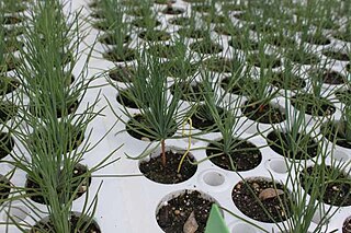
The longleaf pine is a pine species native to the Southeastern United States, found along the coastal plain from East Texas to southern Virginia, extending into northern and central Florida. In this area it is also known as "yellow pine" or "long leaf yellow pine", although it is properly just one out of a number of species termed yellow pine. It reaches a height of 30–35 m (98–115 ft) and a diameter of 0.7 m (28 in). In the past, before extensive logging, they reportedly grew to 47 m (154 ft) with a diameter of 1.2 m (47 in). The tree is a cultural symbol of the Southern United States, being the official state tree of Alabama. This particular species is one of the eight pine tree species that falls under the "Pine" designation as the state tree of North Carolina.

Pinus serotina, the pond pine, black bark pine, bay pine,marsh pine, or pocosin pine, is a pine tree found along the Southeastern portion of the Atlantic coastal plain of the United States, from southern New Jersey south to Florida and west to southern Alabama. Pond pine distribution may be starting to spread west towards Mississippi and Tennessee.

Pinus elliottii, commonly known as slash pine, is a conifer tree native to the Southeastern United States. Slash pine is named after the "slashes" – swampy ground overgrown with trees and bushes – that constitute its habitat. Other common names include swamp pine, yellow slash pine, and southern Florida pine. Slash pine has two different varieties: P. e. var. elliottii and P. e. var. densa. Historically, slash pine has been an important economic timber for naval stores, turpentine, and resin. The wood of slash pine is known for its unusually high strength, especially for a pine. It exceeds many hardwoods and is even comparable to very dense woods such as black ironwood.

The Piney Woods is a temperate coniferous forest terrestrial ecoregion in the Southern United States covering 54,400 square miles (141,000 km2) of East Texas, southern Arkansas, western Louisiana, and southeastern Oklahoma. These coniferous forests are dominated by several species of pine as well as hardwoods including hickory and oak. Historically the most dense part of this forest region was the Big Thicket though the lumber industry dramatically reduced the forest concentration in this area and throughout the Piney Woods during the 19th and 20th centuries. The World Wide Fund for Nature considers the Piney Woods to be one of the critically endangered ecoregions of the United States. The United States Environmental Protection Agency (EPA) defines most of this ecoregion as the South Central Plains.

Flatwoods, pineywoods, pine savannas and longleaf pine–wiregrass ecosystem are terms that refer to an ecological community in the southeastern coastal plain of North America. Flatwoods are an ecosystem maintained by wildfire or prescribed fire and are dominated by longleaf pine, and slash pine in the tree canopy and saw palmetto, gallberry and other flammable evergreen shrubs in the understory, along with a high diversity of herb species. It was once one of the dominant ecosystem types of southeastern North America. Although grasses and pines are characteristic of this system, the precise composition changes from west to east, that is, from Texas to Florida. In Louisiana, savannas even differ between the east and west side of the Mississippi River. The key factor maintaining this habitat type is recurring fire. Without fire, the habitat is eventually invaded by other species of woody plants.

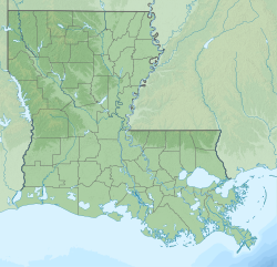
Kisatchie National Forest, the only National forest in Louisiana, United States, is located in the forested piney hills and hardwood bottoms of seven central and northern parishes. It is part of the Cenozoic uplands and has large areas of longleaf pine forests. It is one of the largest pieces of natural landscape in Louisiana, with some 604,000 acres (2,440 km2) of public land, more than half of which is vital longleaf pine and flatwoods vegetation. These support many rare plant and animal species. There are also rare habitats, such as hillside seepage bogs and calcareous prairies. The forest also contains and provides a buffer for the Kisatchie Hills Wilderness, a nationally designated wilderness area that contributes to protecting biodiversity of the coastal plain region of the United States.
Pyrophytes are plants which have adapted to tolerate fire.

The Mountain Longleaf National Wildlife Refuge is a 9,016-acre (36 km2) National Wildlife Refuge located in northeastern Alabama near the city of Anniston on the former site of Fort McClellan. Its name comes from some of the last remaining montane longleaf pine ecosystem in the southeastern United States which the refuge protects.

The Atlantic Plain is one of eight distinct physiographic divisions of the contiguous United States. Using the USGS physiographic classification system, the Atlantic Plain division comprises two provinces and six sections. The Coastal Plain province is differentiated from the Continental Shelf province simply based on the portion of the land mass above and below sea level.

Pinus × sondereggeri is the only named southern pine hybrid. Its common names include Sonderegger pine and bastard pine. It is a naturally occurring cross between loblolly pine (P. taeda) and longleaf pine (P. palustris). It was originally described by H. H. Chapman (1922), who named it after its discoverer, V. H. Sonderegger, a state forester of Louisiana. This pine usually occurs singly or in small groups where both loblolly and longleaf pines overlap in range. Because both parental trees usually produce cones at the same time of year, no phenological barrier exists, thus the two freely cross.
The Great Southern Lumber Company was chartered in 1902 to harvest and market the virgin longleaf pine forests in southeastern Louisiana and southwestern Mississippi. Bogalusa, Louisiana was developed from the ground up as a company town and was the location for Great Southern Lumber Company's sawmill, which began operation in 1908. Other company interests included a railroad and paper mill. The company ceased operation in 1938, when the supply of virgin pines was depleted. Bogalusa became the site of a paper mill and chemical operations, followed by other industry.

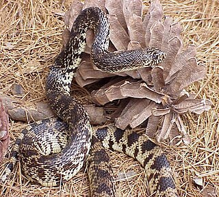
The Louisiana pine snake is a species of large, non-venomous, constrictor in the family Colubridae. This powerful snake is notable because of its large eggs and small clutch sizes. The Louisiana pine snake is indigenous to west-central Louisiana and East Texas, where it relies strongly on Baird's pocket gophers for its burrow system and as a food source. The Louisiana pine snake is rarely seen in the wild, and is considered to be one of the rarest snakes in North America. The demise of the species is due to its low fecundity coupled with the extensive loss of suitable habitat - the longleaf pine savannas in the Gulf coastal plain of the southeastern United States. Management activities are being conducted to promote the species' recovery.

The eastern woodlands of the United States covered large portions of the southeast side of the continent until the early 20th century. These were in a fire ecology of open grassland and forests with low ground cover of herbs and grasses.
An experimental forest, or experimental range, as defined by the United States Forest Service, is "an area administered ... 'to provide for the research necessary for the management of the land.'"

Big Sandy Creek is a stream in Texas, United States. It rises in Polk County before flowing approximately 40 miles (64 km) southeast into Hardin County where it merges with Kimball Creek, forming Village Creek. Long sections of the creek pass through the Big Thicket National Preserve. The 14,343 acres (58.04 km2) Big Sandy Creek unit is named after the stream. The creek also passes through the Alabama-Coushatta Reservation east of Livingston.

The Southeastern conifer forests are a temperate coniferous forest ecoregion of the southeastern United States. It is the largest conifer forest ecoregion east of the Mississippi River. It is also the southernmost instance of temperate coniferous forest within the Nearctic realm.

Crossett Experimental Forest is an experimental forest operated by the Southern Research Station (SRS) of the United States Forest Service in Ashley County, Arkansas. It is managed out of the SRS office in Monticello, Arkansas, with onsite facilities about 6.8 miles (10.9 km) south of Crossett, Arkansas off Arkansas Highway 133.
Winona Lake Research Natural Area is a 280-acre (110 ha) area of old-growth forest in Saline County, in the U.S. state of Arkansas. It is located in the Winona Ranger District of the Ouachita National Forest, on the south end of the Fourche Mountains, near Jessieville, Arkansas. The area was designated a National Natural Landmark in 1977. The land is owned by the U.S. Federal Government and is administered by the USDA Forest Service.
The Southern Research Station (SRS) is one component of seven units that provide the framework for the US Forest Service (USFS) Research and Development organization. Forest Service R&D is described as "...the most extensive natural resources research organization in the world".

Harrison Experimental Forest is an experimental forest facility operated by the Southern Research Station (SRS) of the United States Forest Service in Harrison County, Mississippi. The experimental forest is located within the De Soto National Forest about 25 mi (40 km) north of Gulfport, Mississippi off Old Mississippi Highway 67.


