East Godavari district or Toorpu Godavari Jilla is a district in Coastal Andhra region of Andhra Pradesh, India. Its district headquarters is at Kakinada. As of Census 2011, it became the most populous district of the state with a population of 5,151,549. Rajahmundry and Kakinada are the two largest cities in the Godavari districts in terms of population.

Coastal Andhra, is a region in the state of Andhra Pradesh, India. This region was part of Madras State before 1953 and Andhra State from 1953 to 1956. According to the 2011 census, it has an area of 95,442 square kilometres (36,850 sq mi) which is 57.99% of the total state area and a population of 34,193,868 which is 69.20% of Andhra Pradesh state population. This area includes the coastal districts of Andhra Pradesh on the Coromandel Coast between the Eastern Ghats and the Bay of Bengal, from the northern border with Odisha to Pulicat lake of South.

West Godavari district or Paschima Godavari Jilla is one of the 13 districts in the Indian state of Andhra Pradesh. The district is situated in Coastal Andhra region of the state. The administrative headquarters of the district is situated at Eluru. As of 2011 census of India, the district has an area of 7,742 km2 (2,989 sq mi) and a population of 3,936,966. It is bounded by Krishna district on the west, East Godavari district on the east, Bay of Bengal on the south and the state of Telangana on the north.

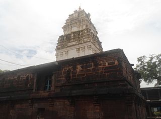
Palakollu is the administrative headquarters of Palakollu Mandal in Narasapuram revenue division in West Godavari district of the Indian state of Andhra Pradesh. Palakollu is situated in Coastal Andhra region of the state. Occupying 19.49 square kilometres (7.53 sq mi) As of 2011 census, it has a population of about 61.2 kilo and a Metro population of about 81.1 kilo, making it the fourth most populous city in West Godavari District in Andhra pradesh. Palakollu City was selected for the year 2015-16 Housing for All Under Pradhan Mantri Awas Yojana for house less poor in the urban areas. At an average altitude of 1.5 metres (4.9 ft), Palakollu city is situated on National Highway 165 (India) and National Highway 216 (India) It is bounded by Krishna district on the west, East Godavari district on the east, Bay of Bengal on the south and the state of Telangana on the north. which is home to Ksheerarama, one of the five great Pancharama Kshetras.

Nidadavolu is a town in West Godavari district of the Indian state of Andhra Pradesh. It is a municipality and the mandal headquarters of Nidadavolu mandal in Kovvur revenue division.

Rampachodavaram is a census town in East Godavari district of the Indian state of Andhra Pradesh. It is located in Rampachodavaram mandal of Rampachodavaram revenue division.
Samalkota is a town in East Godavari district of the Indian state of Andhra Pradesh. The town also forms a part of Godavari Urban Development Authority. Previously spelled as Samulcottah
Sileru River is a tributary of Sabari River. It originates in Andhra Pradesh and also flows through Odisha before merging with Sabari. Sabari river crosses the border into Andhra Pradesh to merge with Godavari river. Sileru river joins Sabari river tri-junction boundary point of Andhra Pradesh, Chhattisgarh and Odisha.habby

Andhra Pradesh lies between 12°41' and 19.07°N latitude and 77° and 84°40'E longitude, and is bordered by Telangana, Chhattisgarh, and Orissa in the north, the Bay of Bengal in the East, Tamil Nadu to the south and Karnataka to the west. Among the other states, which are situated on the country's coastal area, Andhra Pradesh has got a coastline of around 974 km, which gives it the 2nd longest coastline in the nation. Two major rivers, the Godavari and the Krishna run across the state. A small enclave 12 sq mi (30 km²), the Yanam district of Puducherry, lies in the Godavari Delta in the north east of the state. The state includes the eastern part of Deccan plateau as well as a considerable part of the Eastern Ghats.

National Highway 216 is a National Highway in the Indian state of Andhra Pradesh. The former highways of NH 214 and 214A were merged and renanmed to NH 216. It starts from NH 16 junction at Kattipudi and meets NH 16 again at Ongole, in the state of Andhra Pradesh. Visakhapatnam - Kakinada Petro Chemical Corridor was proposed along this highway.Land survey and acquisition process is on track

Kakinada revenue division is an administrative division in the East Godavari district of the Indian state of Andhra Pradesh. It is one of the 3 revenue divisions in the district which consists of 8 mandals under its administration. Kakinada city is the divisional headquarters.
Pandalapaka is a village in Visakhapatnam district of the Indian state of Andhra Pradesh. It is under of Visakhapatnam revenue division.
Pandalapaka may refer to:

Amalapuram revenue division is an administrative division in the East Godavari district of the Indian state of Andhra Pradesh. It is one of the 7 revenue divisions in the district which consists of 16 mandals under its administration. Amalapuram is the divisional headquarters.

Peddapuram revenue division is an administrative division in the East Godavari district of the Indian state of Andhra Pradesh. It is one of the 7 revenue divisions in the district which consists of 12 mandals under its administration. Peddapuram is the divisional headquarters.

Biccavolu mandal is one of the 65 mandals in East Godavari district of the Indian state of Andhra Pradesh. It is under the administration of Rajahmundry revenue division and the headquarters are located at Biccavolu village. Biccavolu Mandal is bounded by Rayavaram Mandal towards South, Pedapudi Mandal towards East, Anaparthy Mandal towards west, Ramachandrapuram Mandal towards north. It is located ata distance of 41 kilometres from Rajahhmundry.

Andhra Pradesh Eastern Power Distribution Company Limited or APEPDCL is the Electricity Distribution company owned by the Government of Andhra Pradesh for the Five Districts of Andhra Pradesh.