Pando Creek

Last updated
Pando Creek
Arroyo Pando at Pando.jpg
Location
Country Uruguay
Physical characteristics
Length28 kilometres (17 mi)

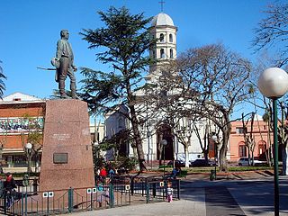
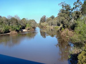
Pando Creek (Spanish : Arroyo Pando) is a Uruguayan stream, crossing Canelones Department. It flows into the Río de la Plata. Its name derives from the nearby city of Pando.

Spanish language Romance language

Spanish or Castilian is a Romance language that originated in the Castile region of Spain and today has hundreds of millions of native speakers in the Americas and Spain. It is a global language and the world's second-most spoken native language, after Mandarin Chinese.

Uruguay republic in South America

Uruguay, officially the Oriental Republic of Uruguay, is a country in the southeastern region of South America. It borders Argentina to its west and Brazil to its north and east, with the Río de la Plata to the south and the Atlantic Ocean to the southeast. Uruguay is home to an estimated 3.44 million people, of whom 1.8 million live in the metropolitan area of its capital and largest city, Montevideo. With an area of approximately 176,000 square kilometres (68,000 sq mi), Uruguay is geographically the second-smallest nation in South America, after Suriname.

Canelones Department Place in Uruguay

The Departamento de Canelones , with an area of 4,536 km2 (1,751 sq mi) and 518,154 inhabitants, is located in the south of Uruguay. Its capital is Canelones.

See also

Related Research Articles

Armed Forces of Uruguay combined military forces of Uruguay

The Armed Forces of Uruguay consist of an army, navy, and air force. These three branches are constitutionally subordinate to the President of Uruguay through the Minister of Defense. By offering early retirement incentives, the government has trimmed the armed forces to about 16,800 for the army; 6,000 for the navy; and 3,000 for the air force. As of February 2003, Uruguay has more than 2,500 soldiers deployed on 12 UN Peacekeeping missions. The largest groups are in the Democratic Republic of the Congo and Haiti. There is also a 58-man contingent in the MFO in the Sinai.

Arctic Archipelago Canadian archipelago

The Arctic Archipelago, also known as the Canadian Arctic Archipelago, is a group of islands north of the Canadian mainland.

Pando may refer to:

Derrubadas municipality of Brazil

Derrubadas is a municipality of the Brazilian state of Rio Grande do Sul.

Moreruela de Tábara is a municipality located in the province of Zamora, Castile and León, Spain. According to the 2004 census (INE), the municipality has a population of 482 inhabitants.

Lussich Arboretum arboretum

The Lussich Arboretum is an arboretum of 192 hectares located in the Maldonado Department of Uruguay near Punta del Este and Punta Ballena.

Vivallos Glacier is a short, steep glacier flowing north into Leith Cove, Paradise Harbor, Danco Coast. Following survey by the Chilean Antarctic Expedition, 1950–51, the glacier was named for Cabo Jose L. Vivallos, a member of the expedition.

Pando, Uruguay City & Municipality in Canelones, Uruguay

Pando is a city in Canelones Department of Uruguay. It is an important commercial and industrial centre which has become part of the wider metropolitan area of Montevideo. It is the birthplace of Abel Hernández who plays for CSKA Moscow.

Empalme Olmos Village in Canelones Department, Uruguay

Empalme Olmos is a village in the Canelones Department of southern Uruguay.

Estanque de Pando Suburb of Pando in Canelones Department, Uruguay

Estanque de Pando is a northern suburb of Pando in the Canelones Department of southern Uruguay.

Jardines de Pando Suburb of Pando in Canelones Department, Uruguay

Jardines de Pando is a suburb of the city of Pando in the Canelones Department of southern Uruguay.

Route 10 (Uruguay) highway in Uruguay

Route 10 is a national route of Uruguay. In 1983, it was assigned the name Juan Díaz de Solís, honouring the Spanish navigator.

Fraccionamiento Camino Maldonado Suburb of Pando (2 fragments) in Canelones Department, Uruguay

Fraccionamiento Camino Maldonado is a suburb of Pando. It is composed of two fragments, one at the northeast and one at the southwest of Barros Blancos. The three together form a southwestern extension of the urban area of Pando, and they all belong to the wider metropolitan area of Montevideo.

Ruta Interbalnearia highway in Uruguay

Ruta Interbalnearia or Ruta Líber Seregni is a national route of Uruguay. It connects Montevideo with Punta del Este to the east along the coast. The road is approximately 90 kilometres (56 mi) in length. It is marked on maps and signs as IB.

Guazú-Virá human settlement

Guazuvirá or Guazú-Virá is a seaside resort in Canelones Department, Uruguay.

Santa Ana, Canelones Uruguay

Santa Ana is a seaside resort in Canelones Department, Uruguay.

Santa Lucía del Este

Santa Lucía del Este is a seaside resort in Canelones Department, Uruguay.

References

    Coordinates: 34°48′S55°52′W / 34.800°S 55.867°W / -34.800; -55.867

    Geographic coordinate system Coordinate system

    A geographic coordinate system is a coordinate system that enables every location on Earth to be specified by a set of numbers, letters or symbols. The coordinates are often chosen such that one of the numbers represents a vertical position and two or three of the numbers represent a horizontal position; alternatively, a geographic position may be expressed in a combined three-dimensional Cartesian vector. A common choice of coordinates is latitude, longitude and elevation. To specify a location on a plane requires a map projection.