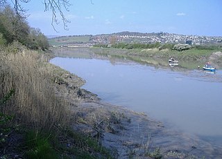
The River Usk rises on the northern slopes of the Black Mountain, Wales, in the westernmost part of the Brecon Beacons National Park. Initially forming the boundary between Carmarthenshire and Powys, it flows north into Usk Reservoir, then east by Sennybridge to Brecon before turning southeast to flow by Talybont-on-Usk, Crickhowell and Abergavenny after which it takes a more southerly course.

Raglan (; is a village and community in Monmouthshire, south east Wales, United Kingdom. It is located some 9 miles south-west of Monmouth, midway between Monmouth and Abergavenny on the A40 road very near to the junction with the A449 road. The fame of the village derives from Raglan Castle, built for William ap Thomas and now maintained by Cadw. The community includes the villages of Llandenny and Pen-y-clawdd. Raglan itself has a population of 1,183.

Llanfihangel Gobion is a village and rural parish of Monmouthshire, Wales, lying within the administrative community of Llanover.

Llanellen is a village in Monmouthshire, south-east Wales, United Kingdom. It is located three miles (4.8 km) south of Abergavenny. The population was 506 in 2011.

Llanishen is a village in Monmouthshire, south east Wales, United Kingdom. It is located 7 miles (11 km) south west of Monmouth and 3 miles (4.8 km) south of Trellech on the B4293 road, although the main part of the village is set immediately to the west of the road, overlooking the Vale of Usk.

St Mary the Virgin is the former parish church for Llanfair Kilgeddin, near Usk in Monmouthshire, south east Wales. It is a Grade I listed building, notable for its significant Arts and Crafts interior. The church was declared redundant in the 1980s and is now in the care of the Friends of Friendless Churches.

LlanvihangelCourt, Llanvihangel Crucorney, is a Tudor country house in Monmouthshire, Wales. The architectural historian John Newman, in his Gwent/Monmouthshire volume of The Buildings of Wales series described the court as "the most impressive and richly decorated house of around 1600 in Monmouthshire". The origins of the house are medieval, with a traditional date of construction of 1471. The building was given its present appearance by a substantial enlargement and re-casing of circa 1600 by Rhys Morgan, of the family of the original owners. In the very early 17th century it was owned briefly by Edward Somerset, 4th Earl of Worcester.

Monmouthshire is a county and principal area of Wales. It borders Torfaen and Newport to the west; Herefordshire and Gloucestershire to the east; and Powys to the north. The largest town is Abergavenny, with other large settlements being Chepstow, Monmouth, and Usk. The present county was formed under the Local Government (Wales) Act 1994, and comprises some sixty percent of the historic county. Between 1974 and 1996, the county was known by the ancient title of Gwent, recalling the medieval Welsh kingdom. The county is 850 km2 in extent, with a population of 95,200 as of 2020.

Monmouthshire is a county and principal area of Wales. It borders Torfaen and Newport to the west; Herefordshire and Gloucestershire to the east; and Powys to the north. The largest town is Abergavenny, with the other major towns being Chepstow, Monmouth, and Usk. The county is 850 km2 in extent, with a population of 95,200 as of 2020. The present county was formed under the Local Government (Wales) Act 1994, and comprises some sixty percent of the historic county. Between 1974 and 1996, the county was known by the ancient title of Gwent, recalling the medieval Welsh kingdom. In his essay on local government in the fifth and final volume of the Gwent County History, Robert McCloy suggests that the governance of "no county in the United Kingdom in the twentieth century was so transformed as that of Monmouthshire".

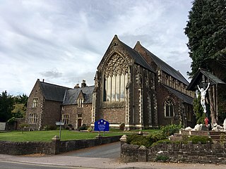
The Church of Our Lady and St Michael in Abergavenny, Monmouthshire, is a Roman Catholic parish church. A Grade II* listed building, it was built between 1858 and 1860 to a design by Benjamin Bucknall.

Abergavenny Bridge,, crosses the River Usk at the boundary between Abergavenny and Llanfoist. The bridge carries the A4143. The bridge is of medieval origin, but was substantially reconstructed in the early 19th century, to support a tramroad, and in the mid 19th century, when the two bridges were combined.

Llanwenarth Baptist Chapel, Govilon, Monmouthshire is the oldest Baptist chapel in Wales. Founded in 1652, the present building was constructed in 1695, and was remodelled in the 18th, 19th and 21st centuries. The chapel is a Grade II* listed building and remains an active Baptist chapel.

The Church of St Cadoc, Llangattock-Juxta-Usk, Monmouthshire is a parish church with its datable origins in the 15th century. The church was restored in 1827 and again in 1864–5. It is a Grade II* listed building.

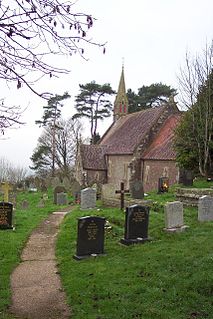
The Church of St Michael, Llanvihangel Gobion, Monmouthshire is a parish church with datable origins to the 15th century. There is no record of a Victorian restoration, although one must have occurred, but there is documented evidence of a "light" reconstruction in 1925. Since the date, the church has barely been altered. It now is closed, having been declared redundant and is in the care of the Representative Body of the Church in Wales. It is a Grade II* listed building.

The Church of St Cadoc, Llangattock Vibon Avel, Monmouthshire is a parish church of medieval origins which was heavily restored in the 19th century. The estate church of The Hendre, it is closely connected with the Rolls family and the grave of Charles Stewart Rolls, the motoring and aviation pioneer, is located in the churchyard. The church is a Grade II* listed building and is now in the care of the Friends of Friendless Churches.

The Pant, Llanvihangel-Ystern-Llewern, Monmouthshire is a hall-house dating from the 16th century with an attached 17th century Quaker meeting house. It is a Grade II* listed building.

Great House, Llanover, Monmouthshire is a country house dating from the late-16th century. Extended in the mid-18th century and little altered thereafter, it is a Grade II* listed building.

Maerdy Farmhouse , Llanvihangel-Ystern-Llewern, Monmouthshire is a farmhouse dating from about 1700. Extended later in the 18th century, it is an early example of the use of brick, rather than stone, in Monmouthshire. The farmhouse is Grade II* listed with its stableblock and shelter shed, and its barn and cider house having their own Grade II listings.

Millbrook, Llanvihangel Crucorney, Monmouthshire is a house dating from the early 17th century and is a Grade II* listed building.


