Related Research Articles
Parish councils are civil local authorities found in England which are the lowest tier of local government. They are elected corporate bodies, with variable tax raising powers, and they carry out beneficial public activities in geographical areas known as civil parishes. There are about 10,480 parish and town councils in England. Parish councils may be known by different styles, they may resolve to call themselves a town council, village council, community council, neighbourhood council, or if the parish has city status, it may call itself a city council. However their powers and duties are the same whatever name they carry.

North Kesteven is a local government district in Lincolnshire, England. The district is located to the east of Nottinghamshire, north-east of Leicestershire and south of the city of Lincoln. Its council, North Kesteven District Council, is based in Sleaford in the former offices of Kesteven County Council. Notable towns and villages in the district include Cranwell, Metheringham, North Hykeham, Sleaford and Waddington.

Referendums in the United Kingdom are occasionally held at a national, regional or local level. Historically, national referendums are rare due to the long-standing principle of parliamentary sovereignty. There is no constitutional requirement to hold a national referendum for any purpose or on any issue; the UK Parliament is free to legislate through an Act of Parliament for a referendum to be held on any question at any time, but these cannot be constitutionally binding on either the Government or Parliament, although they usually have a persuasive political effect.

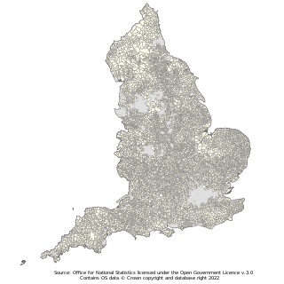
In England, a civil parish is a type of administrative parish used for local government. It is a territorial designation which is the lowest tier of local government. Civil parishes can trace their origin to the ancient system of ecclesiastical parishes, which historically played a role in both secular and religious administration. Civil and religious parishes were formally differentiated in the 19th century and are now entirely separate. Civil parishes in their modern form came into being through the Local Government Act 1894, which established elected parish councils to take on the secular functions of the parish vestry.
A town council, city council or municipal council is a form of local government for small municipalities.
Horndean is a village and civil parish in Hampshire, England, 8 miles (13 km) north of Portsmouth.
A community council is a public representative body in Great Britain.

Morcott is a village and civil parish in the county of Rutland in the East Midlands of England. The population at the 2001 census was 329 falling slightly to 321 at the 2011 census. It is located about 7 miles (11 km) south-east of the county town of Oakham on the A47 and A6121 roads. A prominent reconstructed windmill can be seen from both East and West-bound approaches to Morcott along the A47.
Neighborhood planning is a form of urban planning through which professional urban planners and communities seek to shape new and existing neighborhoods. It can denote the process of creating a physical neighborhood plan, for example via participatory planning, or an ongoing process through which neighborhood affairs are decided.
Bleadon is a village and civil parish in Somerset, England. It is about 4 miles (6.4 km) south of Weston-super-Mare and, according to the 2011 census, has a population of 1,079.
Claverton is a small village and civil parish about 2 miles (3 km) east of Bath at the southern end of the Cotswolds Area of Outstanding Natural Beauty, in Somerset, England. The parish has a population of 115.

Liverton is a village in the borough of Redcar and Cleveland and the ceremonial county of North Yorkshire, England.
Shadwell is a village and civil parish in north-east Leeds, West Yorkshire, England. The village is 6 miles (9.7 km) to the north east of Leeds city centre.
Collingtree is a village and civil parish in the West Northamptonshire district of Northamptonshire, England. It is part of the Northampton built-up area.

Seavington St Mary is a village and civil parish in Somerset, England. It is situated next to the village of Seavington St Michael, about 3 miles (4.8 km) east of Ilminster, within the South Somerset district and had a population of 384 inhabitants at the 2011 census.
Pannal is a village in the Harrogate district of North Yorkshire, England. Historically part of the West Riding of Yorkshire, it is situated to the immediate south of Harrogate. Since 2016 it has formed part of the new civil parish of Pannal and Burn Bridge. The village is served by Pannal railway station on the Harrogate (Railway) Line between Leeds and York.
Crowmarsh is a fairly large, mostly rural civil parish in South Oxfordshire, England east and southeast of the town of Wallingford on the opposite bank of the River Thames and may also refer to its larger district council ward which extends to Ipsden and Nuffield.
Village design statement (VDS) is a term of English rural planning practice. A VDS is a document that describes the distinctive characteristics of the locality, and provides design guidance to influence future development and improve the physical qualities of the area.

Lawshall is a village and civil parish in Suffolk, England. Located around a mile off the A134 between Bury St Edmunds and Sudbury, it is part of Babergh district. The parish has nine settlements comprising the three main settlements of The Street, Lambs Lane and Bury Road along with the six small hamlets of Audley End, Hanningfield Green, Harrow Green, Hart's Green, Hibb's Green and Lawshall Green.

Lawshall Green is a hamlet in the civil parish of Lawshall in the Babergh district in the county of Suffolk, England. It is located east of Hibb's Green and is less than half a mile off the A134 between Bury St Edmunds and Sudbury.
References
- 1 2 "Community Led Planning". ACRE – Action with Communities in Rural England . 2011. Archived from the original on 5 April 2011 – via Internet Archive.
- ↑ "Community Led Planning". Rural Community Council of Essex. Retrieved 13 March 2023.
| | This article relating to Town and country planning in the United Kingdom is a stub. You can help Wikipedia by expanding it. |