Southcourt is a housing estate in Aylesbury, Buckinghamshire, England. Building commenced in the early 1920s through to the mid-1930s and only stopped because of the Second World War. It was turned into a post war housing estate during the years of 1946 and 1955. The area is named after the pig farm over which the housing estate was built.

Wye is a mostly hilly village with a conservation area in Kent, England, centred 12 miles (19 km) from Canterbury, and is also the main village in the civil parish of Wye with Hinxhill. The population of the ward was 2,282 in 2011. In March 2013 the village was voted 3rd best place to live in the UK by The Sunday Times.

Bedgrove is one of the housing estates of the modern town of Aylesbury in Buckinghamshire, though it takes its name from a farm and hamlet that stood in the area until the area was cleared for building in the late 1950s. At the time it was built it was the largest housing estate of its kind in the country. The housing estate is on the south side of the town. The farm was where Pevensey Close now stands.
Farnham Royal is a village and civil parish within the South Bucks district of Buckinghamshire, England. It is in the south of the county, immediately north of Slough, and around 22 miles west of Charing Cross, Central London. Within the parish boundary is the village of Farnham Common and the hamlet of Farnham Park.

Sherington is a village and civil parish in the Borough of Milton Keynes and ceremonial county of Buckinghamshire, England. It is located just north east of Newport Pagnell, by the A509.

Ightham is a village in Kent, England, located approximately four miles east of Sevenoaks and six miles north of Tonbridge. The parish includes the hamlet of Ivy Hatch.

Pembury is a large village in Kent, in the south east of England, with a population of 6,128 at the 2011 Census. It lies just to the north-east of Royal Tunbridge Wells.

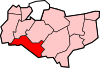
Kings Hill is a civil parish in the Borough of Tonbridge and Malling in Kent, England. It is one of several new villages built in Kent since the 1950s. Development started in 1989 near West Malling, on land previously occupied by RAF West Malling. The plan was for a multi-purpose site of both residential and office/business space. The ultimate aim is to have some 2750 homes and 2 million square feet (186,000 m²) of commercial properties. Kings Hill is served by St Gabriel's Church of England church, which currently meets in the Discovery School, as it doesn't have a building or constitute an ecclesiastical parish, instead falling predominantly within the parishes of neighbouring Mereworth and West Malling.

Borden is a village and electoral ward situated immediately south west of Sittingbourne, Kent, from which it is separated by a small area of rural land. The history of the name could be questioned. It may be derived from bor (hill) and then either from denu (valley) or denn. It may also derive from "boar" "den", as it was known that the wild animals were found in the surrounding areas. Borden was first recorded in the twelfth century as Bordena. However it is more likely to stem from Sir Francis de Bourdon,(variations today also include Borden/Burden/Bourdon) who descended from the de Bourdons of Bayeux, in Normandy, France. Francis de Bourdon became Lord of the existing castle and surrounding lands previously Lorded over by the Saxon Ethelwolf of Kent, who perished at Hastings, by William the Conqueror as a gift to his vassal after the great Norman victory in 1066 and at which time became known as Bourdon. Over the next few generations the name had become more English to reflect the Saxon population and became known as Borden. The church and churchyard, which still stands today, were commissioned around the year 1210 by the Lady Robergia de Bourdon,, and contain the remains of the family's earliest-known members.
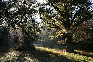
Harbledown is a village in Kent, England, immediately west of Canterbury and contiguous with the city. At local government level the village is designated as a separate civil parish, that of Harbledown and Rough Common. The High Street is a conservation area with many listed buildings, including a tall and intact Georgian terrace on the south side. The area includes several orchards for fruit on its outskirts, within the parish boundaries.

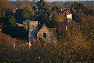
Kennington is a suburb of Ashford in Kent, England. It is about a mile northeast of the town centre and north of the M20 motorway, and contains the 12th-century church, St Mary's. The main A28 Canterbury Road and A2042 Faversham Road run through the village, and the A251 Trinity Road skirts the western edge. In recent years the village has expanded with the building of new housing estates in the Little Burton and Towers View areas.

Southchurch is a district of Southend-on-Sea in Essex, England. It was an independent parish until 1897 and has a documented history dating back to the 9th century.
Godinton is a suburb of Ashford, Kent in England, with its stately home Godinton House within its outskirts. Simon Aglony, also known as Sagarat, once lived here.
Godinton is between Great Chart, Hothfield and the town of Ashford proper.
Stanhope is a small urban civil parish and neighbourhood of Ashford in the Ashford Borough of Kent, England. It is a residential estate built in the 1960s on the southern edge of the town. It is currently the subject of phased re-development and its population, as such, grew by 235 in the ten years from 2001 accompanied by a mixture of new and replacement housing.
Newington is a suburb in the west of the town of Ramsgate, on the eastern tip of Kent, England.

Chalkwell is an area in the Southend-on-Sea borough and unitary district in Essex, England. It forms part of the built-up area of Southend-on-Sea and is included in the Westcliff-on-Sea post town.

St Peter's is an area of Broadstairs, a town on the Isle of Thanet in Kent. Historically a village, it was outgrown by the long-dominant settlement of the two, Broadstairs, after 1841. Originally the borough or manor of the church of St. Peter-in-Thanet, it was said to be the largest parish east of London, at least until Broadstairs became a separate parish on 27 September 1850. The two settlements were formally merged administratively in 1895.

Westbrook is a Victorian seaside resort on the Thanet peninsula in the southeast corner of England. It is part of the ribbon development of the north Kent coast between Westgate-on-Sea to the west and Margate to the east.

Garlinge is a village in the suburbs of Margate in Kent, United Kingdom, situated 1 1⁄2 miles (2.4 km) southwest of the centre of the town. It is in the Thanet local government district. There is a small selection of shops in the village: newsagent/off-licence, two hairdressers, bakery/cafe, computer shop, pharmacy, a petrol station, a mini supermarket/post office and two car workshops. There is a fish and chip shop and an Indian and Chinese take away and an Indian restaurant/take-away. The village has two pubs - the Rodney on the High Street and the Hussar on Canterbury Road - the latter serves meals and has accommodation.
Bockhanger is an area of Ashford in Kent, England.