Pascagama River

Last updated
Pascagama
Nottaway map.png
Watershed of Nottaway River
Location
Country Canada
Province Quebec
Region Nord-du-Québec
Physical characteristics
SourceMarceau Lake
  location La Tuque, Mauricie, Quebec
  coordinates 48°57′06″N75°01′22″W / 48.95167°N 75.02278°W / 48.95167; -75.02278
  elevation464 m (1,522 ft)
Mouth Pascagama Lake
  location
Senneterre, Abitibi-Témiscamingue, Quebec
  coordinates
48°37′52″N75°33′25″W / 48.63111°N 75.55694°W / 48.63111; -75.55694 Coordinates: 48°37′52″N75°33′25″W / 48.63111°N 75.55694°W / 48.63111; -75.55694
  elevation
393 m (1,289 ft)
Length82.5 km (51.3 mi) [1]

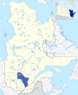
The Pascagama River is a tributary of Pascagama Lake. It flows in the Northwest of Quebec, in Canada, in the administrative regions of:

Pascagama Lake lake flowing in Senneterre, in the La Vallée-de-lOr RCM, in Abitibi-Témiscamingue, Quebec, Canada

Pascagama Lake is a freshwater body of the eastern part of Senneterre in La Vallée-de-l'Or Regional County Municipality (RCM), in the administrative region of Abitibi-Témiscamingue, in the province of Quebec, in Canada. This body of water extends in the townships of Deschamps, Logan and Bernier.

Quebec Province of Canada

Quebec is one of the thirteen provinces and territories of Canada. It is bordered to the west by the province of Ontario and the bodies of water James Bay and Hudson Bay; to the north by Hudson Strait and Ungava Bay; to the east by the Gulf of Saint Lawrence and the province of Newfoundland and Labrador; and to the south by the province of New Brunswick and the US states of Maine, New Hampshire, Vermont, and New York. It also shares maritime borders with Nunavut, Prince Edward Island, and Nova Scotia. Quebec is Canada's largest province by area and its second-largest administrative division; only the territory of Nunavut is larger. It is historically and politically considered to be part of Central Canada.

Canada Country in North America

Canada is a country in the northern part of North America. Its ten provinces and three territories extend from the Atlantic to the Pacific and northward into the Arctic Ocean, covering 9.98 million square kilometres, making it the world's second-largest country by total area. Its southern border with the United States, stretching some 8,891 kilometres (5,525 mi), is the world's longest bi-national land border. Canada's capital is Ottawa, and its three largest metropolitan areas are Toronto, Montreal, and Vancouver.

Contents

Mauricie Administrative region in Quebec, Canada

Mauricie is a traditional and current administrative region of Quebec. La Mauricie National Park is contained within the region, making it a prime tourist location. The region has a land area of 35,855.22 km² and a 2006 census population of 258,928 residents. Its largest cities are Trois-Rivières and Shawinigan.

Abitibi-Témiscamingue Administrative region in Quebec, Canada

Abitibi-Témiscamingue is an administrative region located in western Québec, Canada, along the border with Ontario. It became part of the province in 1898. It has a land area of 57,674.26 km2. The region is divided into five regional county municipalities and 79 municipalities. Its economy continues to be dominated by resource extraction industries. These include logging, mining all along the rich geologic Cadillac Fault between Val-d'Or and Rouyn-Noranda, as well as agriculture.

Senneterre City in Quebec, Canada

Senneterre is a town in the Abitibi-Témiscamingue region of northwestern Quebec, Canada. It is in the Vallée-de-l'Or Regional County Municipality. The town's territory includes a vast undeveloped area stretching from the Bell River to the Mauricie region. The town centre itself is about 60 km (37 mi) northeast of Val-d'Or on the banks of the Bell River, at the intersection of the Canadian National Railway and Quebec Route 113.

Forestry is the main economic activity of this watershed; recreational tourism activities come second.

The surface of the river is usually frozen from early November to the end of April, however, safe ice circulation is generally from early December to mid-April.

Geography

The Pascagama River originates at the mouth of Lake Marceau (length: 4.5 kilometres (2.8 mi), altitude: 465 metres (1,526 ft)) in Marceau Township. The mouth of this lake is located at:
Parent, Quebec Village in Quebec, Canada

Parent is a community in northern Quebec, Canada, located within the City of La Tuque and about 150 kilometres (93 mi) north-west of La Tuque's town centre. In 2011, it had a population of 611.

Baie-James Municipality in Quebec, Canada

The Municipality of Baie-James was a municipality in northern Quebec, Canada, which existed from 1971 to 2012. Located to the east of James Bay, Baie-James covered 297,332.84 km2 (114,800.85 sq mi) of land, making it the largest incorporated municipality in Canada — only eight unorganized territories were larger. Its territory almost entirely covered the administrative region of Jamésie, although it contained less than five percent of the population. Essentially, it was the remainder of the Jamésie Territory's land after all of the major population centres were removed.

Obedjiwan, Quebec First Nations reserve in Quebec, Canada

Obedjiwan is a First Nations reserve and village on the north shore of Gouin Reservoir in the Mauricie region of Quebec, Canada. It belongs to the Atikamekw d'Opitciwan band of the Atikamekw Nation.

From the mouth of Marceau Lake, the Pascagama River flows over 82.5 kilometres (51.3 mi), according to the following segments:

The Pascagama River flows on the north shore of Pascagama Lake in the Township of Deschamps to:

Gouin Reservoir reservoir in Haute-Mauricie (Quebec, Canada)

The Gouin Reservoir is a man-made lake, in La Tuque, in Mauricie, in the central portion of the Canadian provinceof Quebec, fully within the boundaries of the City of La Tuque. It is not one contiguous body of water, but the collective name for a series of connected lakes separated by innumerable bays, peninsulas, and islands with highly irregular shapes. It has therefore a relative long shoreline of over 5,600 km compared to its surface area of 1,570 km². It is the source of the Saint-Maurice River.

Mégiscane River tributary of the Bell River (Nottaway side), Mauricie, Abitibi-Témiscamingue and Nord-du-Québec, Canada

The Mégiscane River is a tributary of Parent Lake (Abitibi). It flows in the Northwest of Quebec, in Canada, in the administrative regions of:

Toponymy

The term "Pascagama" is of Algonquin origin and refers to a camp, dam, lake and river.

The toponym "Pascagama River" was formalized on December 5, 1968, at the Commission de toponymie du Québec, when the commission was created. [3]

See also

Notes and references

  1. "Atlas of Canada". atlas.nrcan.gc.ca. Retrieved 2018-01-21.
  2. River segments measured from the Atlas of Canada (published on the Internet) of the Department of Natural Resources Canada.
  3. Commission de toponymie du Quebec - Bank of Place Names - Toponym: "Pascagama River"

Related Research Articles

Aigle River (Doda Lake) watercourse in Canada

The Des Aigle River is a tributary of Doda Lake, flowing in Quebec, Canada, in the administrative regions of:

Canusio Lake lake crossed by the Mégiscane River, in Abitibi-Témiscamingue, Quebec, Canada

Canusio Lake is a freshwater body in the northeastern part of Senneterre in the La Vallée-de-l'Or Regional County Municipality (RCM), in the administrative region of Abitibi-Témiscamingue, in the province of Quebec, in Canada.

Barry Lake Head Lake of Saint Cyr South River in Abitibi-Témiscamingue, Quebec, Canada

Barry Lake is a body of freshwater in the north-eastern part of Senneterre in the La Vallée-de-l'Or Regional County Municipality (RCM), in the administrative region of Abitibi-Témiscamingue, in the province of Quebec, in Canada.

Saint-Cyr Lake (Saint-Cyr River South) lake crossed by the Saint-Cyr South River in Abitibi-Témiscamingue, Quebec, Canada

Saint-Cyr Lake is a freshwater body of water crossed by the Saint-Cyr River South in the north-eastern part of Senneterre, in La Vallée-de-l'Or Regional County Municipality (RCM), in the administrative region of Abitibi-Témiscamingue, in the province of Quebec, in Canada.

Saint-Cyr River South river in Abitibi-Témiscamingue, Quebec

The Saint-Cyr River South is a tributary of the Mégiscane River (via the Canusio Lake, flowing into Senneterre, in the administrative region of Abitibi-Témiscamingue, in Quebec, in Canada.

Cherrier Lake Lake on the side of the Saint-Cyr River South (Mégiscane and Nottaway side), in Abitibi-Témiscamingue, Quebec, Canada

Cherrier Lake is a body of freshwater in the north-eastern part of Senneterre in the Vallée-de-l'Or Regional County Municipality (RCM), in the administrative region of Abitibi-Témiscamingue, in the province of Quebec, in Canada.

Mesplet Lake Saint-Cyr River South Slope Lake, Mégiscane, Bell and Nottaway, in Senneterre, Abitibi-Témiscamingue, Quebec, Canada

Mesplet Lake is a freshwater body in the north-eastern part of Senneterre in Vallée-de-l'Or Regional County Municipality (RCM), in the administrative region of Abitibi-Témiscamingue, in the province of Quebec, in Canada.

Macho River tributary of the Mégiscane River, flowing into Eeyou Istchee Baie-James (municipality) and Senneterre, Quebec, Canada.

The Macho River is a tributary of the Mégiscane River, flowing in Quebec, Canada, in the territories of:

Achepabanca River North-East river in Abitibi-Témiscamingue, Quebec, Canada.

The Achepabanca River Northeast is a tributary of the Achepabanca River, flowing into the northeastern part of Senneterre within La Vallée-de-l'Or Regional County Municipality (RCM), in the administrative region of Abitibi-Témiscamingue, in Quebec, in Canada.

Collin River (Mégiscane River tributary) River in Canada.

Collin River is a tributary of the North Shore of the Mégiscane River, flowing into Senneterre, in La Vallée-de-l'Or Regional County Municipality, in the administrative region of Abitibi-Témiscamingue, Quebec, Canada.

Wapous River tributary of the Gouin Reservoir, in Haute-Mauricie, Quebec, Canada

The Wapous River is a tributary of the Gouin Reservoir, flowing in the territory of the town of La Tuque, in the administrative region of Mauricie, in Quebec, in Canada.

The Toussaint River is a tributary of the north shore of the Gouin Reservoir, flowing in Quebec, in Canada in the administrative region of:

Pokotciminikew River river in Mauricie, Quebec, Canada

The Pokotciminikew River is a tributary of the North Shore of the Kakospictikweak River, flowing into the territory of the Town of La Tuque, in the administrative region of Mauricie, in Quebec, in Canada. The course of this river successively crosses the cantons of Pfister, Balete and Mathieu.

Tamarac River (Gatineau River tributary) tributary of the Gatineau River, Outaouais (Quebec, Canada)

The Tamarac River is a tributary of Pain de Sucre Lake, flowing north of the St. Lawrence River, first in Senneterre (MRC of La Vallée-de-l'Or Regional County Municipality, in Abitibi-Témiscamingue and in the territory of La Tuque, in the administrative region of Mauricie, in Quebec, in Canada.

Plamondon Bay Gouin Reservoir Bay, in La Tuque, Mauricie (Quebec, Canada)

Plamondon Bay is a body of freshwater located in the western part of Gouin Reservoir, in the territory of the town of La Tuque, in the administrative region of the Mauricie, in the province of Quebec, in Canada.

The Plamondon Creek is a tributary of the Plamondon Bay located in the western part of the Gouin Reservoir. This stream runs entirely in forest zone in the town of La Tuque, in the administrative region of Mauricie, in Quebec, in Canada.

The De la Rencontre Creek is a tributary of the Du Mâle Lake located in the western part of the Gouin Reservoir, flowing entirely into forest area in the town of La Tuque, in the administrative region of Mauricie, Quebec, Canada.

The Piponisiw River is a tributary of Simard Lake located in the western part of the Gouin Reservoir, flowing entirely into the forest zone in the town of La Tuque, in the administrative region of Mauricie, Quebec, Canada.