Pasi Poljana

Last updated

Pasi Poljana
urban settlement
CountryFlag of Serbia.svg  Serbia
District Nišava District
Municipality Flag of Nis.gif  Niš
Time zone UTC+1 (CET)
  Summer (DST) UTC+2 (CEST)

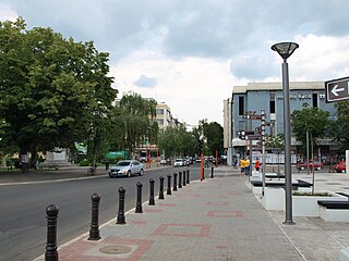
Pasi Poljana is an urban settlement in Niš municipality in Serbia. [1] Pasi Poljana is a suburb of Niš in the area of the city municipality of Palilula in the Nišava district. It is located on the wavy terrain of the Bubanj zone, about 4.5 km southwest of the center of Nis. According to the 2002 census, there were 2,139 inhabitants (according to the 1991 census there were 1705 inhabitants). In the settlement there are separate classes of all grades of the primary school Kralj Petar Prvi.

Niš City in Southern and Eastern Serbia, Serbia

Niš is the third largest city in Serbia and the administrative center of the Nišava District. According to the 2011 census, the city proper has a population of 187,544, while its administrative area has a population of 260,237 inhabitants.

Serbia Republic in Southeastern Europe

Serbia, officially the Republic of Serbia, is a country situated at the crossroads of Central and Southeast Europe in the southern Pannonian Plain and the central Balkans. The sovereign state borders Hungary to the north, Romania to the northeast, Bulgaria to the southeast, North Macedonia to the south, Croatia and Bosnia and Herzegovina to the west, and Montenegro to the southwest. The country claims a border with Albania through the disputed territory of Kosovo. Serbia's population is about seven million, most of whom are Orthodox Christians. Its capital, Belgrade, ranks among the oldest and largest citiеs in southeastern Europe.

Contents

History

Passy Poljana is old, but in the Middle Ages, a village was formed, since the Turkish census was recorded in 1498 as Pasi Pola, with 21 houses, 5 unmarried and 1 widowed house, and with duties of 3.233 aces. According to the Turkish census of the Nakhije of Nis from 1516, the place was one of the 111 villages of Nahije and it was named Pasje Polje, and it had 19 houses, 3 widowed households, and 5 single households. [1] In the later times, the village dies and occasionally comes down to the status of a mezra.

At the beginning of the 19th century, embossing the boots from various parts, it is renewed by the Spahija Stabeg. Turčin set himself a house (tower) in the present-day Economic Valley, in the quest for Crkviste, and tried to seize the peasants of the village around them. Thus in the Economic valley, in some parts of it, the ancestors of today's Savinac, Kosutin, Mrstinac and Nizin originate from Leskovac region. For these, in the 19th century, newcomers from Pirot (Adžijina) and Svrljiški region (Denčini, Redžini and Živići) and others were settled. Prior to liberation from the Turks, with 36 houses, he managed Ali-aga from Djakovica. In 1878, the village had 36 households and 302 inhabitants.

In the period of Serbia and inter-Yugoslav Yugoslavia, it gradually loses its natural characteristics, focusing on market and suburban agriculture. In 1930, there were 105 households and 720 inhabitants.

The development after 1945 caused, on the one hand, the relocation or gradual dislocation of the settlement towards Nis, while the proximity of the city, on the other hand, attracted newcomers from other villages. At the same time there was a significant economic and social restructuring of the population (in 1971 there were 32 agricultural, 104 mixed and 158 non-agricultural households). On this basis, Passi Poljana lost the traditional rural features (though not the traditional rural organization of the settlement) already in the 1960s, and was first mixed, then from 1975/80. year and city hallmarks as a peripheral workers' settlement Nis.

Demography

In the village of Pasi Poljana there are 1663 adult inhabitants, and the average age of the population is 38.7 years (38.6 in males and 38.8 in females). In the settlement there are 936 households, and the average number of members per household is 3.14.

This settlement was largely inhabited by Serbs (according to the 2002 census), and in the last three censuses, there was an increase in the number of inhabitants.

Related Research Articles

Ćuprija Town and municipality in Šumadija and Western Serbia, Serbia

Ćuprija is a town and municipality located in the Pomoravlje District of central Serbia. The population of the town is 19,380, while the municipality has 30,645 inhabitants.

Nišava District District of Serbia in Southern and Eastern Serbia

The Nišava District is one of nine administrative districts of Southern and Eastern Serbia. It expands to the south-eastern parts of Serbia. According to the 2011 census results, it has a population of 372,404 inhabitants. The administrative center of the district is the city of Niš.

Alibunar Town and municipality in Vojvodina, Serbia

Alibunar is a town and municipality located in the South Banat District of the autonomous province of Vojvodina, Serbia. Alibunar town and Alibunar municipality have a population of 2,883 and 19,780 respectively.

Kula, Serbia Town and municipality in Vojvodina, Serbia

Kula is a town and municipality located in the West Bačka District of the autonomous province of Vojvodina, Serbia. The town has a population of 17,866, while the municipality has a population of 43,101.

Svrljig Town and municipality in Southern and Eastern Serbia, Serbia

Svrljig is a town and municipality located in the Nišava District of the southern Serbia. According to 2011 census, the town has a population of 7,553 inhabitants, while the municipality has 14,249.

Žitorađa Village and municipality in Southern and Eastern Serbia, Serbia

Žitorađa is a village and municipality located in the Toplica District of the southern Serbia. The municipality includes 30 settlements. According to the 2011 census, the population of the municipality is 16,368 inhabitants.

Vlasotince Town and municipality in Southern and Eastern Serbia, Serbia

Vlasotince is a town and municipality located in Jablanica District of southern Serbia. As of 2011, the municipality has 29,669 inhabitants, while the town itself has a population of 15,830 inhabitants.
Pantelej City municipality in Southern and Eastern Serbia, Serbia

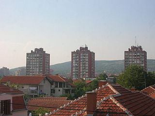
Pantelej is one of five city municipalities which constitute the city of Niš. The municipality has a population of 79,290 inhabitants, according to the 2011 census results.

Aleksinac Town and municipality in Southern and Eastern Serbia, Serbia

Aleksinac is a town and municipality located in the Nišava District of the southern Serbia. According to 2011 census, the town has a population of 17,978 inhabitants, while the municipality has 51,863 inhabitants.

Ražanj Village and municipality in Southern and Eastern Serbia, Serbia

Ražanj is a village and municipality located in the Nišava District of southern Serbia. The municipality is consisted of 23 settlements having a total population of 9,150 inhabitants. The municipality covers an area of 289 square kilometers and it is located 50 kilometers (31 mi) northwest of Niš.

Gadžin Han Village and municipality in Southern and Eastern Serbia, Serbia

Gadžin Han is a village and municipality located in the Nišava District of the southern Serbia. According to 2011 census, the municipality has 8,389 inhabitants.

Azbresnica is a village situated in Merošina municipality in Serbia.

Berbatovo is an inhabited settlement in Palilula in Nis region in Nisava district. It is located on the southern edge of Nis valley, at the foot of the mountain SELIČEVICA, 10 km from the center of Nis. In 1878 had 45 households and 375 residents, and 1930 132 households and 687 inhabitants. According to the census of 2002, there were 364 people.

Berčinac is an inhabited settlement in Serbia in the city of Nisavski. It is located in southeastern Europe, 12 km northwest from the city of Niš. According to the census of 2002, there were 129 people .>

Donji Komren is a suburb of Nis in Nisava district, in south-eastern Serbia. Administratively part of the city municipality of the Red Cross. It is located about 4 km north of the city center. According to the census of 2002, there were 5725 people.

Gornji Komren inhabited settlement in the city municipality of the Red Cross in the area of the city of Nis in Nisava district. Located at the foot of the hill Winnick, about 5 km from the center of Nis. According to the census of 2002, there were 946 people.

Lalinac is a village situated in the city municipality of Palilula in the Nisava district of the city Niš, Serbia. It is located on the alluvial terrace of South Morava and Nisava, about 10 km west of the center of Nis. According to the 2002 census, there were 1828 inhabitants. municipality in Serbia.

Beloinje Village in Nišava District, Serbia

Beloinje is a village in Serbia, in the municipality of Svrljig in Nisava district. According to the census of 2002, there were 343 people.

Prosek is a village in the municipality of Niška Banja, within the city of Niš, Serbia. According to the 2002 census, the village had 600 inhabitants.

References

Coordinates: 43°17′39″N21°52′09″E / 43.2942°N 21.8692°E / 43.2942; 21.8692

Geographic coordinate system Coordinate system

A geographic coordinate system is a coordinate system that enables every location on Earth to be specified by a set of numbers, letters or symbols. The coordinates are often chosen such that one of the numbers represents a vertical position and two or three of the numbers represent a horizontal position; alternatively, a geographic position may be expressed in a combined three-dimensional Cartesian vector. A common choice of coordinates is latitude, longitude and elevation. To specify a location on a plane requires a map projection.