Hollyvilla is a home rule-class city in Jefferson County, Kentucky, United States. The population was 537 at the 2010 census.
Leander Lake is an unorganized territory in Saint Louis County, Minnesota, United States; located near Britt and Great Scott Township. The population was 119 at the 2000 census.

Arenigs is an informal term for a group of mountains in central Snowdonia, in north Wales. They are not strictly defined, but normally include at least the following peaks:
Hinckley is an unincorporated community in Medina County, in the U.S. state of Ohio.
Hilton is a village and civil parish in County Durham, about 9 miles (14 km) northwest of Darlington. Nearby places are Ingleton and Staindrop.
Rosenort is an unincorporated community recognized as a local urban district in Manitoba located about 17 kilometres from Morris and about 47 kilometres south of Winnipeg. It is located in the Rural Municipality of Morris which had a population of 3,047 inhabitants in 2016.
Neodesha is an unincorporated community in Wagoner County, Oklahoma, United States. It was founded by C. R. White, a former resident of Neodesha, Kansas. The name is derived from the Osage Indian word, Ni-o-sho-de, and is translated as The-Water-Is-Smoky-With-Mud.

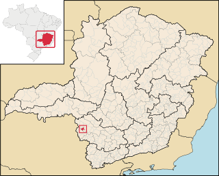
Pratápolis is a Brazilian municipality located in the southwest of the state of Minas Gerais. Its population as of 2007 was 8,653 people living in a total area of 214 km². The city belongs to the meso-region of Sul e Sudoeste de Minas and to the micro-region of Passos. It became a municipality in 1943.

St. Michael and All Angels' Church, Bartley Green is a parish church in the Church of England located in Bartley Green, Birmingham.

Malczkówko is a village in the administrative district of Gmina Potęgowo, within Słupsk County, Pomeranian Voivodeship, in northern Poland. It lies approximately 10 kilometres (6 mi) south-west of Potęgowo, 22 km (14 mi) east of Słupsk, and 84 km (52 mi) west of the regional capital Gdańsk.

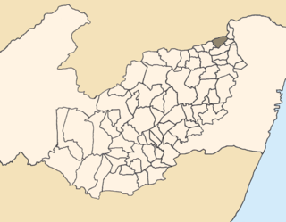
Orobó is a municipality/city in the state of Pernambuco in Brazil. The population in 2009 was 22.239 inhabitants and the total area is 140.78 km2. The city has the best children's mortality rate of the state (2.9) and one of the best in the whole country.

Bayport was a station stop along the Montauk Branch of the Long Island Rail Road. It was located on Railroad Street between Oakwood and Snedecor Avenues in Bayport, New York, and was the easternmost station along the Montauk Branch in the Town of Islip.

Hancock Field is a former airport and military airfield about 2 miles (3.2 km) south-southeast of Santa Maria, California. Also known as Santa Maria Municipal Airport, the airport was closed about 1959 and today is the site of Allan Hancock College.
Bel Air is an unincorporated community in Stafford County, in the U.S. state of Virginia.

Emerald is an unincorporated exurban community in Washington Township, Lehigh County, Pennsylvania located two miles west of Slatington. The Trout Creek flows eastward through it into the Lehigh River in Slatington. Interstate 476 (the Northeast Extension of the Pennsylvania Turnpike crosses the Franklin Slate Quarry on the east edge of Emerald. The immediate area is served by the Slatington post office with the zip code of 18080.

The Great Guild was a guild for merchants and artisans, operating in Tallinn from at least the 14th century until 1920. It was based in the Great Guild hall, a Gothic building in the historical centre of Tallinn, today housing the Estonian History Museum.
Fillmore is an unincorporated community in Washington County, in the U.S. state of Ohio.

Arapiles is a ward (barrio) of Madrid belonging to the district of Chamberí.
High Ridge Township is a township in Jefferson County, Missouri.

Coppess Corner is an unincorporated community in Washington Township, Adams County, in the U.S. state of Indiana.


