| Pełcza | |
|---|---|
| Village | |
| Country | |
| Voivodeship | Greater Poland |
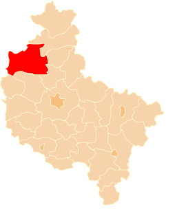
| County | Czarnków-Trzcianka |
| Gmina | Drawsko |
Pełcza [ˈpɛu̯t͡ʂa] is a village in the administrative district of Gmina Drawsko, within Czarnków-Trzcianka County, Greater Poland Voivodeship, in west-central Poland. [1]

A village is a clustered human settlement or community, larger than a hamlet but smaller than a town, with a population ranging from a few hundred to a few thousand. Though villages are often located in rural areas, the term urban village is also applied to certain urban neighborhoods. Villages are normally permanent, with fixed dwellings; however, transient villages can occur. Further, the dwellings of a village are fairly close to one another, not scattered broadly over the landscape, as a dispersed settlement.
Gmina Drawsko is a rural gmina in Czarnków-Trzcianka County, Greater Poland Voivodeship, in west-central Poland. Its seat is the village of Drawsko, which lies approximately 37 kilometres (23 mi) west of Czarnków and 78 km (48 mi) north-west of the regional capital Poznań.
Czarnków-Trzcianka County is a unit of territorial administration and local government (powiat) in Greater Poland Voivodeship, west-central Poland. It came into being on January 1, 1999, as a result of the Polish local government reforms passed in 1998. Its administrative seat is the town of Czarnków, which lies 61 kilometres (38 mi) north-west of the regional capital Poznań. The county contains three other towns: Trzcianka, 18 km (11 mi) north of Czarnków, Krzyż Wielkopolski, 38 km (24 mi) west of Czarnków, and Wieleń, 27 km (17 mi) west of Czarnków.


