Related Research Articles

Easton is an incorporated town in and the county seat of Talbot County, Maryland, United States. The population was 15,945 at the 2010 census, with an estimated population in 2019 of 16,671. The primary ZIP Code is 21601, and the secondary is 21606. The primary phone exchange is 822, the auxiliary exchanges are 820, 763, and 770, and the area code is 410.

Gilpin Township is a Second class Township in Armstrong County, Pennsylvania, United States. At the 2010 census it had a population of 2,496. As of the 2020 census, its population had decreased to 2,411, a 3.4% decrease.

Saxton is a borough in Bedford County, Pennsylvania, United States. The population was 722 at the 2020 census.

Roaring Spring is a borough in Blair County, Pennsylvania, United States. The population was 2,392 at the 2020 census. It is part of the Altoona, PA Metropolitan Statistical Area

Nanty Glo is a borough in Cambria County, Pennsylvania, United States. It is part of the Johnstown, Pennsylvania Metropolitan Statistical Area. The population was 2,734 at the 2010 census. The name comes from the Welsh Nant Y Glo, meaning "The Ravine of Coal."
Portage is a borough with home rule status in Cambria County, Pennsylvania, United States. It is 10 miles (16 km) southeast of Ebensburg and 22 miles (35 km) southwest of Altoona. It is part of the Johnstown, Pennsylvania Metropolitan Statistical Area. The population was 2,638 at the 2010 US census.

Jim Thorpe is a borough and the county seat of Carbon County in the U.S. state of Pennsylvania. It is part of Northeastern Pennsylvania. It is historically known as the burial site of Native American sports legend Jim Thorpe.

Lock Haven is the county seat of Clinton County, in the U.S. state of Pennsylvania. Located near the confluence of the West Branch Susquehanna River and Bald Eagle Creek, it is the principal city of the Lock Haven Micropolitan Statistical Area, itself part of the Williamsport–Lock Haven combined statistical area. At the 2010 census, Lock Haven's population was 9,772.

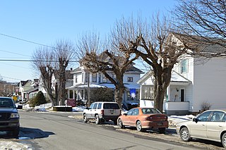
White Haven is a borough in Luzerne County, Pennsylvania, United States. It is located along the Lehigh River. The population was 1,163 at the 2020 census.

Tamaqua is a borough in eastern Schuylkill County in the Coal Region of Pennsylvania, United States. It had a population of 6,934 as of the 2020 U.S. census.

Chartiers Township is a township in Washington County, Pennsylvania, United States. The population was 8,632 at the 2020 census. Along with the borough of Houston, the township makes up the Chartiers-Houston School District. It is part of the Pittsburgh metropolitan area.
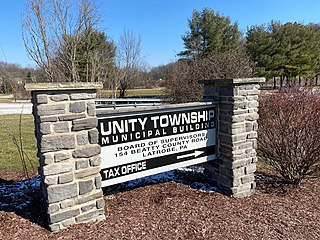
Unity Township is a township in Westmoreland County, Pennsylvania, United States. The population was 21,724 at the 2020 census, a decline of approximately 4% compared to the 2010 census.
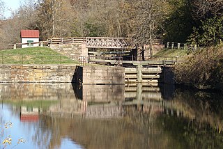
The Schuylkill Canal, or Schuylkill Navigation, was a system of interconnected canals and slack-water pools along the Schuylkill River in the U.S. state of Pennsylvania, built as a commercial waterway in the early 19th-century. Chartered in 1815, the navigation opened in 1825 to provide transportation and water power. At the time, the river was the least expensive and most efficient method of transporting bulk cargo, and the eastern seaboard cities of the U.S. were experiencing an energy crisis due to deforestation. It fostered the mining of anthracite coal as the major source of industry between Pottsville and eastern markets. Along the tow-paths, mules pulled barges of coal from Port Carbon through the water gaps to Pottsville; locally to the port and markets of Philadelphia; and some then by ship or through additional New Jersey waterways, to New York City markets.
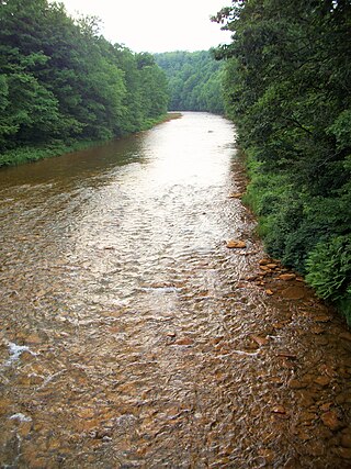
Moshannon Creek is a 57.4-mile-long (92.4 km) tributary of the West Branch Susquehanna River in Centre County, Pennsylvania in the United States. Throughout its length, it serves as the boundary between Centre and Clearfield counties.

Wehrum is an abandoned coal mining company town in Buffington Township, Indiana County, Pennsylvania, United States, that thrived for a time during the early 20th century. The mine upon which it was entirely dependent closed in 1929, and the last known inhabitants left in 1934. Essentially all that remains of Wehrum today are shadowy remnants of some of the streets and various building foundations hidden in the woods. Wehrum is now one of the ghost towns included in Pennsylvania's Ghost Town Trail.
Black Creek is a 7.6-mile-long (12.2 km) brook tributary of the Lehigh River in Carbon County, Pennsylvania, in the United States,. Its waters start at the very south edge of Weatherly, Pennsylvania at the confluence of Beaver and Hazle Creeks, then runs nearly due east to its mouth on the Lehigh River in Maple Hollow at the former railroad depot of Penn Haven Junction just east of Hinkles Valley. The confluence was a waypoint along the 19th-century Lehigh & Susquehanna Turnpike Black Creek has two major tributaries joining within Weatherly, the 7 miles (11 km) long Beaver Creek The tributary Quakake Creek, is the more dispersed and disorganized source waters, originating in over half-a-dozen small streams; it is also listed by the Geographic Names Information System (GNIS) as a variant name for Black Creek.

The Lehigh Canal is a navigable canal that begins at the mouth of Nesquehoning Creek on the Lehigh River in the Lehigh Valley and Northeastern regions of Pennsylvania. It was built in two sections over a span of 20 years beginning in 1818. The lower section spanned the distance between Easton and present-day Jim Thorpe. In Easton, the canal met the Delaware and Morris Canals, which allowed anthracite coal and other goods to be transported further up the U.S. East Coast. At its height, the Lehigh Canal was 72 miles (116 km) long.

Bald Eagle Valley is a low-lying area in Pennsylvania that drains into Bald Eagle Creek between the Allegheny Front and Bald Eagle Mountain, south of the West Branch Susquehanna River, in the Ridge-and-valley Appalachians. The valley is located southwest of West Branch Susquehanna Valley and includes Williamsport, Nittany Valley, and State College in the central portion of Centre County and southern portion of Clinton County.

The Pennsylvania Canal was a complex system of transportation infrastructure improvements including canals, dams, locks, tow paths, aqueducts, and viaducts. The Canal and Works were constructed and assembled over several decades beginning in 1824, the year of the first enabling act and budget items. It should be understood the first use of any railway in North America was the year 1826, so the newspapers and the Pennsylvania Assembly of 1824 applied the term then to the proposed rights of way mainly for the canals of the Main Line of Public Works to be built across the southern part of Pennsylvania.
The Bald Eagle and Spring Creek Navigation Company was a canal company in central Pennsylvania intended to link the iron industry of Bellefonte, Pennsylvania, with the Pennsylvania canal system. Opened for half its length in 1837, the remainder of the canal was not completed until 1848. Destroyed by flooding in 1865, it was not rebuilt; a paralleling railroad completed that year replaced it.
References
- ↑ "Home". peale.org.
- 1 2 "History of Peale -".
40°59′52″N78°04′53″W / 40.99778°N 78.08139°W
| | This Clearfield County, Pennsylvania state location article is a stub. You can help Wikipedia by expanding it. |
| | This United States ghost town-related article is a stub. You can help Wikipedia by expanding it. |