Related Research Articles

Titian Ramsay Peale was an American ornithologist, entomologist, photographer, and explorer from Philadelphia, Pennsylvania. He was a scientific illustrator whose paintings and drawings of wildlife were known for their beauty and accuracy.
Raft Island is a private island and CDP located near the Pierce County community of Rosedale, Washington, United States. Gig Harbor, Washington is the nearest incorporated town, although unincorporated Artondale is much closer. The island features approximately 200 homes on 160 acres. All of these homes are served through the Gig Harbor post office.

McNeil Island is an island in the northwest United States in south Puget Sound, located southwest of Tacoma, Washington. With a land area of 6.63 square miles (17.2 km2), it lies just north of Anderson Island; Fox Island is to the north, across Carr Inlet, and to the west, separated from Key Peninsula by Pitt Passage. The Washington mainland lies to the east, across the south basin of Puget Sound.

The United States Exploring Expedition of 1838–1842 was an exploring and surveying expedition of the Pacific Ocean and surrounding lands conducted by the United States. The original appointed commanding officer was Commodore Thomas ap Catesby Jones. Funding for the original expedition was requested by President John Quincy Adams in 1828, however, Congress would not implement funding until eight years later. In May 1836, the oceanic exploration voyage was finally authorized by Congress and created by President Andrew Jackson.

The Colvos Passage is a tidal strait within Puget Sound in the American state of Washington running west of Vashon Island between the island and the Kitsap Peninsula. It lies just north of the Dalco Passage. Colvos Passage has a permanent predominantly northbound current, in contrast to the rest of Puget Sound which varies with the tide. The communities of Fragaria, Olalla, Sunrise Beach, Spring Beach, Maplewood, Lisabeula, Paradise Cove and Sylvan Beach are located on Colvos Passage.

Anderson Island is the southernmost island in Puget Sound and a census-designated place of Pierce County, Washington, United States. It is accessible by boat or a 20-minute ferry ride from Steilacoom. Anderson Island is just south of McNeil Island. To the northwest, Key Peninsula is across Drayton Passage. The south basin of Puget Sound separates the island from the mainland to the southeast, while to the southwest the Nisqually Reach of Puget Sound separates the island from the mainland.

Agate Pass or Agate Passage is a high-current tidal strait in Puget Sound connecting Port Madison and mainland Kitsap County. It lies between Bainbridge Island and the mainland of the Kitsap Peninsula near Suquamish. It leads south towards Bremerton, extending about one mile (1.6 km) in a straight, southwesterly direction. The depth is about 20 feet (6.1 m). The shores are wooded and fairly steep. The shoreline is mostly rocky and fringed with kelp to Point Bolin. The tidal currents have velocities up to six knots; the flood tide sets southwesterly, and the ebb tide northeasterly.
Squaxin Island is in the extreme southwestern part of Puget Sound in Mason County, Washington, United States. The island is an Indian reservation of the Native American Squaxin Island Tribe. It once contained a Washington State Park by the same name, which has since been closed, and the land returned to the Squaxin Tribe. The island's land area is 5.739 km2 (2.216 sq mi). There was no resident population as of the 2000 census.
Crane Island is one of the San Juan Islands in San Juan County, Washington, United States. It lies just off the southwestern shore of Orcas Island, between it and the northwest corner of Shaw Island. Crane Island has a land area of 0.956 km². The 2000 census reported a population of 20 permanent residents.

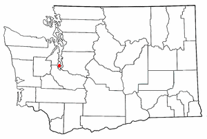
Harstine Island is an island in Mason County, Washington, United States. The US Census recognizes it as an unincorporated community. The island is located west of Case Inlet in southern Puget Sound, 16 km (9.9 mi) north of Olympia. It has a land area of 48.305 km2 (18.651 sq mi), and had a population of 1,412 as of the 2010 census.

Pickering Passage is a strait, in the southern end of part of Puget Sound in the U.S. state of Washington. Entirely within Mason County, the Pickering Passage separates Hartstine Island from the mainland, and connects Totten Inlet with the north end of Case Inlet.

Rich Passage is a tidal strait in Puget Sound, allowing access to Bremerton, Washington, Sinclair Inlet, and Dyes Inlet. It separates Bainbridge Island from the Manchester area of Kitsap Peninsula. Due to the activities at Puget Sound Naval Shipyard, Rich Passage has a high volume of marine traffic. The Seattle-Bremerton ferry, part of the Washington State Ferries, travels the length of Rich Passage on its route.
Dalco Passage is a tidal strait within Puget Sound in the U.S. state of Washington. Located between the southern end of Vashon Island and the mainland near Tacoma, Dalco Passage connects the northern main Puget Sound basin to the southern basin, via the Tacoma Narrows strait. Colvos Passage, Commencement Bay, and Quartermaster Harbor are also connected to Dalco Passage.

Saratoga Passage lies in Puget Sound between Whidbey Island and Camano Island.

Totten Inlet lies in the southern end of Puget Sound in the U.S. state of Washington. The inlet extends 9 miles (14 km) southwest from the western end of Squaxin Passage, and much of the county line between Mason and Thurston counties runs down the center of it. A spit extends west for about 300 feet (91 m) from Steamboat Island. The inlet shoals gradually to near Burns Point, 100 feet high, on the south shore, where it bares at low tide.
Pitt Passage is a strait, in the southern of part of Puget Sound in the U.S. state of Washington. Entirely within Pierce County, Pitt Passage separates Key Peninsula from McNeil Island. Pitt Island lies in the passage.
Carr Inlet, in southern Puget Sound in the U.S. state of Washington, is an arm of water between Key Peninsula and Gig Harbor Peninsula. Its southern end is connected to the southern basin of Puget Sound. Northward, it separates McNeil Island and Fox Island as well as the peninsulas of Key and Gig Harbor. The northern end of Carr Inlet is named Henderson Bay, Washington, which feeds into Burley Lagoon.
Case Inlet, in southern Puget Sound in the U.S. state of Washington, is an arm of water between Key Peninsula on the east and Hartstine Island on the west. Its northern end, called North Bay, reaches nearly to Hood Canal, creating the defining isthmus of Kitsap Peninsula. Case Inlet is the boundary between Pierce County and Mason County. The southern end of Case Inlet is connected to Nisqually Reach, part of the southern basin of Puget Sound. Herron Island lies in Case Inlet.
Hale Passage is the name of two different bodies of water in Puget Sound, in the U.S. state of Washington.
Ketron Island is an island and a census-designated place (CDP) in Pierce County, Washington, United States. The island had a population of 24 persons according to the 2000 census, and 17 persons at the 2010 census.
References
- ↑ Phillips, James W. (1971). Washington State Place Names . University of Washington Press. ISBN 0-295-95158-3.
Coordinates: 47°11′42.3″N122°53′38.4″W / 47.195083°N 122.894000°W
| | This Mason County, Washington state location article is a stub. You can help Wikipedia by expanding it. |