
Ontonagon County is a county in the Upper Peninsula of the U.S. state of Michigan. As of the 2010 United States Census, the population was 6,780, making it Michigan's third-least populous county. The county seat is Ontonagon. The county was set off in 1843, and organized in 1848. Its territory had been organized as part of Chippewa and Mackinac counties. With increasing population in the area, more counties were organized. After Ontonagon was organized, it was split to create Gogebic County. It is also the westernmost U.S. county that uses the Eastern Time Zone.

Bessemer is a city in the U.S. state of Michigan. As of the 2010 census, the city population was 1,914. It is the county seat of Gogebic County.

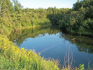
Bergland Township is a civil township of Ontonagon County in the U.S. state of Michigan. As of the 2000 census, the township population was 550.

Watersmeet is an unincorporated community and census-designated place (CDP) in Watersmeet Township, Gogebic County, Michigan, in the United States. As of the 2010 census, the CDP had a population of 428, out of a total population in the township of 1,417. The community was platted in 1884, designated as a station of the Chicago, St. Paul, Minneapolis & Omaha Railways.
Firesteel River is an 18.3-mile-long (29.5 km) river in Ontonagon County on the Upper Peninsula of the U.S. state of Michigan. The river flows generally northwest between the Flintsteel River and the West Sleeping River and empties into Lake Superior. Branches of the river are identified as the West Branch and East Branch, and the river receives Black Creek about three miles north of the junction of the two main branches.
The Mineral River is an 18.7-mile-long (30.1 km) tributary of Lake Superior on the western Upper Peninsula of Michigan in the United States. It flows for its entire length in western Ontonagon County, rising in the Ottawa National Forest and flowing generally northward to meet Lake Superior about 11 miles (18 km) west-southwest of Ontonagon. The United States Board on Geographic Names settled on "Mineral River" as the stream's name in 1976; according to the Geographic Names Information System it has also been known historically as "Beaver Creek".

The Ontonagon River is a river flowing to Lake Superior on the western Upper Peninsula of Michigan in the United States. The main stem of the river is 25 miles (40 km) long and is formed by a confluence of several longer branches, portions of which have been collectively designated as a National Wild and Scenic River. Several waterfalls occur on the river including Agate Falls and Bond Falls.

M-64 is a north–south state trunkline highway in the Upper Peninsula of the US state of Michigan. It runs for approximately 63 3⁄4 miles (102.6 km) through the western part of the state in land that is part of the Ottawa National Forest. The highway connects with County Trunk Highway B (CTH-B) at the state line near Presque Isle, Wisconsin. As it passes through dense forests, M-64 runs along lakes Gogebic and Superior. The northern end is at a junction with US Highway 45 (US 45) in Ontonagon.

Lake Gogebic is the largest natural inland lake of the Upper Peninsula of Michigan. It is located within the one million acre (4,000 km²) Ottawa National Forest. Lake Gogebic State Park is located along its western shore.

The Gogebic Range is an elongated area of iron ore deposits located within a range of hills in northern Michigan and Wisconsin just south of Lake Superior. It extends from Lake Namakagon in Wisconsin eastward to Lake Gogebic in Michigan, or almost 80 miles. Though long, it is only about a half mile wide and forms a crescent concave to the southeast. The Gogebic Range includes the communities of Ironwood in Michigan, plus Mellen and Hurley in Wisconsin.
The East Sleeping River is a 21.3-mile-long (34.3 km) river in Ontonagon County, Michigan, in the United States. It is a tributary of Lake Superior.
The West Sleeping River is an 8.5-mile-long (13.7 km) river in Ontonagon County, Michigan, in the United States. It is a tributary of Lake Superior.
The Little Black River is a 19.6-mile-long (31.5 km) stream in Gogebic County in the U.S. state of Michigan. It rises in Bessemer Township at 46°21′23″N89°53′09″W} and flows mostly north to Sunday Lake in Wakefield, then westward for approximately a mile before emptying into the Black River at 46°29′18″N89°59′49″W, just north of Ramsay. The water is approximately 14 inches (360 mm) deep.
Carp River is the name of several rivers in the U.S. state of Michigan.
Floodwood River is an 11.0-mile-long (17.7 km) river in Ontonagon County in the U.S. state of Michigan.
Carp River is a 10.3-mile-long (16.6 km) river in Gogebic and Ontonagon counties in the U.S. state of Michigan. The Carp River is formed by the outflow of the Lake of the Clouds at 46°48′04″N89°45′38″W in the Porcupine Mountains of the Upper Peninsula.
Little Carp River is a 15-mile-long (24 km) river in Gogebic and Ontonagon counties in the U.S. state of Michigan. The Carp River rises at 46°45′54″N89°44′44″W in the Porcupine Mountains of the Upper Peninsula.
The Tamarack River is an 8.8-mile-long (14.2 km) tributary of the Middle Branch Ontonagon River in Iron and Gogebic counties on the Upper Peninsula of Michigan in the United States. The stream source is the outflow from Tamarack Lake. Via the Middle Branch of the Ontonagon River, its water flows north to the Ontonagon River and ultimately to Lake Superior.


