Related Research Articles
The M67 is a 5-mile (8.0 km) urban motorway in Greater Manchester, England, which heads east from the M60 motorway passing through Denton and Hyde before ending near Mottram. The road was originally conceived as the first section of a trans-Pennine motorway between Manchester and Sheffield that would connect the A57(M) motorway with the M1 motorway; however, the motorway became the only part to be built.

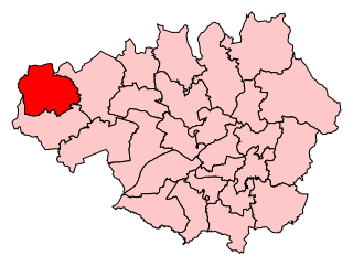
The Metropolitan Borough of Wigan is a metropolitan borough of Greater Manchester, in North West England. It is named after the main settlement of Wigan. It covers the towns of Atherton, Ashton-in-Makerfield, Golborne, Hindley, Ince-in-Makerfield, Leigh and Tyldesley. The borough also covers the villages and suburbs of Abram, Aspull, Astley, Bryn, Hindley Green, Lowton, Mosley Common, Orrell, Pemberton, Shevington, Standish, Winstanley and Worsley Mesnes. The borough is also the second-most populous district in Greater Manchester.

Orrell is a ward of the Metropolitan Borough of Wigan, Greater Manchester, England. The population of the ward had fallen at the 2011 Census to 11,513. The centre of the area lies 3 miles (4.8 km) to the west of Wigan town centre and serves as a predominantly residential suburb of Wigan. The area is contiguous with the district of Pemberton.
Wigan is a constituency in Greater Manchester, represented in the House of Commons of the UK Parliament since 2010 by Lisa Nandy of the Labour Party, who also serves as the Shadow Housing and Levelling Up Secretary.
Abram is a village and electoral ward in the Metropolitan Borough of Wigan, Greater Manchester, England. It lies on flat land on the northeast bank of the Leeds and Liverpool Canal, 2 miles (3.2 km) west of Leigh, 3 miles (4.8 km) southeast of Wigan, and 14.5 miles (23 km) west of Manchester. Abram is a dormitory village with a population of 9,855.

Standish-with-Langtree was, and to a limited extent remains, a local government district centred on Standish, Lancashire, in North West England. Historically it was an ancient township in the hundred of West Derby and county of Lancashire. This unit was abolished in 1974 following the Local Government Act 1972, the same act which established Greater Manchester.
Wigan Rural District was an administrative district in Lancashire, England from 1894 to 1974. The rural district comprised an area to the north, but did not include the town of Wigan.
Ormskirk was an urban district in the county of Lancashire from 1894 to 1974. It was named after the town of Ormskirk, which constituted its main settlement.
Ince was a parliamentary constituency in England which elected one Member of Parliament (MP) to the House of Commons of the Parliament of the United Kingdom. It comprised the town of Ince-in-Makerfield and other towns south of Wigan.
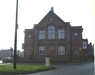
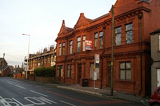
Pemberton is a town and an electoral ward of the Metropolitan Borough of Wigan, in Greater Manchester, England. It lies on the southwestern bank of the River Douglas, which separates it from the town of Wigan, and east of the M6 motorway. The area today serves as a predominantly residential suburb along with the adjoining area of Orrell and as a ward has a population of 13,638, increasing to 13,982 at the 2011 Census.
Billinge was, from 1872 to 1974, a local government district in the administrative county of Lancashire, England.
The County Borough of Wigan was, from 1889 to 1974, a local government district centred on Wigan in the northwest of England. It was alternatively known as Wigan County Borough.
Leigh Rural District was, from 1894 to 1933, a rural district of the administrative county of Lancashire, in northwest England. It spanned a rural area outlying from the town Leigh.

Wigan is a large town in Greater Manchester, England, on the River Douglas. The town is midway between the two cities of Manchester, 16 miles (25.7 km) to the south-east, and Liverpool, 17 miles (27 km) to the south-west. Bolton lies 10 miles (16 km) to the north-east and Warrington 12 miles (19 km) to the south. It is the largest settlement in the Metropolitan Borough of Wigan and is its administrative centre. The town has a population of 107,732 and the wider borough of 330,713. Wigan was formerly within the historic county of Lancashire.

The Wigan Urban Area is an area of land defined by the Office for National Statistics consisting of the built-up, or 'urbanised' area containing Wigan in Greater Manchester and Skelmersdale in West Lancashire.
Orrell Urban District was, from 1894 to 1974, a local government district in the administrative county of Lancashire, England. Its boundaries were centred on Orrell, but also included parts of Upholland.

The geography of Greater Manchester is dominated by one of the United Kingdom's largest metropolitan areas, and in this capacity the landlocked metropolitan county constitutes one of the most urbanised and densely populated areas of the country. There is a mix of high density urban areas, suburbs, semi-rural and rural locations in Greater Manchester, but overwhelmingly the land use in the county is urban.

The Wigan Metropolitan Borough Council is the local authority for the Metropolitan Borough of Wigan in the United Kingdom. It consists of 75 Councillors with one-third being elected every three years in four. The borough is separated into 25 wards. Councillors are democratically accountable to the ward they are elected to represent. Each ward is represented on the council by three council members.

Tyldesley cum Shakerley Urban District and its successor Tyldesley Urban District was, from 1894 to 1974, a local government district in Lancashire, England.

Atherton was, from 1863 to 1974, a local government district in Lancashire, England.
References
- ↑ "Pemberton Urban District – Wigan Archives". archives.wigan.gov.uk. Retrieved 28 June 2022.
- ↑ records incl and rel to minutes, education, registers, rates, treasurers, and surveyors. 1872–1908.