The San Luis Valley is a region in south-central Colorado with a small portion overlapping into New Mexico. The valley is approximately 122 miles (196 km) long and 74 miles (119 km) wide, extending from the Continental Divide on the northwest rim into New Mexico on the south. It contains 6 counties and portions of 3 others. It is an extensive high-elevation depositional basin of approximately 8,000 square miles (21,000 km2) with an average elevation of 7,664 feet (2,336 m) above sea level. The valley is a section of the Rio Grande Rift and is drained to the south by the Rio Grande, which rises in the San Juan Mountains to the west of the valley and flows south into New Mexico. The San Luis Valley has a cold desert climate but has substantial water resources from the Rio Grande and groundwater.

The Grand Staircase–Escalante National Monument (GSENM) is a United States national monument protecting the Grand Staircase, the Kaiparowits Plateau, and the Canyons of the Escalante in southern Utah. It was established in 1996 by President Bill Clinton under the authority of the Antiquities Act with 1.7 million acres of land, later expanded to 1,880,461 acres (7,610 km2). In 2017, the monument's size was reduced by half in a succeeding presidential proclamation, and it was restored in 2021. The land is among the most remote in the country; it was the last to be mapped in the contiguous United States.

The Red Rock Canyon National Conservation Area in Clark County, Nevada, United States, is an area managed by the Bureau of Land Management as part of its National Landscape Conservation System, and protected as a National Conservation Area. It is about 15 miles (24 km) west of Las Vegas, and is easily seen from the Las Vegas Strip. More than three million people visit the area each year.

Bridge Mountain is a mountain located in the Spring Mountain range of southern Nevada. It is located on land managed by the United States Bureau of Land Management as the Red Rock Canyon National Conservation Area, part of the Rainbow Mountain Wilderness. Bridge Mountain is named for the natural feature of a bridge-like natural arch of sandstone near the summit.

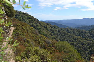
Castle Rock State Park is a 5,242-acre (2,121 ha) state park of California, United States, located along the crest of the Santa Cruz Mountains and almost entirely in Santa Cruz County, with parts extending into Santa Clara County and San Mateo County. It embraces coast redwood, Douglas fir, and madrone forest, most of which has been left in its wild, natural state. Steep canyons are sprinkled with unusual rock formations that are a popular rock climbing area. The park is named after a sandstone formation called Castle Rock. The forest here is lush and mossy, crisscrossed by 32 miles (51 km) of hiking trails. These trails are part of an even more extensive trail system that links the Santa Clara and San Lorenzo valleys with Castle Rock State Park, Big Basin Redwoods State Park, and the Pacific Coast. Due to its overnight parking lot, Castle Rock is a popular starting point for the Skyline-to-the-Sea Trail, a 30-mile (48 km) trail that begins near by at Saratoga Gap and leads to Waddell Beach north of Santa Cruz. There are two walk-in campgrounds within the park for overnight backpacking.

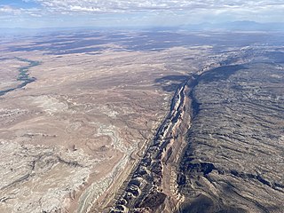
The San Rafael Swell is a large geologic feature located in south-central Utah, United States about 16 miles (26 km) west of Green River. The San Rafael Swell, measuring approximately 75 by 40 miles, consists of a giant dome-shaped anticline of sandstone, shale, and limestone that was pushed up during the Paleocene Laramide Orogeny 60–40 million years ago. Since that time, infrequent but powerful flash floods have eroded the sedimentary rocks into numerous valleys, canyons, gorges, mesas, buttes, and badlands.

Datil is a census-designated place in Catron County, New Mexico, United States. As of the 2010 census it had a population of 54. Located at the intersection of U.S. Route 60 and New Mexico State Road 12, Datil is on the edge of the Cibola National Forest. The Very Large Array is also nearby. Rock climbers are attracted to Datil because it holds the Enchanted Tower, a climbing hotspot.

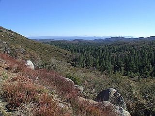
The Cleveland National Forest encompasses 460,000 acres/720 sq mi (1,900 km2) of inland montane regions—approx. 60 miles from the Pacific Ocean—within the counties of San Diego, Riverside, and Orange, California. The landscape varies somewhat, with mostly chaparral canyons, arroyos and high desert, but dotted with meadows and oak and conifer forests. Near water sources, riparian environments and perennial aquatic plants attract native and migratory wildlife, such as at San Diego’s man-made Lake Cuyamaca. A generally warm and dry, inland-Mediterranean climate prevails over the forest, with the cooler months producing morning frost and snowfall. It is the southernmost U.S. National Forest of California. The area is administered by the U.S. Forest Service, a government agency within the United States Department of Agriculture, and is locally overseen by the Descanso, Palomar and Trabuco Ranger Districts.

The Carrizo Plain is a large enclosed grassland plain, approximately 50 miles (80 km) long and up to 15 miles (24 km) across, in southeastern San Luis Obispo County, California, about 100 miles (160 km) northwest of Los Angeles. It contains the 246,812-acre (99,881 ha) Carrizo Plain National Monument, and it is the largest single native grassland remaining in California. It includes Painted Rock in the Carrizo Plain Rock Art Discontiguous District, which is listed on the National Register of Historic Places. In 2012 it was further designated a National Historic Landmark due to its archeological value. The San Andreas Fault occurs along the eastern edge of the Carrizo Plain at the western base of the Temblor Range.

The Organ Mountains are a rugged mountain range in southern New Mexico in the Southwestern United States. Organ Mountains–Desert Peaks National Monument was declared a national monument on May 21, 2014. They lie 10 mi (16 km) east of the city of Las Cruces, in Doña Ana County.

The San Luis Reservoir is an artificial lake on San Luis Creek in the eastern slopes of the Diablo Range of Merced County, California, approximately 12 mi (19 km) west of Los Banos on State Route 152, which crosses Pacheco Pass and runs along its north shore. It is the fifth largest reservoir in California. The reservoir stores water taken from the San Joaquin-Sacramento River Delta. Water is pumped uphill into the reservoir from the O'Neill Forebay which is fed by the California Aqueduct and is released back into the forebay to continue downstream along the aqueduct as needed for farm irrigation and other uses. Depending on water levels, the reservoir is approximately nine miles (14 km) long from north to south at its longest point, and five miles (8 km) wide. At the eastern end of the reservoir is the San Luis Dam, the fourth largest embankment dam in the United States, which allows for a total capacity of 2,041,000 acre-feet (2,518,000 dam3). Pacheco State Park lies along its western shores.

Montaña de Oro is a state park in Central Coastal California, six miles southwest of Morro Bay and two miles south of Los Osos.

Leslie Gulch is a canyon in Malheur County, Oregon, United States. It is on the east side of Owyhee Lake, a reservoir on the Owyhee River. Its abundant and striking rock formations are made of tuff.

Sugarite Canyon State Park is a state park of New Mexico, United States, featuring a historic early-20th century coal-mining camp and natural scenery at the border of the Rocky Mountains and the Great Plains. The park is located on the Colorado–New Mexico state line 6 miles (9.7 km) northeast of Raton, New Mexico.

The Ochoco Mountains are a mountain range in central Oregon in the United States, located at the western end of the Blue Mountains. They were formed when Permian, Triassic, and Jurassic rocks were slowly uplifted by volcanic eruptions to form the Clarno Formation. Today, the highest point in the range is Lookout Mountain. The dominant vegetation on the west side of the range is old-growth ponderosa pine; on the east side, western juniper is common. The western area of the mountains is administered by the Ochoco National Forest, while the southeastern section is part of the Malheur National Forest. The Ochoco Mountains are used for hiking, camping, bird watching, rockhounding, and hunting, as well as cross-country skiing in the winter.

The Santa Rosa Wilderness is a 72,259-acre (292.42 km2) wilderness area in Southern California, in the Santa Rosa Mountains of Riverside and San Diego counties, California. It is in the Colorado Desert section of the Sonoran Desert, above the Coachella Valley and Lower Colorado River Valley regions in a Peninsular Range, between La Quinta to the north and Anza Borrego Desert State Park to the south. The United States Congress established the wilderness in 1984 with the passage of the California Wilderness Act, managed by both the US Forest Service and the Bureau of Land Management. In 2009, the Omnibus Public Land Management Act was signed into law which added more than 2,000 acres (8.1 km2). Most of the Santa Rosa Wilderness is within the Santa Rosa and San Jacinto Mountains National Monument.

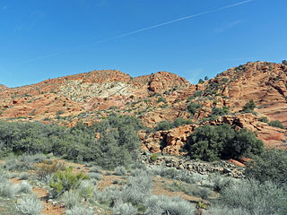
Cottonwood Canyon Wilderness is a 11,712-acre (47.4 km2) wilderness area in the US state of Utah. It was designated March 30, 2009, as part of the Omnibus Public Land Management Act of 2009. Located adjacent to the southern edge of the Dixie National Forest, it encompasses and protects a transition zone between the Colorado Plateau to the east and the Mojave Desert to the west. It is bordered by the Cottonwood Forest Wilderness to the northeast and is itself a part of the Red Cliffs National Conservation Area.

Zapata Falls is a waterfall located in the San Luis Valley near the base of the Sangre de Cristo Mountains on Bureau of Land Management land adjacent to Rio Grande National Forest and south of Great Sand Dunes National Park and Preserve in Alamosa County, Colorado. The waterfall has a drop of about 30 feet (9 m). Access to this waterfall entails a mildly steep 0.5-mile (800 m) hike. Viewing the falls requires fording the stream and climbing rocks.

Wild Rivers Recreation Area is located in north central New Mexico within the Rio Grande del Norte National Monument. Two rivers that run through the park, the Rio Grande and Red River are National Wild and Scenic Rivers. NM 378 that traverses the recreation area is designated a New Mexico Scenic Byway. Recreational opportunities include whitewater rafting, hiking, biking, fishing and camping.

The San Luis Hills are a group of small mountain ranges in Conejos and Costilla counties in the San Luis Valley in southern Colorado. The individual mountain ranges that make up the San Luis Hills include the Fairy Hills, the Brownie Hills, the Piñon Hills, and the South Piñon Hills. The San Luis Hills' highest point is Flat Top, elevation 9,206 feet


