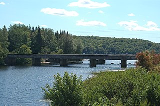
Covington Township is a civil township of Baraga County in the U.S. state of Michigan. The population was 476 at the 2010 census.

The Wolf River is a 225 mi (362 km) long tributary of the Fox River in northeastern Wisconsin in the Great Lakes region of the United States. The river is one of the two National Scenic Rivers in Wisconsin, along with the St. Croix River. The scenic portion is 24 miles (39 km) long. The river and its parent the Fox River and associated lakes are renown for their sturgeon which spawn every spring upstream on the lower river until blocked by the Shawano Dam. The river flows through mostly undeveloped forestland southerly from central Forest County in the north to Lake Poygan in the south. The lake is part of the Winnebago Pool of lakes fed by both the Fox and Wolf Rivers. The Fox-Wolf basin is usually considered to be a single unified basin and the rivers themselves may be referred to as the Fox-Wolf River system.

Celilo Village, Oregon is an unincorporated Native American community on the Columbia River in northeastern Wasco County in the U.S. state of Oregon. It is near Lake Celilo, the former site of Celilo Falls; it is just south of the community of Wishram, Washington, across the Columbia River.

Otter Lake is the name of several lakes and one village in the U.S. state of Michigan.
Black River is a 29.8-mile-long (48.0 km) river on the Upper Peninsula of the U.S. state of Michigan. The river flows into the Middle Branch Escanaba River in Ely Township of Marquette County at 46°23′53″N87°46′15″W and on into Lake Michigan.

The Brule River is a 52.3-mile-long (84.2 km) river in the U.S. states of Michigan and Wisconsin. Nearly the entire course forms a portion of the boundary between the two states.

Chassell is an unincorporated community in Chassell Township of Houghton County in the Upper Peninsula of the U.S. state of Michigan. It is located on Pike Bay at the south end of Portage Lake 47°01′42″N88°31′30″W and is the largest community in the township.
The Mitchigan River is a 14.9-mile-long (24.0 km) stream in the Upper Peninsula of the U.S. state of Michigan. It flows into the Fence River at 46°17′27″N88°09′58″W in northeast Iron County in Mansfield Township. The Fence River is a tributary of the Michigamme River, which is itself a tributary the Menominee River, flowing to Lake Michigan. The Mitchigan River has its source in the southeast corner of Baraga County at 46°24′58″N88°08′05″W. It flows mostly southward along the boundary between Iron and Marquette counties, crossing briefly into western Marquette County.
The Iron River is a 17.1-mile-long (27.5 km) river in Iron County, Michigan, in the United States. It flows from northwest to southeast through the city of Iron River to the Brule River. It is part of the Menominee River watershed, flowing to Lake Michigan.
The Murphy River is a 6.6-mile-long (10.6 km) river in Baraga County on the Upper Peninsula of Michigan in the United States. It is a tributary of Worm Lake, the outlet of which is the Rock River, which flows to the Sturgeon River and eventually to Lake Superior.
The Net River is a 14.9-mile-long (24.0 km) river in Michigan in the United States. Its headwaters rise in Baraga County and flow southwest into Iron County, where the main stem forms and flows to the Paint River above Crystal Falls.
The Otter River is a 10.0-mile-long (16.1 km) river in Houghton County, Michigan, in the United States. It was home to the last known population of Michigan Grayling. No grayling have been seen or caught in the river since 1938.

The Peshekee River is a 31.1-mile-long (50.1 km) river on the Upper Peninsula of Michigan in the United States. It is a tributary of Lake Michigamme, and its waters flow via the Michigamme River and the Menominee River to Lake Michigan.
The Sante River is an 8.7-mile-long (14.0 km) stream on the Upper Peninsula of Michigan in the United States. Via the North Branch Otter River, Otter River, Sturgeon River and Portage River, its waters flow to Lake Superior.

Sturgeon River may refer to any of the following streams in the U.S. state of Michigan:
The Silver River is a 31.3-mile-long (50.4 km) stream in the Upper Peninsula in the U.S. state of Michigan.
Sturgeon River is a 63.6-mile-long (102.4 km) river in the U.S. state of Michigan, flowing mostly southward through Alger County and Delta County counties on the Upper Peninsula.
The Pike River is an 11.6-mile-long (18.7 km) stream in Houghton County in the U.S. state of Michigan.
The Rock River is a 6.1-mile-long (9.8 km) stream in Baraga County on the Upper Peninsula of Michigan in the United States. It rises at the outlet of Worm Lake, east of Covington, and flows northwest to the Sturgeon River, which continues west, then north to Portage Lake and Lake Superior. The Rock River descends 350 feet (110 m) over its 6-mile (10 km) course, for an average rate of 58 feet per mile.


