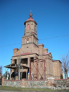
Balaganj is an upazila of Sylhet District in Sylhet Division, Bangladesh.

Jędrzejowice is a village in the administrative district of Gmina Dzierżoniów, within Dzierżoniów County, Lower Silesian Voivodeship, in south-western Poland. Prior to 1945 it was in Germany. It lies approximately 16 kilometres (10 mi) north-east of Dzierżoniów and 42 km (26 mi) south-west of the regional capital Wrocław.

Mielenko is a village in the administrative district of Gmina Mogilno, within Mogilno County, Kuyavian-Pomeranian Voivodeship, in north-central Poland. It lies approximately 9 kilometres (6 mi) west of Mogilno and 52 km (32 mi) south of Bydgoszcz.
Fort-Liberté is an arrondissement in the Nord-Est department of Haiti. As of 2015, the population was 60,632 inhabitants. Postal codes in the Fort-Liberté Arrondissement start with the number 21.

Majdan Wielki is a village in the administrative district of Gmina Trzeszczany, within Hrubieszów County, Lublin Voivodeship, in eastern Poland. It lies approximately 6 kilometres (4 mi) west of Trzeszczany, 16 km (10 mi) west of Hrubieszów, and 90 km (56 mi) south-east of the regional capital Lublin.

Kozłówka is a village in the administrative district of Gmina Rajgród, within Grajewo County, Podlaskie Voivodeship, in north-eastern Poland. It lies approximately 8 kilometres (5 mi) south of Rajgród, 17 km (11 mi) east of Grajewo, and 69 km (43 mi) north-west of the regional capital Białystok.

Malinowo is a village in the administrative district of Gmina Dziadkowice, within Siemiatycze County, Podlaskie Voivodeship, in north-eastern Poland. It lies approximately 5 kilometres (3 mi) west of Dziadkowice, 14 km (9 mi) north of Siemiatycze, and 67 km (42 mi) south of the regional capital Białystok.

Pietroasa is a commune in Timiș County, Romania. It is composed of four villages: Crivina de Sus (Felsőgörbed), Fărășești (Forrásfalva), Pietroasa and Poieni (Ruszkatő).
Vălișoara is a commune in Hunedoara County, Romania. It is composed of four villages: Dealu Mare (Gyalumáre), Săliștioara (Szelistyora), Stoieneasa (Sztojenyásza) and Vălișoara.

Zofibór is a village in the administrative district of Gmina Wojcieszków, within Łuków County, Lublin Voivodeship, in eastern Poland. It lies approximately 9 kilometres (6 mi) north-east of Wojcieszków, 10 km (6 mi) south of Łuków, and 67 km (42 mi) north of the regional capital Lublin.

Stronie is a village in the administrative district of Gmina Stryszów, within Wadowice County, Lesser Poland Voivodeship, in southern Poland. It lies approximately 4 kilometres (2 mi) east of Stryszów, 14 km (9 mi) south-east of Wadowice, and 32 km (20 mi) south-west of the regional capital Kraków.

Osuchów is a village in the administrative district of Gmina Promna, within Białobrzegi County, Masovian Voivodeship, in east-central Poland. It lies approximately 9 kilometres (6 mi) west of Promna, 9 km (6 mi) west of Białobrzegi, and 63 km (39 mi) south of Warsaw.

Nowy Karmin is a village in the administrative district of Gmina Dobrzyca, within Pleszew County, Greater Poland Voivodeship, in west-central Poland. It lies approximately 6 kilometres (4 mi) south-east of Dobrzyca, 10 km (6 mi) south-west of Pleszew, and 82 km (51 mi) south-east of the regional capital Poznań.

Karski is a village in the administrative district of Gmina Ostrów Wielkopolski, within Ostrów Wielkopolski County, Greater Poland Voivodeship, in west-central Poland. It lies approximately 10 kilometres (6 mi) east of Ostrów Wielkopolski and 103 km (64 mi) south-east of the regional capital Poznań.

Miłkowice is a village in the administrative district of Gmina Dobra, within Turek County, Greater Poland Voivodeship, in west-central Poland. It lies approximately 9 kilometres (6 mi) south-east of Dobra, 24 km (15 mi) south-east of Turek, and 136 km (85 mi) south-east of the regional capital Poznań.

Brynica is a village in the administrative district of Gmina Łubniany, within Opole County, Opole Voivodeship, in south-western Poland.
Papel Pampa Municipality is the second municipal section of the Gualberto Villarroel Province in the La Paz Department, Bolivia. Its seat is Papel Pampa.
Yalbotina is a village in Dragoman Municipality, Sofia Province, western Bulgaria.
Katrishte is a village in Kyustendil Municipality, Kyustendil Province, south-western Bulgaria.
Gumoshtnik is a village in Troyan Municipality, Lovech Province, northern Bulgaria.


