
A petroglyph is an image created by removing part of a rock surface by incising, picking, carving, or abrading, as a form of rock art. Outside North America, scholars often use terms such as "carving", "engraving", or other descriptions of the technique to refer to such images. Petroglyphs, estimated to be 20,000 years old are classified as protected monuments and have been added to the tentative list of UNESCO's World Heritage Sites. Petroglyphs are found worldwide, and are often associated with prehistoric peoples. The word comes from the Greek prefix petro-, from πέτρα petra meaning "stone", and γλύφω glýphō meaning "carve", and was originally coined in French as pétroglyphe.

Gabriola Island is one of the Gulf Islands in the Strait of Georgia in British Columbia (BC), Canada. It is about 5 kilometres (3.1 mi) east of Nanaimo on Vancouver Island, to which it is linked by a 20-minute ferry service. It has a land area of about 57.6 square kilometres (22.2 sq mi) and a resident population of 4,500.

Mi'kmaw hieroglyphic writing or Suckerfish script was a writing system for the Mi'kmaw language, later superseded by various Latin scripts which are currently in use. Mi'kmaw are a Canadian First Nation whose homeland, called Mi'kma'ki, overlaps much of the Atlantic provinces, specifically all of Nova Scotia, Prince Edward Island, and parts of New Brunswick and Newfoundland and Labrador.

Petroforms, also known as boulder outlines or boulder mosaics, are human-made shapes and patterns made by lining up large rocks on the open ground, often on quite level areas. Petroforms in North America were originally made by various Native American and First Nation tribes, who used various terms to describe them. Petroforms can also include a rock cairn or inukshuk, an upright monolith slab, a medicine wheel, a fire pit, a desert kite, sculpted boulders, or simply rocks lined up or stacked for various reasons. Old World petroforms include the Carnac stones and many other megalithic monuments.
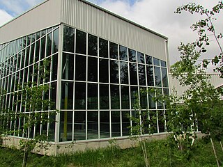
Petroglyphs Provincial Park is a historical-class provincial park situated in Woodview, Ontario, Canada, northeast of Peterborough. It has the largest collection of ancient First Nations petroglyphs in Ontario. The carvings were created in the pre-Columbian era and represents aspects of First Nations spirituality, including images of shamans, animals, reptiles, and, possibly, the Great Spirit itself.

Writing-on-Stone Provincial Park is located about 100 kilometres (60 mi) southeast of Lethbridge, Alberta, Canada, or 44 kilometres (30 mi) east of the community of Milk River, and straddles the Milk River itself. It is one of the largest areas of protected prairie in the Alberta park system, and serves as both a nature preserve and protection for many First Nations (indigenous) rock carvings and paintings. The park is sacred to the Blackfoot and many other aboriginal tribes.
Saint Victor may refer to:

Petroglyph Provincial Park is a Canadian provincial park located at the south end of the city of Nanaimo, British Columbia. The park was established on August 24, 1948, to protect a collection of petroglyphs found near the estuary of the Nanaimo River.
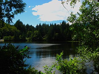
Murrin Provincial Park is a provincial park in British Columbia, Canada, located just south of Squamish beside the Sea-to-Sky Highway. The park is approximately 24 ha. in size and has a popular highway-side picnic ground and small swimming lake, but it is most notable for a collection of petroglyphs located away from the highway and accessed by trail. Several rockfaces in the area of the park are popular with the local mountain-climbing community, though the site is nowhere as busy as the nearby Stawamus Chief.
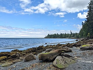
Sandwell Provincial Park is a provincial park in British Columbia, Canada. It is a small oceanfront site on Lock Bay, on the northeast shore of Gabriola Island. Hiking, swimming and beach-walking are popular activities here, though it is only accessible at low tide and park facilities are limited. There are also petroglyphs carved into the sandstone boulders on Lock Bay's foreshore.

Sir Alexander Mackenzie Provincial Park is a provincial park in British Columbia, Canada. Located at the mouth of Elcho Harbour on Dean Channel, it enshrines the farthest point west reached by Alexander Mackenzie in 1793 and the rock he marked to commemorate his journey. The park is also the location of a historical First Nations village, with petroglyphs that can be found along the beach.
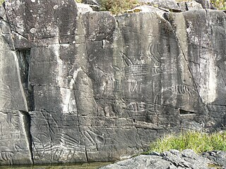
Sproat Lake Provincial Park is a provincial park near Port Alberni in British Columbia, Canada's Vancouver Island. Its name derives from a lake named after 19th century entrepreneur and colonial official Gilbert Malcolm Sproat.

Sanilac Petroglyphs Historic State Park is a historic preservation area in the U.S. state of Michigan. The state park, also known as ezhibiigadek asin, consists of 240 acres (97 ha) in Greenleaf Township, Sanilac County, in Michigan's Thumb. It contains the largest collection of Native American petroglyphs in Michigan. The carvings were created in the pre-Columbian era and represent aspects of Native American spirituality. An interpretive hiking trail within the park passes along the nearby Cass River.

Alberta has been a tourist destination since the early days of the 20th Century, with attractions including national parks, National Historic Sites of Canada, urban arts and cultural facilities, outdoor locales for skiing, hiking and camping, shopping locales such as West Edmonton Mall, outdoor festivals, professional athletic events, international sporting competitions such as the Commonwealth Games and Olympic Winter Games, as well as more eclectic attractions.
Highway 2 is a provincial highway in the Canadian province of Saskatchewan. It is the longest highway in Saskatchewan at 809 km (503 mi). The highway has a few divided sections but is mostly undivided. However, only about 18 kilometres (11 mi) near Moose Jaw, 11 kilometres (7 mi) near Chamberlain, and 21 kilometres (13 mi) near Prince Albert are divided highway. Highway 2 is a major north-south route beginning at the Canada–US border at the Port of West Poplar River and Opheim, Montana customs checkpoints. Montana Highway 24 continues south. It passes through the major cities of Moose Jaw in the south and Prince Albert in the north. Highway 2 overlaps Highway 11 between the towns of Chamberlain and Findlater. This 11 kilometres (7 mi) section of road is a wrong-way concurrency. The highway ends at La Ronge, where it becomes Highway 102.
The Saskatchewan Archaeological Society is a society of amateur and professional archaeologists who encourage the preservation of archaeological artifacts and sites, publish, educate, and assist the public in the interest of archaeological activities. The Saskatchewan Archaeological Society also helps to form local branches of archaeological communities, such as the Regina Archaeological Society. Many of the archaeology sites of Saskatchewan are of aboriginal ancestry and include rock paintings, habitation sites, medicine wheels, as well as kill and processing sites. Archaeology focuses on the anthropological study of human history and lifestyle using artifacts.
Painted Rock or Painted Rocks may refer to:
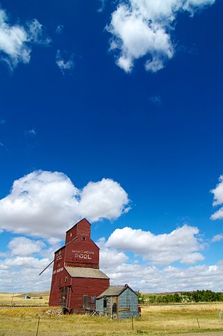
Wood Mountain is a village in the Canadian province of Saskatchewan within the Rural Municipality of Old Post No. 43 and Census Division No. 3. Its name is derived from the Red River Métis words "montagne de bois", due to the abundance of poplar trees in the otherwise barren region. Highway 18 and Highway 358 intersect south of the community.

St. Victor, or Saint Victor, is a Fransaskois community in the Rural Municipality of Willow Bunch No. 42. In 2006, it had a population of 43 people. It previously held the status of village until February 26, 2003. St. Victor is located 37 km south of the town of Assiniboia 10 km east of Highway 2. St. Victor Petroglyphs Provincial Park is two kilometres south of the community.

St. Victor Petroglyphs Provincial Historic Park is a historical provincial park in the Canadian province of Saskatchewan. The park is located in the RM of Willow Bunch No. 42, about 2 kilometres (1.2 mi) south of St. Victor. The 3.9 ha park is situated on the northern slope of the Wood Mountain Upland on a cliff at the top of a partially wooded coulee. The Wood Mountain Hills are a plateau east of the Cypress Hills along the Missouri Coteau in the semi-arid Palliser's Triangle. The site was designated as an historic site in the 1960s and became a provincial park in 1986.


