Phakchamara

Last updated
Phakchamara

फाक्चामारा
Nepal adm location map.svg
Red pog.svg
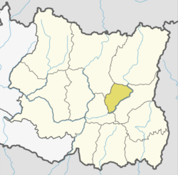
Phakchamara
Location in Nepal
Coordinates: 27°02′N87°31′E / 27.03°N 87.51°E / 27.03; 87.51 Coordinates: 27°02′N87°31′E / 27.03°N 87.51°E / 27.03; 87.51
CountryFlag of Nepal.svg    Nepal
Zone Koshi Zone
District Terhathum District
Population
 (1991)
  Total3,041
Time zone UTC+5:45 (Nepal Time)

Phakchamara is a village development committee in the Himalayas of Terhathum District in the Kosi Zone of eastern Nepal. At the time of the 1991 Nepal census it had a population of 3041. [1] . Brahmin, Chhetri, and Limbu are the main cast of this VDC. Naween Shikshya Sadan Higher Secondary School is the oldest School of this region as well as of this VDC. Several philanthropists contribute to the educational development of this VDC through this school. Mr. Krishna Prasad Dahal was a long time "Head sir" of this school and significantly contributed to the local society for uplifting the educational levels of numerous people of this region. "Dahal" and "Niroula" families contributions are tremendous for the development of this region and of this VDC. Currently, under new reformation of the political system in Nepal, it is included within "Chhathar VDC Ward No. 4". The Chhathar VDC chair after the election on 2017 is Santosh Tigela from Communist Party of Nepal. The only road that connects this region to Teria and accessible municipalities like Dhankuta and Dharan is by "Sindhuwa Sukrabare Road". The construction of this 8 km road has been started in 1986 but not pitched and completed yet due to corruption and idiot leaders. "Sukrabare bazaar" is the major business hub of this region. Buses and private vehicles are now run in this road 12 months after the graveling of the road in 2019. This is beautiful VDC with a pristine panorama of "KumbhaKarna Mountain" and a silver lining shine of Tamor River. Rhododendroen is everywhere mostly in the higher region. Water crises, foreign employment are the major problems. The Upper regions which are mostly wetland should be protected and initiate aforestation for the future of this VDC.

Related Research Articles

Bajura District District in Sudurpashchim Pradesh, Nepal

Bajura District, a part of Sudurpashchim Pradesh, is one of the seventy-seven districts of Nepal. The district, with Martadi as its district headquarters, covers an area of 2,188 km2 (845 sq mi) and had a population of 108,781 in 2001 and 134,912 in 2011. The district has nine municipalities, 9 Ilakas and 1 constituency areas. The district is situated in Longitude between 81° 10′ 20″ to 81° 48′ 27″ East and Latitude 29° 16′ 21″ to 29° 56′ 56″ North. Geographically the district is divided in three distinct regions from north to south viz. Higher Himalayan Region, Higher Mountain and mid – Mountains. The Higher Himalayan region comprises Saipal Himalayan range; High Mountain region comprises Doha Lekh and Ghori Lekh. Similarly, Mid-Mountain range comprises different ranges of mountains e.g. Badimalika Temple. The District has started from 300m to 6400m in height. The annual rainfall is about 13,433 mm and temperatures vary from 0 °C to 40 °C. The livelihood of more than 80% of the district population depends on agriculture farming, mainly small scale livestock. Due to low level of agricultural production, the majority of the households face acute food shortages for a large part of the year. According to the National Census 2011, the total population of the district is 134,912 comprising 69,106 female (51%) and 65,806 male (49%) residing in 24,908 households. Bajura district has an average population density of around 62 people per square km. The average family size is 5.4. Life expectancy of the people is 58 years. The average literacy rate is about 32%. Bajura district has a multi ethnic composition with Chhetri, Kami, Thakuri, Brahman, Damai, SarkI and Sanyashi. The common language is Nepali (96%) followed by Bhote Sherpa (0.46%) and Tamang (0.42%). Although accessibility to Bajura is very poor, this is improving rapidly. The Government strategy is mainly focused on the connection of VDC headquarters with all-weather motor able roads to SRN or District headquarters. Moreover, the DDC body of Bajura district has given higher priority on rural roads.

Kohalpur Municipality in Bheri Zone, Nepal

Kohalpur is a municipality in Banke District of province no 5 of Nepal. The municipality was established on 18 May 2014 merging the existing two Village Development Committees i.e. Rajhena and Kohalpur. The town is in East-West highway and one of the fastest developing places in Nepal. A neighboring city Nepalgunj is on South (16 km), with Ghorahi city (135 km) to west in Dang District and further 6 km is the Indian border. In fact it is a growing city in the western region of Nepal. It has a junction to diverse the roadway transport to east, west, north and south from the city.

Khandbari Municipality in Kosi Zone, Nepal

Khandbari is the district headquarters of Sankhuwasabha District in Province No. 1 of north-eastern Nepal. The 2011 Nepal census counted 26,301 population.

Sisautiya Village development committee in Province No. 2, Nepal

Sisautiya सिसौटिया is a small and most populated village in the southernmost part of Nepal commonly known as Madhesh or Terai. Sisautiya is 9km north of the Indian border, 18km south from Brahathawa municipality 9km west from district headquarters Malangawa. It is located at 26°52'0N 85°34'0E with an altitude of 79 metres(262 feet) There is a customs checkpoint at the border crossing. It is part of the Sarlahi district and Province No. 2. It forms the main part of the Sisautiya village development committee. At the time of the 2011 Nepal census it had a population of 13,729 people living in 2259 individual households.

Myanglung Municipality in Province No. 1, Nepal

Myanglung is a municipality and the district headquarters of Terhathum District of Province No. 1 in eastern Nepal. The municipality is situated at an elevation of about 1500 metres above sea level. Myanglung was converted into a municipality from a village development committee on 18 May 2014, merging the existing village development committees of Myanglung, Piple, Jirikhimti, Ambung, Sabla and Tamphula. According to the census of 2011 the total population of Myanglung is 19,659 including five VDCs.

Sandhikharka City in Lumbini Zone, Nepal

Sandhikharka Municipality is the headquarter of Arghakhanchi District which lies in the Lumbini Zone of Nepal. The former village development committee (VDC) was converted into a municipality on 18 May 2014 by merging the existing Sandhikharka, Wangla, Narapani, Khanchikot, Kimadada, Argha and Dibharna VDCs evdo. It is located, in a valley surrounded by hills, in the western part of the capital, Kathmandu.

Narayansthan is a village development committee in Baglung District in the Dhaulagiri Zone of central Nepal.It is located above the bank of Kali gandaki River. Now, it has become one of the major important place in baglung. They have planned to construct the domestic Airport. At the time of the 2011 Nepal census it had a population of 2,876 and had 781 houses in the town. The major castes living in the VDC are Brahman,Chhetry and Newar. There are 2 high schools - Janatadhan Higher School and Ganesh Secondary School and one campus. Krishna Gandaki Campus is at the premises of Janatadhan HSS. Ganesh Secondary School, one of the best schools in the region is known for its quality education movement. Established in 1957 [2014 BS] by Soldier Board (India), Ganesh Secondary School is one of the oldest schools. In 1964 [2021 BS], the Indian Soldier Board stopped its grant. Since there was no school support mechanism developed from the Government of Nepal, the school passed through many ups and downs. After Modern Education Act came in effect in 1971 BS [2028 BS], the school merged with Janatadhan Higher Secondary School. In 1980 [2037 BS], the school was reopened.

Kailashmandau Village development committee in Sudurpashchim Pradesh, Nepal

Kailashmandau used to be VDC in Bajura District in the Seti Zone of north-western Nepal. At the time of the 2011 Nepal census it had a population of 9,586 and had 1818 houses. There is a small market and it is also the junction to many villages of this region.

Phakphok Village Development Committee in Mechi Zone, Nepal

Phakphok is a town and Village Development Committee (VDC) in Ilam District in the Mechi Zone of eastern Nepal. At the time of the 1991 Nepal census it had a population of 4,233 persons living in 734 individual households.

Bidyapur Village development committee in Karnali Pradesh, Nepal

Bidyapur is a village development committee in Surkhet District in Karnali Pradesh of mid-western Nepal. At the time of the 1991 Nepal census it had a population of 4053 people living in 707 individual households.

Jijodamandau Village development committee in Seti Zone, Nepal

Jijodamandau is a village development committee in Doti District in the Seti Zone of western Nepal. At the time of the 1991 Nepal census it had a population of 1906 living in 365 individual households.

Dudhauli Municipality in Central, Nepal

Dudhauli is a municipality of the Sindhuli District in the Janakpur Zone of south-eastern Nepal.

Hawaku is a village development committee in the Himalayas of Terhathum District in the Kosi Zone of eastern Nepal. At the time of the 1991 Nepal census it had a population of 3390 people living in 589 individual households. A higher secondary school is the only school of Hwaku. It is bordered with IWa, Sakranti, Nighuradin (Taplejung) and Amarpur (Panchthar). The Tamor river lies to the east Hwaku making it an area suitable for cultivation.

Morahang Village development committee in Kosi Zone, Nepal

Morahang is a village development committee in the Himalayas of Terhathum District in the Kosi Zone of eastern Nepal. At the time of the 1991 Nepal census it had a population of 3679 people living in 699 individual households.

Piple is a market center in Myanglung Municipality in the Himalayas of Terhathum District in the Kosi Zone of eastern Nepal. Formerly a Village Development Committee this place was merged to form the new municipality since 18 May 2014. At the time of the 1991 Nepal census it had a population of 1613 people residing in 285 individual households.The piple is one of the vdc located down from myamglumg.

Solma Village development committee in Kosi Zone, Nepal

Solma is a village development committee in the Himalayas of Terhathum District in the Kosi Zone of eastern Nepal. At the time of the 1991 Nepal census it had a population of 4093 people living in 717 individual households. Solma is a Village Development Committee (VDC) lies on western part of Tehrathum District. The main ethnicity distribution of this VDC is Limbu (1190), Bramans (873), Kchhetri (663), Magar (381), Gurungs(287), Newar (166), Tamang (43) Kami (119)and Dam/Darji (100), Bhujel/Gharti (47). This VDC have one high school named Ratna Higher Secondary School, one Health Post, Post Office, Agriculture and Veterinary Center.

Surunga Town in Mechi Zone, Nepal

Surunga is a trade center of Jhapa District. It is located in Kankai Municipality in Jhapa District in the Mechi Zone of south-eastern Nepal. At the time of the 1991 Nepal census it had a population of 16,747 people living in 2996 individual households. Surunga is one of the rapidly developing towns of Jhapa district. It is situated on the bank of the Kankai River.

Phidim Municipality in Mechi Zone, Nepal

Phidim Municipality is the headquarters of the Panchthar District in the Mechi Zone of eastern Nepal. Phidim was upgraded to a 'municipality' from a 'village', when a development committee merged with other VDCs - including the Phidim, Chokmagu and Siwa villages - on May 18, 2014. It offers a route for trekkers and locals, who travel to and from the Taplejung district bordering with the Tibetan Autonomous Region of China. It is also a commercial hub for the rural surroundings.

Sunwal Municipality in Lumbini Zone, Nepal

Sunwal is a municipality in Nawalparasi District. It lies in Western Development Region, Lumbini Zone. It was announced as a municipality on 2011 combining two neighboring Village Development Committees; Sunwal and Swathi; of the district. It is the urban core of a rapidly growing urban agglomerate in Nepal. Sunwal is one of the biggest and richest Municipalitiem of Nawalparasi district. Recently, it belongs to the State no.5 under new constitution.

Laligurans Municipality in Province No. 1, Nepal

Laligurans is a municipality located in Terhathum District in the Province No. 1 of eastern Nepal. After the government announcement, the municipality was established on 19 September 2015 by merging the existing Basantapur, Phulek, Dangpa, Sungnam and Solma village development committees (VDCs). The center of the municipality is established in Basantpur. At the time of the 2011 Nepal census after merging the five VDCs population it had a total population of 16,934 persons. After the government decision the number of municipalities has reached 217 in Nepal.

References

  1. "Nepal Census 2001". Nepal's Village Development Committees. Digital Himalaya . Retrieved 19 November 2008.