Related Research Articles

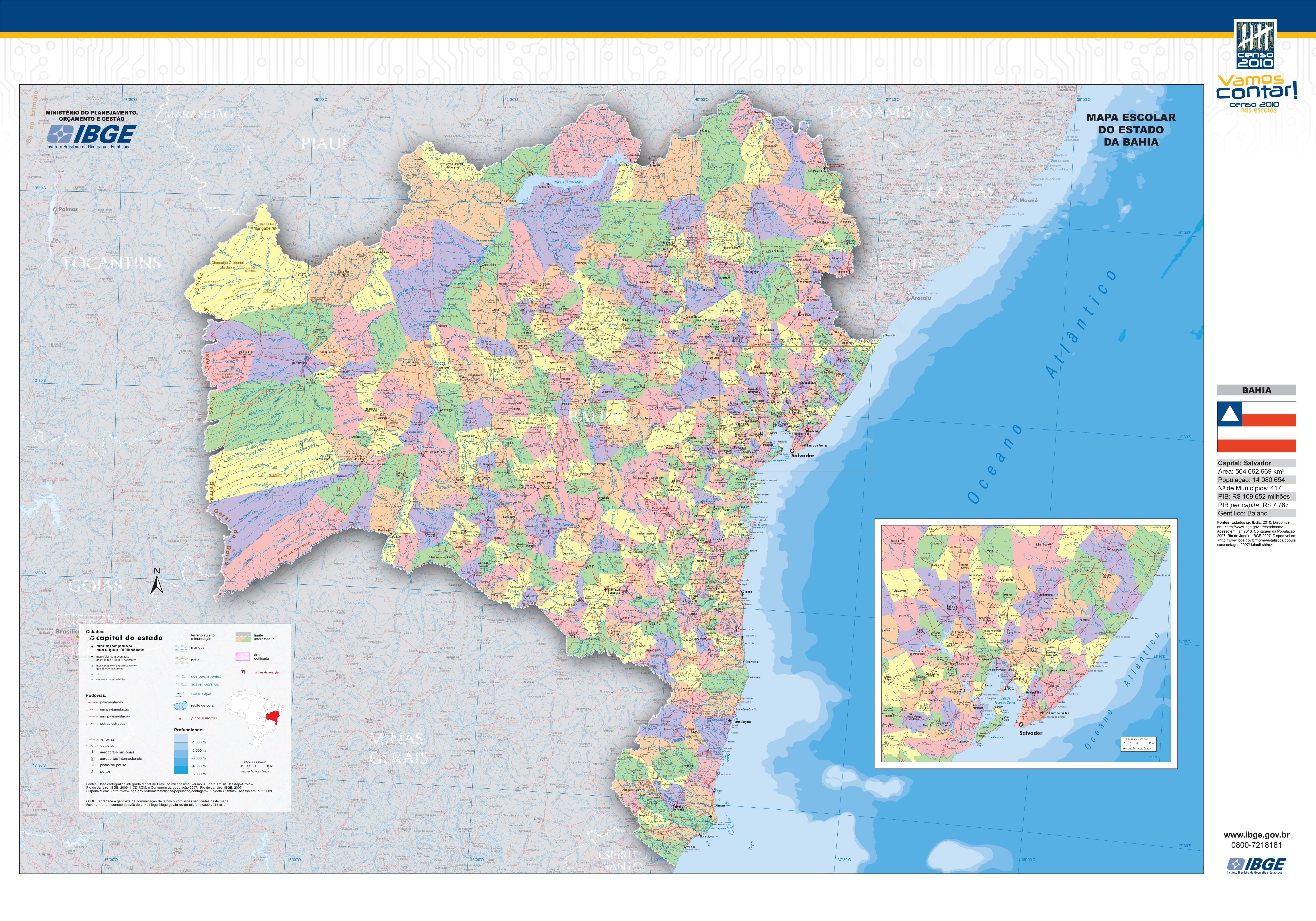
Bahia is one of the 26 states of Brazil and is located in the northeastern part of the country on the Atlantic coast. It is the 4th-largest Brazilian state by population and the 5th-largest by area. Bahia's capital is the city of Salvador, located on a spit of land separating the Bay of All Saints from the Atlantic. Once a monarchial stronghold dominated by agricultural, slaving, and ranching interests, Bahia is now a major manufacturing center whose last four elections have been dominated by the Workers' Party.

The São Francisco River or Rio São Francisco is a river in Brazil. With a length of 2,914 kilometres (1,811 mi), it is the longest river that runs entirely in Brazilian territory, and the fourth longest in South America and overall in Brazil. It used to be known as the Opara by the indigenous people before colonisation, and is today also known as Velho Chico.
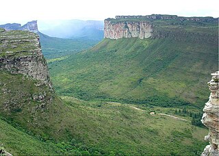
The Chapada Diamantina National Park is a national park in the Chapada Diamantina region of the State of Bahia, Brazil. The terrain is rugged, and mainly covered by flora of the Caatinga biome.

Cachoeira, is an inland municipality of Bahia, Brazil, on the Paraguaçu River. The town exports sugar, cotton and tobacco and is a thriving commercial and industrial centre.

Caravelas is a city of about 20,000 inhabitants in southern Bahia, Brazil, a few miles above the mouth of the Caravelas River.

Paulo Afonso is a city in Bahia, Brazil. It was founded in 1958.
Ipiaú is a city in Bahia, Brazil. It is located at around 14°8′13″S39°44′2″W.

The Paraguaçu River is a river in Bahia state of eastern Brazil. It runs 500 kilometres (310 mi) from the Chapada Diamantina highlands of central Bahia to its mouth at the Baía de Todos os Santos. The Paraguaçu is the largest river entirely within Bahia. Its banks are fertile and the cities at its mouth are navigable. It was a main route of transportation and communication of the entire region both in the pre-Colonial and Portuguese Colonial period. Its lower reaches are home to the Baía do Iguape Marine Extractive Reserve, created in 2000.

Ibirapitanga is a municipality and a town in the State of Bahia, Brazil, located inland from the coast about 45 km. At the 2010 census the municipality had 22,610 inhabitants.
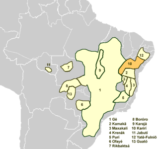
The Karirí languages, generally considered dialects of a single language, are extinct languages formerly spoken by the Kiriri people of Brazil. It was spoken until the middle of the 20th century; the 4,000 ethnic Kiriri are now monolingual Portuguese speakers, though a few know common phrases and names of medicinal plants.
Mucugê is a municipality in the state of Bahia, in the North-East region of Brazil. It is close to the Chapada da Diamantina National Park.

São Francisco do Conde is a municipality in the state of Bahia in the North-East region of Brazil. São Francisco do Conde covers 262.856 km2 (101.489 sq mi), and has a population of 38,838 with a population density of 150 inhabitants per square kilometer. It is located 67 kilometres (42 mi) from the state capital of Salvador. According to the Brazilian Institute of Geography and Statistics São Francisco do Conde has the highest concentration of Brazilians of African descent (90%) in Bahia.

Nazaré, also known as Nazaré das Farinhas, is a municipality in the state of Bahia in the North-East region of Brazil. The municipality has a population of 29,546 with a population density of 107 inhabitants per square kilometer. It is located 110 km (68 mi) from the state capital of Bahia, Salvador. Nazaré is within the Bahian Recôncavo, an interior region of the state of Bahia. It borders the municipalities of Muniz Ferreira, Aratuípe, Jaguaripe, São Felipe, and Maragogipe. The Jaguaripe River crosses through the middle of the town. It is sits on the intersection of two Bahian state highways, BA-001 and BA-046..

Acajutiba is a municipality in the state of Bahia in the North-East region of Brazil.
São Félix, Bahia is a municipality in Bahia, Brazil. The municipality has a population of 15,310 with a population density of 142 inhabitants per square kilometer. It is located 110 km (68 mi) from the state capital of Bahia, Salvador.
Rio Real is a municipality in the state of Bahia in the North-East region of Brazil. It is named for the nearby river.

Backwater is located in −9.623349, −42.081079 municipality in the state of Bay in the North-East region of Brazil.

Cairu is a municipality in the state of Bahia in the North-East region of Brazil. The municipality has a population of 18,176 with a population density of 33.3 inhabitants per square kilometer. The municipality consists of three island: the Island of Cairu, which is only separated from the mainly by a narrow river; Tinharé Island, which has the dense tourist settlement of Morro de São Paulo to the north; and Boipeba Island.
Tuxá was the eastern Brazilian language of the Tuxá people, who now speak Portuguese. The language ceased being spoken in the late 19th century, but in the 1960s a research team found two women that had been expelled from the Tuxa tribe in Bahia who knew some thirty words.

Uibaí is a municipality in the state of Bahia in the North-East region of Brazil. It is located about 508 kilometres (316 mi) byroad northwest of Salvador. It lies to the northeast of Gentio do Ouro and about 30 kilometres (19 mi) south-southwest of Irecê, the nearest city. Xique-Xique and the São Francisco River is to the northwest.
References
- ↑ "Mapa escolar do estado do Bahia". IBGE. 2010.
| This article related to a river in Bahia, Brazil is a stub. You can help Wikipedia by expanding it. |