
Kidderminster is a large market and historic minster town and civil parish in Worcestershire, England, 17 miles (27 km) south-west of Birmingham and 15 miles (24 km) north of Worcester. Located north of the River Stour and east of the River Severn, in the 2021 census, it had a population of 57,400. The town is twinned with Husum, Germany.
The River Piddle or Trent or North River is a small rural Dorset river which rises in the Dorset Downs and flows into Poole Harbour near Wareham.

Wychavon is a local government district in Worcestershire, England, with a population size of 132,500 according to the 2021 census. Its council is based in the town of Pershore, and the other towns in the district are Droitwich Spa and Evesham. The district extends from the southeast corner of Worcestershire north and west. It borders all the other districts of Worcestershire, as well as the counties of Gloucestershire and Warwickshire.
The River Wyre in Lancashire, England, flows into the Irish Sea at Fleetwood. It is 28 miles (45 km) long and has a sheltered estuary which penetrates deep into the Fylde peninsula.

Puddletown is a village and civil parish in Dorset, England. It is situated by the River Piddle, from which it derives its name, about 4.5 miles (7 km) northeast of the county town Dorchester. Its earlier name Piddletown fell out of favour, probably because of connotations of the word "piddle". The name Puddletown was officially sanctioned in the late 1950s. Puddletown's civil parish covers 2,908 hectares and extends to the River Frome to the south. In 2013 the estimated population of the civil parish was 1450.

Wombourne is a large village and civil parish located in the district of South Staffordshire, in the county of Staffordshire, England. It is 4 miles (6 km) south-west of Wolverhampton and just outside the county and conurbation of the West Midlands.

The River Trym is a short river, some 4.5 miles (7.2 km) in length, which rises in Filton, South Gloucestershire, England. The upper reaches are culverted, some underground, through mostly urban landscapes, but once it emerges into the open it flows through a nature reserve and city parks before joining the tidal River Avon at Sea Mills. 18th-century water mills near the mouth gave the area its name.
White Ladies Aston is a village in the Wychavon local government district of Worcestershire, England, United Kingdom, and also lends its name to the civil parish in which the village is located. The village is located to the east of the A44 which started as a Saltway linking Droitwich to Oxford. To the south is Pershore and five miles west is Worcester. The parish is bound to the east by the Bow Brook. The parish, according to the 2011 census, has 87 households with 220 residents.

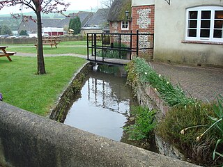
Shitterton is a hamlet in Dorset, England. It has attracted worldwide attention for its name, which dates back at least 1000 years and means "farmstead on the stream used as an open sewer". Shitterton has frequently been noted on lists of unusual place names, due to having the vulgar term "shit" in its name. The hamlet includes a collection of historic thatched buildings dating back to the 18th century and earlier.
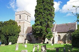
Holt is a village and civil parish in the Malvern Hills District of the county of Worcestershire, England. The church is dedicated to St. Martin, and dates from about the 12th century. Holt Bridge, over the River Severn, was designed by Thomas Telford, and opened in 1830.
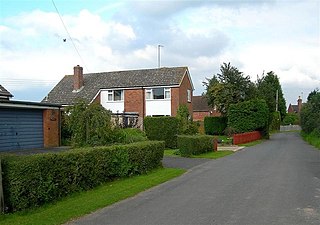
Little Witley is a village and civil parish in the Malvern Hills District in the county of Worcestershire, England.

Bengeworth is a locality adjoining Evesham in Worcestershire, England. In 1887 it had a population of 1,311. Today it has a school and an Anglican church.
Peopleton is a village and civil parish in the Wychavon district of Worcestershire, England. In 2001 the parish had a population of 640, with 245 households.
The Smestow Brook, sometimes called the River Smestow, is a small river that plays an important part in the drainage of Wolverhampton, South Staffordshire, and parts of Dudley in the United Kingdom, and has contributed to the industrial development of the Black Country. It is the most important tributary of the River Stour, Worcestershire and part of the River Severn catchment.
Urse d'Abetot was a Norman who followed King William I to England, and became Sheriff of Worcestershire and a royal official under him and Kings William II and Henry I. He was a native of Normandy and moved to England shortly after the Norman Conquest of England in 1066, and was appointed sheriff in about 1069. Little is known of his family in Normandy, who were not prominent, but he probably got his name from the village Abetot. Although Urse's lord in Normandy was present at the Battle of Hastings, there is no evidence that Urse took part in the invasion of England in 1066.
The Husmerae were a tribe or clan in early medieval England, possibly forming an early settlement of the Hwicce subkingdom. Charter evidence also referred to the group as Wiogorna and was also considered a prouvincia or provincia, an administrative division with its own territorial boundaries. An account also refer to the Husmerae territory as a regio.

North Piddle is a small civil parish in the Wychavon district of Worcestershire, England. It is located within a loop of Piddle Brook.
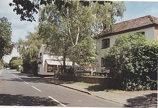
Salwarpe is a small village and civil parish in the Wychavon district of Worcestershire, England, less than two miles south west of Droitwich, but in open country. The name is also spelled Salwarp, and in the time of John Leland was recorded as Salop. Since 2003, Salwarpe has shared a parish council with Hindlip and Martin Hussingtree.
