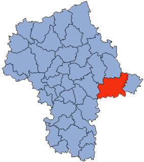
Ożarów Mazowiecki is a town in Poland, just to the west of Warsaw, in Mazowsze Voivodship. It is the capital of Warsaw West County. Its population numbers 8,227 (2004).

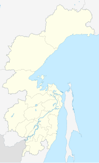
The Chastye Islands is an island group in the southern end of the Sea of Okhotsk. It is located in Tatar Strait, between the mainland shore and the western coast of Sakhalin. Although there are some settlements on the adjacent coast, the Chastye Islands are uninhabited.

Pomiany is a village in the administrative district of Gmina Jeziora Wielkie, within Mogilno County, Kuyavian-Pomeranian Voivodeship, in north-central Poland. It lies approximately 5 kilometres (3 mi) west of Jeziora Wielkie, 22 km (14 mi) south-east of Mogilno, 62 km (39 mi) south-west of Toruń, and 66 km (41 mi) south of Bydgoszcz.
Drążonek is a village in the administrative district of Gmina Mrocza, within Nakło County, Kuyavian-Pomeranian Voivodeship, in north-central Poland.
Konstantynów-Kolonia is a village in the administrative district of Gmina Konstantynów, within Biała Podlaska County, Lublin Voivodeship, in eastern Poland.
Janin is a village in the administrative district of Gmina Tykocin, within Białystok County, Podlaskie Voivodeship, in north-eastern Poland.
Sobotczyzna is a settlement in the administrative district of Gmina Bielsk Podlaski, within Bielsk County, Podlaskie Voivodeship, in north-eastern Poland.

Podrabalina is a village in the administrative district of Gmina Bakałarzewo, within Suwałki County, Podlaskie Voivodeship, in north-eastern Poland. It lies approximately 7 kilometres (4 mi) south-east of Bakałarzewo, 15 km (9 mi) west of Suwałki, and 108 km (67 mi) north of the regional capital Białystok.

Droblin is a village in the administrative district of Gmina Wodzisław, within Jędrzejów County, Świętokrzyskie Voivodeship, in south-central Poland. It lies approximately 3 kilometres (2 mi) south-east of Wodzisław, 17 km (11 mi) south-west of Jędrzejów, and 52 km (32 mi) south-west of the regional capital Kielce.

Krasne is a village in Rzeszów County, Subcarpathian Voivodeship, in south-eastern Poland. It is the seat of the gmina called Gmina Krasne. It lies approximately 7 km (4 mi) east of the regional capital Rzeszów.

Ostrów-Kania is a village in the administrative district of Gmina Dębe Wielkie, within Mińsk County, Masovian Voivodeship, in east-central Poland. It lies approximately 2 kilometres (1 mi) north-west of Dębe Wielkie, 10 km (6 mi) west of Mińsk Mazowiecki, and 30 km (19 mi) east of Warsaw.

Kurpie Szlacheckie is a village in the administrative district of Gmina Troszyn, within Ostrołęka County, Masovian Voivodeship, in east-central Poland. It lies approximately 3 kilometres (2 mi) north-east of Troszyn, 14 km (9 mi) east of Ostrołęka, and 106 km (66 mi) north-east of Warsaw.
Chrościn is a village in the administrative district of Gmina Dzierzążnia, within Płońsk County, Masovian Voivodeship, in east-central Poland.

Marysinek is a village in the administrative district of Gmina Błonie, within Warsaw West County, Masovian Voivodeship, in east-central Poland. It lies approximately 10 kilometres (6 mi) west of Błonie, 22 km (14 mi) west of Ożarów Mazowiecki, and 36 km (22 mi) west of Warsaw.

Dybów-Kolonia is a village in the administrative district of Gmina Radzymin, within Wołomin County, Masovian Voivodeship, in east-central Poland. It lies approximately 3 kilometres (2 mi) south-east of Radzymin, 7 km (4 mi) north of Wołomin, and 26 km (16 mi) north-east of Warsaw.

Chojno-Błota Małe is a village in the administrative district of Gmina Wronki, within Szamotuły County, Greater Poland Voivodeship, in west-central Poland. It lies approximately 12 kilometres (7 mi) west of Wronki, 29 km (18 mi) north-west of Szamotuły, and 60 km (37 mi) north-west of the regional capital Poznań.

Motylewo is a village in the administrative district of Gmina Bogdaniec, within Gorzów County, Lubusz Voivodeship, in western Poland. It lies approximately 2 kilometres (1 mi) west of Bogdaniec and 15 km (9 mi) south-west of Gorzów Wielkopolski.

Szpon is a village in the administrative district of Gmina Nowa Karczma, within Kościerzyna County, Pomeranian Voivodeship, in northern Poland. It lies approximately 6 kilometres (4 mi) north of Nowa Karczma, 17 km (11 mi) north-east of Kościerzyna, and 35 km (22 mi) south-west of the regional capital Gdańsk.

Sucha is a settlement in the administrative district of Gmina Barlinek, within Myślibórz County, West Pomeranian Voivodeship, in north-western Poland. It lies approximately 11 kilometres (7 mi) south of Barlinek, 24 km (15 mi) east of Myślibórz, and 71 km (44 mi) south-east of the regional capital Szczecin.

Shawei station is a Metro station of Shenzhen Metro Line 7. It opened on 28 October 2016.


