Related Research Articles

Holetown, is a small town located in the Caribbean island nation of Barbados. Holetown is located in the parish of Saint James on the sheltered west coast of the island.
Crab Hill is a settlement in Barbados, at the northern end of the parish of Saint Lucy. The place was so named because large numbers of crabs would appear in the area during rainfall; people would catch the crabs and keep them as pets. The population is 727 (2018), which makes it the most populous place in the parish of St. Lucy. Crab Hill is the site of the St. Lucy Police Station. The Mount Gay North Stars cricket grounds are located in Crab Hill.

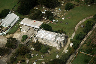
The current Christ Church Parish Church located in Oistins, Christ Church, Barbados was built in 1935 and is the fifth parish church on the site. At various times the previous structures have all been destroyed by natural disasters including flood, fire or hurricanes.

Achiwib is a village in the Upper Takutu-Upper Essequibo Region of Guyana. Achiwib is an Amerindian community, and has as 2020, a school. The main language spoken in the village is Wapishana language.

Glenavy is a village and civil parish in County Antrim, Northern Ireland, 17 kilometres north west of Lisburn on the banks of the Glenavy River. In the 2011 Census it had a population of 5,697 people. In early documents it was known as Lenavy.
Two Mile Hill is an area two miles (3.2 km) away from Bridgetown, in Saint Michael Parish, Barbados. The Two Mile Hill area was historically one of the railway stations on the island of Barbados. The Barbados Railway was a part of the island's colonial distribution network for the sugar cane industry while the country was under the control of Britain. The location no longer has a railway and is now instead known more for its Sherbourne Conference Centre.
Brereton is a village in Saint Philip Parish in Barbados. The Brereton name started with a John Brereton who traveled to Barbados in 1654.
Barclays Park is a 50-acre village in the parish of Saint Andrew in Barbados. Barclays Park was opened in 1966 by HM Queen Elizabeth II after being gifted to the Barbados government once independence was declared in 1966.
Breedy's is a village in the parish of Saint Andrew in Barbados.

Cherry Tree Hill is a village in the parish of Saint Andrew in Barbados. It is approximately 850 ft. above sea level. It is believed that cherry trees lined the hill at some point, which has since been replaced by mahogany trees. The village overlooks the Scotland District.
The Wildey area of the Parish of Saint Michael located roughly 4 km east of Bridgetown, it lies on the border with the Parish of Christ Church. Normally a very busy area with the ABC Highway, Wildey is one of the main convergence points for vehicles travelling either towards the capital-city Bridgetown or towards points in northern Barbados. In recent years the area was reconfigured for traffic mitigation, the tri-directional split or fork in the highway formerly known as the "Wildey Y" was changed to only allow southbound traffic to turn left or right on to Wildey Road only. Northbound traffic must now travel on Wildey Road to Highway R road which brings traffic back to BET hill.
Hopewell is a settlement in Saint Thomas Parish, Barbados.
Nurkse is a village in Vinni Parish, Lääne-Viru County, in northeastern Estonia. Prior to the 2017 administrative reform of Estonian local governments, the village was located in Rägavere Parish.
Blue Waters is a populated place in the parish of Christ Church, Barbados. It is a coastal area located on the south coast of Barbados. Rockley Beach is a beach located in Blue Waters.
Bath is a populated place in the parish of Saint John, Barbados.
Chimborazo is a populated place in the parish of Saint Joseph, Barbados. Chimborazo Hill in Chimborazo is one of the highest points in Barbados.
Bissex is a populated place in the parish of Saint Joseph, Barbados.
The Castle is a populated place in the parish of Saint Peter, Barbados.
Boscobelle is a populated place in the parish of Saint Peter, Barbados.

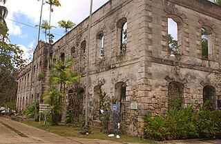
Farley Hill is a national park in Saint Peter, Barbados. It is on the site of Grenade Hall Plantation, established in the seventeenth century.
References
- ↑ Chamberlain, Mary (2013). Empire and Nation-Building in the Caribbean: Barbados, 1937-66. Studies in Imperialism MUP. Manchester University Press. p. 97. ISBN 978-1-84779-278-5 . Retrieved June 28, 2016.
Coordinates: 13°18′N59°35′W / 13.300°N 59.583°W
| This Barbados location article is a stub. You can help Wikipedia by expanding it. |