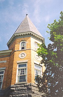
Derby Line is an incorporated village in the town of Derby in Orleans County, Vermont, United States, slightly north of the 45th parallel, the nominal U.S.-Canada boundary. The population was 673 at the 2010 census.

White River Junction is an unincorporated village and census-designated place (CDP) in the town of Hartford in Windsor County, Vermont, United States. The population was 2,286 at the 2010 census, making it the largest community within the town of Hartford.

Jericho is a town in Chittenden County, Vermont, United States. The population was 5,009 at the 2010 census. It was named after the ancient city of Jericho.

Rutland is a town in Rutland County, Vermont, in the United States. The population was 4,054 at the 2010 census. Rutland completely surrounds the city of Rutland, which is incorporated separately from the town of Rutland. The villages of Rutland Town effectively comprise the inner suburbs of Rutland City.
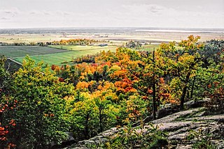
The Gatineau Hills are a geological formation in Canada that makes up part of the southern tip of the Canadian Shield, and acts as the northern shoulder of the Ottawa Valley. They are also the foothills of the Laurentian Mountains which stretch east through Quebec, beginning north of Montreal and joining up with others into Vermont and New Hampshire.

The Green Mountains are a mountain range in the U.S. state of Vermont. The range runs primarily south to north and extends approximately 250 miles (400 km) from the border with Massachusetts to the border with Quebec, Canada. The part of the same range that is in Massachusetts and Connecticut is known as The Berkshires or the Berkshire Hills and the Quebec portion is called the Sutton Mountains, or Monts Sutton in French.
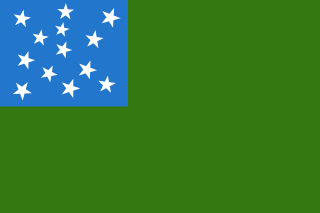
The State of Vermont, also known as Vermont Republic, and until June 2, 1777 known as Republic of New Connecticut and Republic of the Green Mountains, was an independent state in New England that existed from January 15, 1777 to March 4, 1791. The state was founded in January 1777, when delegates from 28 towns met and declared independence from the jurisdictions and land claims of the British colony of Quebec, New Hampshire, and New York. The republic remained in existence for the next fourteen years, albeit without diplomatic recognition from any foreign power. On March 4, 1791 it was admitted into the United States as the State of Vermont, with the constitution and laws of the independent state continuing in effect after admission.

The Canada–United States border, officially known as the International Boundary, is the longest international border in the world between two countries. The terrestrial boundary is 8,891 kilometers (5,525 mi) long. The land border has two sections: Canada's border with the contiguous U.S. to its south, and Canada's border with the U.S. state of Alaska to its west. The bi-national International Boundary Commission deals with matters relating to marking and maintaining the boundary, and the International Joint Commission deals with issues concerning boundary waters. The agencies currently responsible for facilitating legal passage through the international boundary are the Canada Border Services Agency (CBSA) and U.S. Customs and Border Protection (CBP).
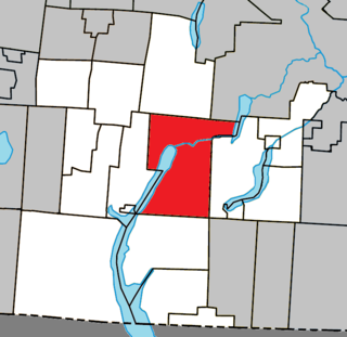
Magog is a city in southeastern Quebec, Canada, about 120 kilometres (75 mi) east of Montreal at the confluence of Lake Memphremagog—after which the city was named—with the Rivière aux Cerises and the Magog River. It is a major centre and industrial city in the Regional County Municipality of Memphremagog. The city lies in the Eastern Townships tourist region.
Lewiston is a former village in the town of Norwich, Windsor County, Vermont, United States. Settlers first arrived in that area in 1765; the village's namesake, Dr. Joseph Lewis, arrived two years later. From the late 19th century, the village was centered on a rail station that was used by both Norwich and the town directly across the Connecticut River, Hanover, New Hampshire.

Beebe Plain is an unincorporated community in the town of Derby in Orleans County, Vermont, United States which extends into the Canadian municipality of Stanstead, Quebec. The village is divided by the Canada–United States border between Canada and the United States; the Canadian portion of Beebe Plain had the status of an incorporated municipality in its own right until 1995.

Potton is a township municipality of about 1,850 people in the Memphrémagog Regional County Municipality. It is located on the western shore of Lake Memphremagog in the Estrie region of Quebec, and is one of the municipalities in Brome County. Potton is located about 125 kilometres (78 mi) southeast of Montreal, 30 kilometres (19 mi) to the southwest of the city of Magog, and next to the United States border, north of North Troy, Vermont.

The Saxtons River is a 22.9-mile-long (36.9 km) river in the U.S. state of Vermont, a tributary of the Connecticut River. Its watershed covers 78 square miles (200 km2) and a range in altitude of 1,800 feet (550 m); land use is about 80% forested and 3% agricultural, and the upper river supports wild brook trout and brown trout, while Atlantic salmon occur but are usually limited to the area below Twin Falls on the lower river.

Lake Memphremagog is a fresh water glacial lake located between Newport, Vermont, United States and Magog, Quebec, Canada. The lake spans both Quebec and Vermont, but is mostly in Quebec. Most of the watershed that feeds the lake is located in Vermont, and is a source for accumulated phosphorus, sediments and other pollutants. Cleanup efforts since the late 1980s have improved the water quality. The lake furnishes potable (drinking) water for 200,000 people.
The Northern Forest Canoe Trail (NFCT) is a 740-mile (1,190 km) marked canoeing trail in the northeastern United States and Canada, extending from Old Forge in the Adirondacks of New York to Fort Kent, Maine. Along the way, the trail also passes through the states and provinces of Vermont, Quebec, and New Hampshire. The trail was opened on June 3, 2006.
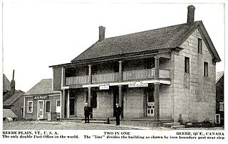
Beebe Plain is an unincorporated geographically-contiguous settlement, split politically between Canada and the United States. An unincorporated village partially in Stanstead and partially in Derby Line, it is divided by the Quebec-Vermont border. This settlement was begun by David and Calvin Beebe in 1798.

The Williams River is a 27.0-mile (43.5 km) river in the U.S. state of Vermont. It is a tributary of the Connecticut River. Its watershed covers 117 square miles; land use is about 80% forested and 4% agricultural, and the upper river supports wild brook trout and brown trout.
Algiers is an unincorporated community in the town of Guilford, Vermont, United States.
Highwater is a village in the Potton township of the Eastern Townships of Quebec, Canada, in Memphrémagog Regional County Municipality of the Estrie region, north of the Canada–United States border from North Troy, Vermont. The Portland-Montreal Pipe Line crosses the border and there is pumping station on the Highwater side. Highwater was the site of the Space Research Corporation test site. The confluence of the North Branch and the South Branch of the Missisquoi River is in Highwater; this forms the Missisquoi River which flows into Lake Champlain at Missisquoi Bay. The Newport Subdivision of the Central Maine and Quebec Railway railroad route from Newport, Vermont to Richford, Vermont traverses Highwater and follows the Mississquoi River. The single runway Mansonville Airport (CSK4) is located on chemin de l'Aeroport.

The Coaticook River is a north-flowing river rising in Vermont, United States, and located primarily in the Estrie region of Quebec, Canada. The mouth of the river is located north of Waterville and south of Lennoxville, near the southern border of the city of Sherbrooke, at the Massawippi River. Via the Massawippi and the Saint-François River, it is part of the St. Lawrence River watershed.


