
The Adirondack Park is a park in northeastern New York protecting the Adirondack Mountains. The park was established in 1892 for "the free use of all the people for their health and pleasure", and for watershed protection. At 6.1 million acres, it is the largest park in the contiguous United States.

The Catskill Park is in the Catskill Mountains in the U.S. state of New York. It consists of 700,000 acres of land inside a Blue Line in four counties: Delaware, Greene, Sullivan, and Ulster. As of 2005, 287,500 acres (116,300 ha) or 41 percent of the land within, is owned by the state as part of the Forest Preserve; it is managed by the Department of Environmental Conservation (DEC). Another 5% is owned by New York City to protect four of the city's reservoirs in the region that lie partially within the park and their respective watersheds.

Big Moose Lake, at the head of the Moose River, is a large lake about five miles (8 km) north of Fourth Lake in the Adirondacks in upstate New York. The lake is within both Herkimer and Hamilton counties, and covers portions of the towns of Webb and Long Lake. Located southwest of the lake is the hamlet of Big Moose.
The Slide Mountain Wilderness Area is, at 47,500 acres (19,200 ha), the largest tract of state-owned Forest Preserve in New York's Catskill Park, and the largest area under any kind of wilderness area protection between the Adirondacks and the southern Appalachians. It is located in the towns of Shandaken, Denning and Olive in Ulster County.

The West Canada Creek is a 76-mile-long (122 km) river in upstate New York, United States. West Canada Creek is an important water way in Hamilton, Oneida, and Herkimer counties, draining the south part of the Adirondack Mountains before emptying into the Mohawk River near the Village of Herkimer. The name "Canada" is derived from an Iroquoian word for "village" (Kanata).

Lows Lake is located in the Adirondack Park in northeastern New York. It is in the New York State Forest Preserve Five Ponds Wilderness Area, 10 miles (16 km) southwest of Tupper Lake. The Adirondack Park Agency classifies the lake as a Primitive Area meaning that it is wilderness in character, but contains artificial structures and private lands.
The Blue Ridge Wilderness Area, a unit of New York's Forest Preserve in the Adirondack Park, is located in the towns of Arietta, Lake Pleasant and Indian Lake in Hamilton County. It is roughly bounded on the north by NY 28; on the east by Route 28 and private lands immediately west of this route; on the south by private lands immediately north and west of Cedar River Flow; and on the west by the Lake Kora and Sagamore Lake properties and the South Inlet of Raquette Lake. It contains 19 bodies of water covering 275 acres and features 15 miles of foot trails and three lean-tos.

The Dix Mountain Wilderness Area is the name previously given to an area of New York's Forest Preserve in the Adirondack Park located in the towns of Elizabethtown, Keene and North Hudson, Essex County. It was roughly bounded on the north by NY 73, on the east by the Adirondack Northway (Interstate 87), on the south by Blue Ridge Road and on the west by Elk Lake Club and Ausable Club lands.
The Five Ponds Wilderness Area, an Adirondack Park unit of New York's Forest Preserve, is located in the towns of Fine and Clifton in St. Lawrence County, the town of Webb in Herkimer County and the town of Long Lake in Hamilton County. It includes 1,064 acres (4.3 km2) of private inholdings, 99 bodies of water covering 1,964 acres (7.9 km2), 57.9 miles (93.2 km) of trails, and 14 lean-tos.
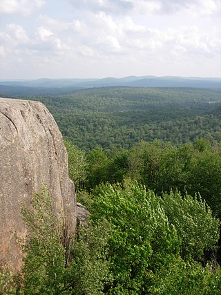
The High Peaks Wilderness Area is the largest wilderness area of the Forest Preserve in the U.S. state of New York. It is located in three counties and six towns in the Adirondack Park: Harrietstown in Franklin County, North Elba, Keene, North Hudson and Newcomb in Essex County and Long Lake in Hamilton County.

The Ha-De-Ron-Dah Wilderness Area, an Adirondack Park unit of New York's Forest Preserve, is located in the town of Webb, Herkimer County, and the Town of Greig, Lewis County. It is bounded on the north by private lands in the vicinity of North Pond, Hitchcock Pond, Moose Pond and the headwaters of the Independence River; on the east by private lands along the Remsen to Lake Placid railroad right-of-way; on the south by private lands along New York State Route 28 and by the wood road leading to the Copper Lake property; and on the west by Pine Creek and a DEC maintained foot trail from Pine Creek to Pine Lake, East Pine Pond, and Big Otter Lake.
The Hoffman Notch Wilderness Area, an Adirondack Park unit of the Forest Preserve, lies in the towns of Schroon, North Hudson and Minerva in Essex County. It is bounded on the north by private lands lying south of the Blue Ridge Road and the Sand Pond Mountain tract donated to the state by Finch, Pruyn and Company for fish and wildlife management and silvicultural research and experimentation purposes, on the east by Interstate 87 and private lands immediately west of the Northway, on the south by private lands lying north of the Loch Muller Road and on the west by the jeep road and trail that extends from Irishtown along Minerva Stream northward to the Blue Ridge Road near Cheney Pond.
The McKenzie Mountain Wilderness Area, an Adirondack Park unit of the Forest Preserve, lies in western Essex County in the towns of St. Armand, North Elba and Wilmington. In general, the Saranac River and Franklin Falls Pond border on the north; the Wilmington-Franklin Falls road, the Whiteface Mountain Memorial Highway and the west branch of the Ausable River form the eastern boundary; the Saranac Lake-Lake Placid Road, NY 86, forms the southern boundary; and the Saranac River forms the western boundary.
The Silver Lake Wilderness Area, an Adirondack Park unit of the Forest Preserve, is located in the towns of Lake Pleasant, Benson, Wells and Arietta in Hamilton County and is roughly bounded on the north by NY 8 and private lands near Piseco Lake, Oxbow Lake, Hamilton Lake, Sand Lake and Lake Pleasant; on the east by NY 30; on the south generally by the Hamilton County line; and on the west by NY 10, the West Branch of the Sacandaga River and the Piseco Outlet.
The West Canada Lake Wilderness Area is an Adirondack Park Forest Preserve management unit in the State of New York, USA.
The William C. Whitney Wilderness Area, an Adirondack Park unit of New York's Forest Preserve, is located in the town of Long Lake, Hamilton County. It is bounded on the east by Hamilton County Route 10, on the south by lands of Whitney Industries, on the west by private lands owned by The Nature Conservancy and the Brandreth Park Association, on the northwest by the Remsen to Lake Placid Railroad right-of-way, and on the north by other private land holdings. The area contains 12 bodies of water covering 4,286 acres (17.34 km2) and 20 miles (32 km) of foot trails. The area is named for William C. Whitney, who was an American political leader and financier.
The Taylor Pond Wild Forest is a discontinuous 53,280-acre area consisting of tracts of state land and easement land spread over a 567 square mile area designated as Wild Forest by the New York State Department of Environmental Conservation in the northeastern Adirondack Park. The area comprises

The Moose River Plains Wild Forest is a 64,322-acre tract in the Adirondack Park in Hamilton and Herkimer counties in the state of New York in the United States of America; it is designated as Wild Forest by the New York State Department of Environmental Conservation.

Lake Lila is a remote 1,436-acre (5.81 km2) lake in the William C. Whitney Wilderness Area, in the west-central portion of the Adirondack Park. It is accessed via a 6-mile (9.7 km) dirt road. Boat access to the lake is by hand-launch only, after a 0.3-mile (0.48 km) portage from the parking lot.

Brown Tract Pond Campground is a campground run by the New York State Department of Environmental Conservation in Raquette Lake, New York. It is located on the shores of Browns Tract Pond in a remote area of the Adirondacks, approximately two miles (3.2 km) from Raquette Lake, near the town of Inlet in Hamilton County.
