Colorado Springs is a city in and the county seat of El Paso County, Colorado, United States. It is the most populous city in El Paso County, with a population of 478,961 at the 2020 census, a 15.02% increase since 2010. Colorado Springs is the second-most populous city and the most extensive city in the state of Colorado, and the 39th-most-populous city in the United States. It is the principal city of the Colorado Springs metropolitan area, which had 755,105 residents in 2020, and the second-most prominent city of the Front Range Urban Corridor. It is located in east-central Colorado on Fountain Creek, 70 miles (113 km) south of Denver.

Great Sand Dunes National Park and Preserve is an American national park that conserves an area of large sand dunes on the eastern edge of the San Luis Valley, and an adjacent national preserve in the Sangre de Cristo Range, in south-central Colorado, United States. The park was originally designated Great Sand Dunes National Monument on March 17, 1932, by President Herbert Hoover. The original boundaries protected an area of 35,528 acres. A boundary change and redesignation as a national park and preserve was authorized on November 22, 2000, and then established on September 24, 2004. The park encompasses 107,342 acres while the preserve protects an additional 41,686 acres for a total of 149,028 acres. The recreational visitor total was 527,546 in 2019.

The American Discovery Trail is a system of recreational trails and roads that collectively form a coast-to-coast hiking and biking trail across the mid-tier of the United States. Horses can also be ridden on most of this trail. The coastal trailheads are the Delmarva Peninsula on the Atlantic Ocean and the northern California coast on the Pacific Ocean. The trail has northern and southern alternates for part of its distance, passing through Chicago and St. Louis respectively. The total length of the trail, including both the north and south routes, is 6,800 miles (10,900 km). The northern route covers 4,834 miles (7,780 km) with the southern route covering 5,057 miles (8,138 km). It is the only non-motorized coast-to-coast trail.
The Ute Pass is a mountain pass west of Colorado Springs that ranges from a peak elevation at Divide of 9,165 to 6,165 feet at its lowest point.

Before it was founded, the site of modern-day Colorado Springs, Colorado, was part of the American frontier. Old Colorado City, built in 1859 during the Pike's Peak Gold Rush was the Colorado Territory capital. The town of Colorado Springs was founded by General William Jackson Palmer as a resort town. Old Colorado City was annexed into Colorado Springs. Railroads brought tourists and visitors to the area from other parts of the United States and abroad. The city was noted for junctions for seven railways: Denver and Rio Grande (1870), Denver and New Orleans Manitou Branch (1882), Colorado Midland (1886–1918), Colorado Springs and Interurban, Atchison, Topeka, and Santa Fe (1889), Rock Island (1889), and Colorado Springs and Cripple Creek Railways. It was also known for mining exchanges and brokers for the Cripple Creek Gold Rush.

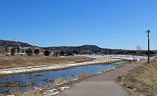
Fountain Creek is a creek that originates in Woodland Park in Teller County and flows through El Paso County to its confluence with the Arkansas River near Pueblo in Pueblo County, Colorado. The 74.5-mile-long (119.9 km) creek, once known as the Fontaine qui Bouille, is a tributary of the Arkansas River.
Colorado Springs geography describes geographical topics regarding the city of Colorado Springs, Colorado in El Paso County, Colorado. With 194.87 sq mi (504.7 km2) of land, it is the state's largest-sized city. Denver is the most populated city.

The Uncompahgre Ute or ꞌAkaꞌ-páa-gharʉrʉ Núuchi is a band of the Ute, a Native American tribe located in the US states of Colorado and Utah. In the Ute language, uncompahgre means "rocks that make water red." The band was formerly called the Tabeguache.

Palmer Park is a regional park in Colorado Springs, Colorado. Located at 3650 Maizeland Road, the park is several miles northeast of the downtown area. Elevation Outdoors Magazine named it Best Urban Park in its Best of Rockies 2017 list. One of Best of the Springs Expert Picks - Sports & Recreation by The Gazette, Seth Boster states that it may have the city's best views of Pikes Peak and a place "where an escape into deep nature is easy. It is strange and marvelous to look out at urban sprawl while perched on some high rock ledge, surrounded by rugged wilderness."

An extensive collection of parks and greenways exists in Huntsville, Alabama for the public's recreational use.
Templeton Gap is a gap between hills and bluffs located in northeastern Colorado Springs, El Paso County, Colorado. It was used by Native Americans to reach Ute Pass and was an area that oxen trains traveled to reach Colorado Springs. Templeton Ranch was operated by A.J. Templeton, for whom the feature is named.

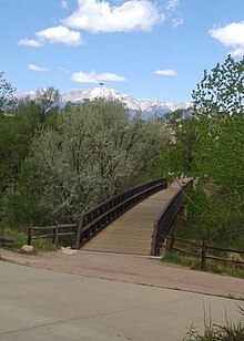
Monument Valley Park is a historic, recreational park in Colorado Springs, Colorado through which Monument Creek flows. It is a National Register of Historic Places listing and is on the Colorado State Register of Historic Properties.

Memorial Park or Memorial Community Park is a community park in Colorado Springs, Colorado. It has a wide range of sports facilities, including an indoor and outdoor pool, a recreation center, trails and Prospect Lake.

Bear Creek Cañon Park is a high-country park located in Colorado Springs, Colorado with steep trails for hiking, mountain biking and horseback riding.

Bear Creek Regional Park and Nature Center is a regional park located in Colorado Springs, Colorado that has trails for hiking, horseback riding, running and cycling. Within the park is a nature center and the El Paso Park Headquarters.

North Cheyenne Cañon Park or North Cheyenne Canyon Park is a regional park located in Colorado Springs, Colorado. It is a National Register of Historic Places listing.

There are a wide range of recreational areas and facilities in Colorado Springs, Colorado.

Edgerton is an extinct town at the confluence of Monument Creek and West Monument Creek eight miles north of present-day Colorado Springs in El Paso County, Colorado, United States. It was across from Black Forest. The Edgerton post office operated from June 16, 1870, until August 28, 1902.