
The Pennsylvania Turnpike is a toll highway operated by the Pennsylvania Turnpike Commission (PTC) in the U.S. state of Pennsylvania. A controlled-access highway, it runs for 360 miles (580 km) across the state. The turnpike's western terminus is at the Ohio state line in Lawrence County, where the road continues west as the Ohio Turnpike. The eastern terminus is at the New Jersey state line at the Delaware River–Turnpike Toll Bridge over the Delaware River in Bucks County, where the road continues east as the Pearl Harbor Memorial Extension of the New Jersey Turnpike.
Westmoreland County is a county in the Commonwealth of Pennsylvania, United States. As of the 2020 census, the population was 364,663. The county seat is Greensburg. Formed from, successively, Lancaster, Northumberland, and later Bedford counties, Westmoreland County was founded on February 26, 1773, and was the first county in the colony of Pennsylvania whose entire territorial boundary was located west of the Allegheny Mountains. Westmoreland County originally included the present-day counties of Fayette, Washington, Greene, and parts of Beaver, Allegheny, Indiana, and Armstrong counties. It is named after Westmorland, a historic county of England.

Rockwood is a borough in Somerset County, Pennsylvania, United States. The population was 850 at the 2020 census. It is part of the Johnstown, Pennsylvania, Metropolitan Statistical Area, and located due north of Pennsylvania's highest peak, Mount Davis, which significantly constricts land travel routing south of the municipality.

Stoystown is a borough in Somerset County, Pennsylvania, United States. It is part of the Johnstown, Pennsylvania, Metropolitan Statistical Area. The population was 300 at the 2020 census. Stoystown is located south-southeast of Johnstown and northeast of Somerset.

Youngstown is a borough in Westmoreland County, Pennsylvania, United States. Youngstown was incorporated on April 2, 1831. The population was 326 at the 2010 census. The borough has its own post office, with zip code 15696, established on April 1, 1813.

Interstate 76 (I-76) is an east–west Interstate Highway in the Eastern United States. The highway runs approximately 435 miles (700 km) from an interchange with I-71 west of Akron, Ohio, east to I-295 in Bellmawr, New Jersey. This route is not contiguous with I-76 in Colorado and Nebraska.

Interstate 283 (I-283) is an auxiliary route of the Interstate Highway System located just east of Harrisburg, Pennsylvania. It travels from the Harrisburg East interchange of I-76 north to I-83/U.S. Route 322 at the Eisenhower Interchange. Pennsylvania Route 283 continues southeast from near the southern terminus of I-283 to Lancaster as a freeway, functioning as an extension of the Interstate, though they are two separate roads.
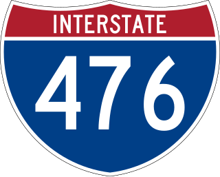
Interstate 476 (I-476) is a 132.1-mile (212.6 km) auxiliary Interstate Highway of I-76 in the U.S. state of Pennsylvania. The highway runs from I-95 near Chester north to I-81 near Scranton, serving as the primary north–south Interstate corridor through eastern Pennsylvania. It consists of both the 20-mile (32 km) Mid-County Expressway, locally referred to as the "Blue Route", through Delaware and Montgomery counties in the suburban Philadelphia area, and the tolled, 110.6-mile (178.0 km) Northeast Extension of the Pennsylvania Turnpike, which connects the Delaware Valley with the Lehigh Valley, the Pocono Mountains, and the Wyoming Valley to the north.

Breezewood is an unincorporated town in East Providence Township, Bedford County in south-central Pennsylvania, United States.

The Pennsylvania Turnpike Commission (PTC) is an agency created in 1937 to construct, finance, operate, and maintain the Pennsylvania Turnpike. The commission consists of five members. Four members are appointed by the Governor of Pennsylvania, while the fifth member is the Pennsylvania Secretary of Transportation.

Interstate 80 (I-80) in the US state of Pennsylvania runs for 311.12 miles (500.70 km) across the northern part of the state. It is designated as the Keystone Shortway and officially as the Z.H. Confair Memorial Highway. This route was built mainly along a completely new alignment, not paralleling any earlier US Routes, as a shortcut to the tolled Pennsylvania Turnpike to the south and New York State Thruway to the north. It does not serve any major cities in Pennsylvania and is mainly as a cross-state route on the Ohio–New York City corridor. Most of I-80's path across the state goes through hilly and mountainous terrain, while the route passes through relatively flat areas toward the western part of the state.

U.S. Route 30 (US 30) runs east–west across the southern part of Pennsylvania, passing through Pittsburgh and Philadelphia on its way from the West Virginia state line east to the Benjamin Franklin Bridge over the Delaware River into New Jersey. In Pennsylvania, US 30 runs along or near the transcontinental Lincoln Highway, an auto trail which ran from San Francisco, California, to New York City before the U.S. Routes were designated. However, the Lincoln Highway turned northeast at Philadelphia, using present US 1 and its former alignments to cross the Delaware River into Trenton, New Jersey.
The Mon–Fayette Expressway is a partially-completed tolled freeway that is planned to eventually link Interstate 68 near Morgantown, West Virginia with Interstate 376 near Monroeville, Pennsylvania. The ultimate goal of the highway is to provide a high speed north–south connection between Morgantown and the eastern side of Pittsburgh while revitalizing economically distressed Monongahela River Valley towns in Fayette and Washington counties, serving as an alternative to Interstate 79 to the west, as well as relieving the PA 51 alignment from Pittsburgh to Uniontown.

Interstate 70 (I-70) in the US state of Pennsylvania runs east–west across the southwest part of the state serving the southern fringe of the Pittsburgh metropolitan area. About half of the route is concurrent with I-76 on the Pennsylvania Turnpike, which is a toll road. This is the oldest segment of I-70 in Pennsylvania, having been completed in 1940, and is only one of two segments of I-70 that are tolled, with the other being the Kansas Turnpike. I-70 is one of only a few Interstate Highways to have a traffic signal—in this case, with U.S. Route 30 (US 30) in Breezewood, where it leaves the Pennsylvania Turnpike and heads toward Maryland.

Pennsylvania Route 66 (PA 66) is a 139.7-mile-long (224.8 km) state highway in Western Pennsylvania. Its southern terminus is at U.S. Route 119 just east of Interstate 70 (I-70) near New Stanton. Its northern terminus is at US 6 in Kane.

Pennsylvania Route 31 is a 74-mile-long (119 km) state highway located in Western Pennsylvania, paralleling U.S. Route 30 and the Pennsylvania Turnpike for most of its length. The designation begins at PA 136 near West Newton and ends at US 30 near Bedford.

Interstate 81 (I-81) is a north–south Interstate Highway, stretching from Dandridge, Tennessee, northeast to Fisher's Landing, New York, at the Canada–United States border. In Pennsylvania, I-81 runs for 232.76 miles (374.59 km) from the Maryland state line near Greencastle northeast to the New York state line near Hallstead and is called the American Legion Memorial Highway. It is the longest north–south Interstate in Pennsylvania.

Pennsylvania Route 130 (PA 130) is a 49-mile-long (79 km) state highway located in Allegheny and Westmoreland counties in Pennsylvania. The western terminus is at PA 8 in Pittsburgh, and the eastern terminus is at PA 381 near Kregar.

Pennsylvania Route 281 is a 45.8-mile-long (73.7 km) state highway located in Fayette and Somerset counties in Pennsylvania. The southern terminus is the West Virginia state line near Markleysburg, where the road becomes West Virginia Route 26. The northern terminus is at U.S. Route 30 in Stoystown.

Chambersburg and Bedford Turnpike Road Company Toll House is a historic toll house located at St. Thomas Township in Franklin County, Pennsylvania. It was built about 1818, and is a two-story, three-bay wide, limestone building. It was owned by the Chambersburg and Bedford Turnpike Road Company until, when it was sold for $60.00.