Stoystown, Pennsylvania

Last updated
Stoystown, Pennsylvania
Borough
MemorialDay2013 080.JPG
Memorial Day parade
Somerset County Pennsylvania Incorporated and Unincorporated areas Stoystown Highlighted.svg
Location of Stoystown in Somerset County, Pennsylvania.
USA Pennsylvania location map.svg
Red pog.svg
Coordinates: 40°06′10″N78°57′14″W / 40.10278°N 78.95389°W / 40.10278; -78.95389
Country United States
State Pennsylvania
County Somerset
Settled1774
IncorporatedMarch 29, 1819
Government
  TypeBorough Council
Area
[1]
  Total0.19 sq mi (0.49 km2)
  Land0.19 sq mi (0.49 km2)
  Water0.00 sq mi (0.00 km2)
Population
 (2020) [2]
  Total300
  Density1,578.95/sq mi (609.08/km2)
Time zone UTC-5 (Eastern (EST))
  Summer (DST) UTC-4 (EDT)
Zip code
15563
Area code 814
FIPS code 42-74672

Stoystown is a borough in Somerset County, Pennsylvania, United States. It is part of the Johnstown, Pennsylvania, Metropolitan Statistical Area. The population was 300 at the 2020 census. [3] Stoystown is located south-southeast of Johnstown and northeast of Somerset.

Contents

History

Stoystown, Somerset County, Pennsylvania, 1860 Map of Stoystown, Somerset County, Pennsylvania, from 1860 Somerset County Map by Edward L Walker.jpg
Stoystown, Somerset County, Pennsylvania, 1860

The site of the Stony Creek Encampment is near the eastern end of Stoystown, slightly north of U.S. Route 30. [4] This small supply depot was located along Forbes Road during the French & Indian War. [4]

Daniel Stoy was one of the first settlers west of the mountains. From the records of Harmon Husband, we find that Stoy lived along the Forbes Road about 1762 near the Casper Stotler place in Shade Township, that he made his living by hunting, and that he was driven from his cabin home several times by the Indians, taking refuge at Fort Bedford. The records of Husband state that on one occasion Stoy shot an Indian intruder from his cabin door. With the construction of the Pennsylvania Road, Stoy decided to move to a place about ten miles farther west along the road where he received a warrant for more than three hundred acres of land. Here on this tract of land along the Pennsylvania Road, he founded the town of Stoystown in 1774. Stoy served as a volunteer in the Revolutionary War with the rank of corporal. It is thought that he also served in the French and Indian War, although the records are rather vague. Henry was born in 1747. Married Sally Stoy, daughter of Daniel M. Stoy, who sold lots and laid out the town of Stoystown about 1800, one of the oldest towns in Somerset Co., Pennsylvania. Daniel M. Stoy served as captain in Gen. George Washington's army for 12 months. He was discharged at Long Island, New York, July 1778. Later he moved to what is now Somerset Co., Pennsylvania. He was a justice of the peace. He served in the General Assembly in 1809–10 and 1813. He died 1834. D.A.R. marker on grave. Daniel Stoy, born in England, May 3, 1738, died January 11, 1835, in Stoystown, Somerset Co., Pennsylvania. He was married about 1759 to Sarah Higgins of Scotland (April 4, 1737 – October 31, 1818. Soon after their marriage they came to America and located at Conchohockin, Pennsylvania, where their six children were born, viz., (1) Sarah (Sally), the oldest daughter, married Henry Beaver; (2)Daniel married a Miss Shedrick; (3)Ned never married; (4) John married Elizabeth Pisel; (5) William; (6) Margaret, the youngest child (Conchohockin, October 15, 1780 – December 6, 1868). She was 7 years old when her parents moved to what was then Bedford Co., now Somerset Co., Pennsylvania. She married Abraham Spangler and they had 14 children. Henry Beaver moved his family from Stoystown, Pennsylvania, to Greensburg, Westmoreland Co., Pennsylvania. They had one son that we know of, John F. Beaver, who read law at Greensburg, Pennsylvania. The Stoystown Historic District and Hite House are listed on the National Register of Historic Places. [5]

September 11 attacks

On September 11, 2001, United Airlines Flight 93 crashed in nearby Stonycreek Township. The Flight 93 National Memorial is located in Stoystown. [6]

Geography

Stoystown is located at 40°6′10″N78°57′14″W / 40.10278°N 78.95389°W / 40.10278; -78.95389 (40.102753, -78.953869). [7] The borough is surrounded by Quemahoning Township.

According to the United States Census Bureau, the borough has a total area of 0.2 square miles (0.52 km2), all land.

Demographics

Historical population
CensusPop.Note
1820 204
1840 357
1850 321−10.1%
1860 316−1.6%
1870 288−8.9%
1880 31910.8%
1890 291−8.8%
1900 3065.2%
1910 35516.0%
1920 342−3.7%
1930 44730.7%
1940 4613.1%
1950 51712.1%
1960 360−30.4%
1970 44623.9%
1980 432−3.1%
1990 389−10.0%
2000 42810.0%
2010 355−17.1%
2020 300−15.5%
2021 (est.)298 [3] −0.7%
U.S. Decennial Census [8]

As of the census [9] of 2000, there were 428 people, 184 households, and 117 families residing in the borough. The population density was 2,267.5 inhabitants per square mile (875.5/km2). There were 201 housing units at an average density of 1,064.9 per square mile (411.2/km2). The racial makeup of the borough was 99.77% White and 0.23% Native American. Hispanic or Latino of any race were 0.23% of the population.

There were 184 households, out of which 26.1% had children under the age of 18 living with them, 53.3% were married couples living together, 7.6% had a female householder with no husband present, and 36.4% were non-families. 33.7% of all households were made up of individuals, and 21.7% had someone living alone who was 65 years of age or older. The average household size was 2.33 and the average family size was 2.99.

In the borough the population was spread out, with 22.0% under the age of 18, 6.5% from 18 to 24, 24.5% from 25 to 44, 21.7% from 45 to 64, and 25.2% who were 65 years of age or older. The median age was 43 years. For every 100 females there were 82.9 males. For every 100 females age 18 and over, there were 85.6 males.

The median income for a household in the borough was $30,313, and the median income for a family was $36,250. Males had a median income of $27,361 versus $21,667 for females. The per capita income for the borough was $14,629. About 11.7% of families and 17.3% of the population were below the poverty line, including 20.8% of those under age 18 and 16.5% of those age 65 or over.

Transportation

Stoystown is accessed and bypassed by U.S. 30 (Lincoln Highway), and Route 281.

Related Research Articles

<span class="mw-page-title-main">Brownstown, Cambria County, Pennsylvania</span> Borough in Pennsylvania, United States

Brownstown is a borough in Cambria County, Pennsylvania, United States. The population was 744 at the 2010 census. It is part of the Johnstown, Pennsylvania Metropolitan Statistical Area and also part of Johnstown's urban area.

<span class="mw-page-title-main">Ferndale, Pennsylvania</span> Borough in Pennsylvania, United States

Ferndale is a borough in Cambria County, Pennsylvania, United States. It is part of the Johnstown, Pennsylvania Metropolitan Statistical Area. The population was 1,636 at the 2010 census, down from 1,834 at the 2000 census.

<span class="mw-page-title-main">Geistown, Pennsylvania</span> Borough in Pennsylvania, United States

Geistown is a borough in Cambria County, Pennsylvania, United States. It is part of the Johnstown, Pennsylvania Metropolitan Statistical Area. The population was 2,467 at the 2010 census.

<span class="mw-page-title-main">Loretto, Pennsylvania</span> Borough in Pennsylvania, United States

Loretto is a borough in Cambria County, Pennsylvania, United States. As of the 2010 census it had a population of 1,302. Like the rest of Cambria County, it is part of the Johnstown, Pennsylvania Metropolitan Statistical Area. Loretto is the home of Saint Francis University.

<span class="mw-page-title-main">Richland Township, Cambria County, Pennsylvania</span> Township in Pennsylvania, United States

Richland Township is a township in Cambria County, Pennsylvania, United States. The population was 12,814 at the 2010 census. It is part of the Johnstown, Pennsylvania Metropolitan Statistical Area.

<span class="mw-page-title-main">Scalp Level, Pennsylvania</span> Borough in Pennsylvania, United States

Scalp Level is a borough in Cambria County, Pennsylvania, United States. It is part of the Johnstown, Pennsylvania Metropolitan Statistical Area. The population was 778 at the 2010 census.

<span class="mw-page-title-main">Stonycreek Township, Cambria County, Pennsylvania</span> Township in Pennsylvania, United States

Stonycreek Township is a township in Cambria County, Pennsylvania, United States. The population was 2,844 at the 2010 census, down from 3,204 at the 2000 census. It is part of the Johnstown, Pennsylvania Metropolitan Statistical Area.

<span class="mw-page-title-main">Addison Township, Pennsylvania</span> Township in Pennsylvania, United States

Addison Township is a township in Somerset County, Pennsylvania, United States. The population was 932 at the 2020 census. It is part of the Johnstown, Pennsylvania, Metropolitan Statistical Area. The township is named for Alexander Addison, the first president judge overseeing Somerset County.

<span class="mw-page-title-main">Hollsopple, Pennsylvania</span> Borough in Pennsylvania, United States

Benson is a borough in Somerset County, Pennsylvania, United States. The town is more commonly known to locals as Hollsopple, which is also the United States Postal Service name for the town, zip code 15935. The population was 185 at the 2020 census. It is part of the Johnstown, Pennsylvania Metropolitan Statistical Area. Benson is served by the Conemaugh Township Area School District.

<span class="mw-page-title-main">Berlin, Pennsylvania</span> Borough in Pennsylvania, United States

Berlin is a borough located approximately 75 miles southeast of Pittsburgh in Somerset County, Pennsylvania, United States. The population was 2,004 at the 2020 census. It is part of the Johnstown, Pennsylvania Metropolitan Statistical Area.

<span class="mw-page-title-main">Callimont, Pennsylvania</span> Borough in Pennsylvania, United States

Callimont is a borough in Somerset County, Pennsylvania, United States. The population was 53 at the 2020 census. It is part of the Johnstown, Pennsylvania, Metropolitan Statistical Area.

<span class="mw-page-title-main">Casselman, Pennsylvania</span> Borough in Pennsylvania, United States

Casselman is a borough in Somerset County, Pennsylvania, United States.

<span class="mw-page-title-main">Central City, Pennsylvania</span> Borough in Pennsylvania, United States

Central City is a borough in Somerset County, Pennsylvania, United States. The population was 998 at the 2020 census. It is part of the Johnstown, Pennsylvania, Metropolitan Statistical Area. It is east-northeast of Stoystown and northeast of Somerset.

<span class="mw-page-title-main">Hooversville, Pennsylvania</span> Borough in Pennsylvania, United States

Hooversville is a borough in Somerset County, Pennsylvania, United States. It is part of the Johnstown, Pennsylvania, Metropolitan Statistical Area. The population was 626 at the 2020 census.

<span class="mw-page-title-main">Jennerstown, Pennsylvania</span> Borough in Pennsylvania, United States

Jennerstown is a borough in Somerset County, Pennsylvania, United States. It is part of the Johnstown, Pennsylvania Metropolitan Statistical Area. The population was 679 at the 2020 census. The borough is the home of Jennerstown Speedway. The town was named for Edward Jenner.

<span class="mw-page-title-main">Larimer Township, Pennsylvania</span> Township in Pennsylvania, United States

Larimer Township is a township in Somerset County, Pennsylvania, United States. The population was 543 at the 2020 census. It is part of the Johnstown, Pennsylvania, Metropolitan Statistical Area. Larimer Township was named for General William Larimer, Jr., president of the Pittsburgh & Connellsville Railroad.

<span class="mw-page-title-main">Milford Township, Somerset County, Pennsylvania</span> Township in Pennsylvania, United States

Milford Township is a township in Somerset County, Pennsylvania, United States. The population was 1,488 at the 2020 census. It is part of the Johnstown, Pennsylvania, Metropolitan Statistical Area.

<span class="mw-page-title-main">Paint Township, Somerset County, Pennsylvania</span> Township in Pennsylvania, United States

Paint Township is a township in Somerset County, Pennsylvania, United States. The population was 3,038 at the 2020 census. It is part of the Johnstown, Pennsylvania, Metropolitan Statistical Area.

<span class="mw-page-title-main">Somerset, Pennsylvania</span> Borough in Pennsylvania, United States

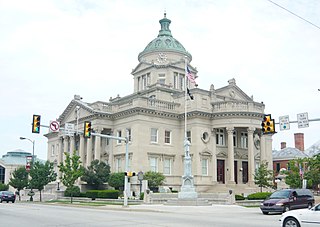
Somerset is a borough in and the county seat of Somerset County, Pennsylvania, United States. The population was 6,046 at the 2020 census. The borough is surrounded by Somerset Township and is located off of the Pennsylvania Turnpike. Somerset is the principal city of the Somerset micropolitan statistical area, which consists of Somerset County, and is also a principal city of the larger Johnstown-Somerset combined statistical area.

<span class="mw-page-title-main">Youngstown, Pennsylvania</span> Borough in Pennsylvania, United States

Youngstown is a borough in Westmoreland County, Pennsylvania, United States. Youngstown was incorporated on April 2, 1831. The population was 326 at the 2010 census. The borough has its own post office, with zip code 15696, established on April 1, 1813.

References

  1. "ArcGIS REST Services Directory". United States Census Bureau. Retrieved October 16, 2022.
  2. "Census Population API". United States Census Bureau. Retrieved Oct 12, 2022.
  3. 1 2 Bureau, US Census. "City and Town Population Totals: 2020—2021". Census.gov. US Census Bureau. Retrieved July 25, 2022.
  4. 1 2 "Pennsylvania Historical Marker Search". Pennsylvania Historical & Museum Commission. Retrieved June 10, 2020.
  5. "National Register Information System". National Register of Historic Places . National Park Service. July 9, 2010.
  6. "Directions". National Park Service. Retrieved 8 May 2017.
  7. "US Gazetteer files: 2010, 2000, and 1990". United States Census Bureau. 2011-02-12. Retrieved 2011-04-23.
  8. "Census of Population and Housing". Census.gov. Retrieved June 4, 2016.
  9. "U.S. Census website". United States Census Bureau . Retrieved 2008-01-31.