Quemahoning Township, Pennsylvania

Last updated
Quemahoning Township,
Somerset County, Pennsylvania
Trostletown Bridge.JPG
Map of Somerset County, Pennsylvania highlighting Quemahoning Township.PNG
Map of Somerset County, Pennsylvania Highlighting Quemahoning Township
Map of Pennsylvania highlighting Somerset County.svg
Map of Somerset County, Pennsylvania
Country United States
State Pennsylvania
County Somerset
Area
[1]
  Total35.75 sq mi (92.59 km2)
  Land35.10 sq mi (90.90 km2)
  Water0.65 sq mi (1.69 km2)
Population
 (2020) [2]
  Total1,838 Decrease2.svg
  Estimate 
(2021) [2]
1,826
  Density55.53/sq mi (21.44/km2)
Time zone UTC-5 (Eastern (EST))
  Summer (DST) UTC-4 (EDT)
FIPS code 42-111-63144

Quemahoning Township is a township in Somerset County, Pennsylvania, United States. The population was 1,838 at the 2020 census. [2] It is part of the Johnstown, Pennsylvania, Metropolitan Statistical Area.

Contents

History

Quemahoning Township, Somerset County, Pennsylvania, 1860 Map of Quemahoning Township, Pennsylvania, from 1860 Somerset County Map by Edward L Walker.jpg
Quemahoning Township, Somerset County, Pennsylvania, 1860

In 1775, Quemahoning Township was organized, by the Bedford County Court, out of part of Brothersvalley and Turkeyfoot townships. At that time, it included the northern portion of present-day Somerset County and part of what is now Cambria County. Its size was later reduced through the formation of new townships. When Somerset County was established in 1795 Quemahoning was one of the six original townships. The name is a Native American name meaning "pine tree lick," [3] with "cuuni" indicating a pine grove and "mahoni" meaning water from a lick. [4]

The Trostletown Bridge was added to the National Register of Historic Places in 1980. [5]

Geography

According to the United States Census Bureau, the township has a total area of 36.2 square miles (93.7 km2), of which 35.6 square miles (92.1 km2) is land and 0.6 square miles (1.6 km2) (1.74%) is water.

It is bordered on the west by Jenner Township, on the north by Conemaugh Township and Paint Township, on the east by Shade Township, and on the south by Stonycreek Township and Somerset Township. Quemahoning Township's eastern border is formed by the Stonycreek River and the north-western border by Quemahoning Creek, from which the township got its name; "Quemahoning" is an Indian word meaning "water issuing from a lick." Quemahoning Township surrounds the borough of Stoystown, and the borough of Hooversville sits on the eastern edge of Quemahoning Township, along its border with Shade Township.

Demographics

Historical population
CensusPop.Note
2010 2,025
2020 1,838−9.2%
2021 (est.)1,826 [2] −0.7%
U.S. Decennial Census [6]

As of the census [7] of 2000, there were 2,180 people, 827 households, and 627 families residing in the township. The population density was 61.3 inhabitants per square mile (23.7/km2). There were 897 housing units at an average density of 25.2/sq mi (9.7/km2). The racial makeup of the township was 99.54% White, 0.05% African American, 0.09% Native American, 0.05% Asian, 0.05% from other races, and 0.23% from two or more races. Hispanic or Latino of any race were 0.37% of the population.

There were 827 households, out of which 31.8% had children under the age of 18 living with them, 63.4% were married couples living together, 8.1% had a female householder with no husband present, and 24.1% were non-families. 21.5% of all households were made up of individuals, and 10.2% had someone living alone who was 65 years of age or older. The average household size was 2.64 and the average family size was 3.06.

In the township the population was spread out, with 25.5% under the age of 18, 7.9% from 18 to 24, 27.3% from 25 to 44, 26.0% from 45 to 64, and 13.3% who were 65 years of age or older. The median age was 38 years. For every 100 females there were 99.6 males. For every 100 females age 18 and over, there were 96.8 males.

The median income for a household in the township was $32,134, and the median income for a family was $37,500. Males had a median income of $27,000 versus $20,096 for females. The per capita income for the township was $14,002. About 9.1% of families and 12.5% of the population were below the poverty line, including 16.3% of those under age 18 and 10.1% of those age 65 or over.

See also

Related Research Articles

<span class="mw-page-title-main">Belmont, Pennsylvania</span> Census-designated place in Pennsylvania, United States

Belmont is an unincorporated community and census-designated place (CDP) in Cambria County, Pennsylvania, United States. The population was 2,784 at the 2010 census.

<span class="mw-page-title-main">Richland Township, Cambria County, Pennsylvania</span> Township in Pennsylvania, United States

Richland Township is a township in Cambria County, Pennsylvania, United States. The population was 12,814 at the 2010 census. It is part of the Johnstown, Pennsylvania Metropolitan Statistical Area.

<span class="mw-page-title-main">Stonycreek Township, Cambria County, Pennsylvania</span> Township in Pennsylvania, United States

Stonycreek Township is a township in Cambria County, Pennsylvania, United States. The population was 2,844 at the 2010 census, down from 3,204 at the 2000 census. It is part of the Johnstown, Pennsylvania Metropolitan Statistical Area.

<span class="mw-page-title-main">Henry Clay Township, Fayette County, Pennsylvania</span> Township in Pennsylvania, United States

Henry Clay Township is a township in Fayette County, Pennsylvania, United States. The population was 1,765 at the 2020 census. The township was created June 9, 1824, from the eastern portion of Wharton Township. It is named for 19th-century American statesman Henry Clay. The northwestern corner of its territory was used to create Stewart Township on November 17, 1855. It is served by the Uniontown Area School District.

<span class="mw-page-title-main">Addison Township, Somerset County, Pennsylvania</span> Township in Pennsylvania, United States

Addison Township is a township in Somerset County, Pennsylvania, United States. The population was 928 at the 2020 census. It is part of the Johnstown, Pennsylvania, Metropolitan Statistical Area. The township is named for Alexander Addison, the first president judge overseeing Somerset County.

<span class="mw-page-title-main">Allegheny Township, Somerset County, Pennsylvania</span> Township in Pennsylvania, United States

Allegheny Township is a township in Somerset County, Pennsylvania, United States. The population was 613 at the 2020 census. It is part of the Johnstown, Pennsylvania, Metropolitan Statistical Area.

<span class="mw-page-title-main">Black Township, Somerset County, Pennsylvania</span> Township in Pennsylvania, United States

Black Township is a township in Somerset County, Pennsylvania, United States. The population was 899 at the 2020 census. It is part of the Johnstown, Pennsylvania, Metropolitan Statistical Area. The township was named for Jeremiah Sullivan Black, a native of Somerset County who became Chief Justice of the Supreme Court of Pennsylvania, U.S. Attorney General, and U.S Secretary of State.

<span class="mw-page-title-main">Boswell, Pennsylvania</span> Borough in Pennsylvania, United States

Boswell is a borough in Somerset County, Pennsylvania, United States. It is part of the Johnstown, Pennsylvania Metropolitan Statistical Area. The population was 1,221 at the 2020 census.

<span class="mw-page-title-main">Brothersvalley Township, Somerset County, Pennsylvania</span> Township in Pennsylvania, United States

Brothersvalley Township is a township in Somerset County, Pennsylvania, United States. The population was 2,374 at the 2020 census. It is part of the Johnstown, Pennsylvania, Metropolitan Statistical Area.

<span class="mw-page-title-main">Conemaugh Township, Somerset County, Pennsylvania</span> Township in Pennsylvania, United States

Conemaugh Township is a township in Somerset County, Pennsylvania, United States. The population was 6,753 at the 2020 census. It is part of the Johnstown, Pennsylvania, Metropolitan Statistical Area. Conemaugh Township includes the towns of Jerome, Davidsville, Tire Hill, Thomas Mills, part of Holsopple, and surrounding countryside.

<span class="mw-page-title-main">Elk Lick Township, Somerset County, Pennsylvania</span> Township in Pennsylvania, United States

Elk Lick Township is a township in Somerset County, Pennsylvania, United States. The population was 2,257 at the 2020 census. Mount Davis, the highest point in Pennsylvania, is located within the township.

<span class="mw-page-title-main">Greenville Township, Somerset County, Pennsylvania</span> Township in Pennsylvania, United States

Greenville Township is a township in Somerset County, Pennsylvania, United States. The population was 752 at the 2020 census. It is part of the Johnstown, Pennsylvania, Metropolitan Statistical Area.

<span class="mw-page-title-main">Jenner Township, Somerset County, Pennsylvania</span> Township in Pennsylvania, United States

Jenner Township is a township in Somerset County, Pennsylvania, United States. The population was 3,703 at the 2020 census. It is part of the Johnstown, Pennsylvania, Metropolitan Statistical Area.

<span class="mw-page-title-main">Lincoln Township, Somerset County, Pennsylvania</span> Township in Pennsylvania, United States

Lincoln Township is a township in Somerset County, Pennsylvania, United States. The population was 1,456 at the 2020 census. It is part of the Johnstown, Pennsylvania, Metropolitan Statistical Area.

<span class="mw-page-title-main">Shade Township, Pennsylvania</span> Township in Pennsylvania, United States

Shade Township is a township in Somerset County, Pennsylvania, United States. The population was 2,452 at the 2020 census. It is part of the Johnstown, Pennsylvania, Metropolitan Statistical Area.

<span class="mw-page-title-main">Somerset Township, Somerset County, Pennsylvania</span> Township in Pennsylvania, United States

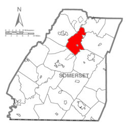
Somerset Township is a township in Somerset County, Pennsylvania, United States. The population was 12,165 at the 2020 census. It is part of the Johnstown, Pennsylvania, Metropolitan Statistical Area and encompasses the census-designated place (CDP) of Friedens.

<span class="mw-page-title-main">Stonycreek Township, Somerset County, Pennsylvania</span> Township in Pennsylvania, United States

Stonycreek Township is a township in Somerset County, Pennsylvania, United States. The township takes its name from the stony creek, which flows through it and represents its western boundary. The stream takes its name from the rocky bed over which it flows for a great part of its course. Its Indian name was Sinne-Hanne or Achsin-Hanne. Hanne means a stream and especially a swift mountain stream. The population was 2,089 at the 2020 census. It is part of the Johnstown, Pennsylvania, metropolitan statistical area.

<span class="mw-page-title-main">Summit Township, Somerset County, Pennsylvania</span> Township in Pennsylvania, United States

Summit Township is a township in Somerset County, Pennsylvania, United States. The population was 2,141 at the 2020 census. It is part of the Johnstown, Pennsylvania, Metropolitan Statistical Area.

<span class="mw-page-title-main">Upper Turkeyfoot Township, Pennsylvania</span> Township in Pennsylvania, United States

Upper Turkeyfoot Township is a township in Somerset County, Pennsylvania, United States. The population was 1,063 at the 2020 census. It is part of the Johnstown, Pennsylvania, Metropolitan Statistical Area.

<span class="mw-page-title-main">Union Township, Tioga County, Pennsylvania</span> Township in Pennsylvania, United States

Union Township is a township in Tioga County, Pennsylvania, United States. The population was 947 at the 2020 census.

References

  1. "2016 U.S. Gazetteer Files". United States Census Bureau. Retrieved Aug 14, 2017.
  2. 1 2 3 4 Bureau, US Census. "City and Town Population Totals: 2020—2021". Census.gov. US Census Bureau. Retrieved July 24, 2022.
  3. Espenshade, A. Howry (1925). Pennsylvania Place Names. State College, PA: Pennsylvania State College. p. 335.
  4. History of Bedford, Somerset and Fulton Counties, Pennsylvania. Chicago: Waterman, Watkins & Co. 1884. p. 494.
  5. "National Register Information System". National Register of Historic Places . National Park Service. July 9, 2010.
  6. "Census of Population and Housing". Census.gov. Retrieved June 4, 2016.
  7. "U.S. Census website". United States Census Bureau . Retrieved 2008-01-31.

40°06′00″N79°00′29″W / 40.10000°N 79.00806°W / 40.10000; -79.00806