Friedens, Pennsylvania

Last updated

Friedens
CDP
Flag of Friedens, Pennsylvania.png
USA Pennsylvania location map.svg
Red pog.svg
Friedens
Location within the U.S. state of Pennsylvania
Coordinates: 40°3′4″N78°59′44″W / 40.05111°N 78.99556°W / 40.05111; -78.99556
Country United States
State Pennsylvania
County Somerset
Area
[1]
  Total3.15 sq mi (8.15 km2)
  Land3.15 sq mi (8.15 km2)
  Water0.00 sq mi (0.00 km2)
Population
 (2020) [2]
  Total1,504
  Density478.22/sq mi (184.63/km2)
Time zone UTC-5 (Eastern (EST))
  Summer (DST) UTC-4 (EDT)
ZIP code
15541 [3]
Area code 814
FIPS code 42-27928

Friedens is a census-designated place (CDP) that is part of Somerset Township in Somerset County, Pennsylvania, United States. The population was 1,523 at the 2010 census. [4] It is part of the Johnstown, Pennsylvania Metropolitan Statistical Area.

Contents

Location

Friedens is located west of Indian Lake and Shanksville and east of Somerset and has access to US 219.

Sites

Friedens is within driving distance of the following attractions:

Geography

Friedens is located at 40°3′4″N78°59′44″W / 40.05111°N 78.99556°W / 40.05111; -78.99556 (40.051182, -78.995474). [5] According to the United States Census Bureau, the CDP has a total area of 3.1 square miles (8.0 km2), all land.

Like most of the Somerset County area, Friedens contains and is surrounded mostly by farmland, including many family-operated farms.

Demographics

Historical population
CensusPop.Note
2020 1,504
U.S. Decennial Census [6]

As of the census [7] of 2000, there were 1,673 people, 636 households, and 485 families residing in the CDP. The population density was 533.1 inhabitants per square mile (205.8/km2). There were 682 housing units at an average density of 217.3 per square mile (83.9/km2). The racial makeup of the CDP was 99.34% White, 0.06% African American, 0.12% Native American, 0.18% Asian, 0.06% from other races, and 0.24% from two or more races. Hispanic or Latino of any race were 0.18% of the population.

There were 636 households, out of which 37.3% had children under the age of 18 living with them, 64.9% were married couples living together, 6.6% had a female householder with no husband present, and 23.6% were non-families. 20.6% of all households were made up of individuals, and 9.9% had someone living alone who was 65 years of age or older. The average household size was 2.61 and the average family size was 3.00.

In the CDP, the population was spread out, with 27.0% under the age of 18, 7.8% from 18 to 24, 30.5% from 25 to 44, 21.4% from 45 to 64, and 13.3% who were 65 years of age or older. The median age was 35 years. For every 100 females, there were 99.2 males. For every 100 females age 18 and over, there were 92.9 males.

The median income for a household in the CDP was $36,117, and the median income for a family was $37,232. Males had a median income of $26,576 versus $20,288 for females. The per capita income for the CDP was $16,571. About 8.2% of families and 8.3% of the population were below the poverty line, including 5.8% of those under age 18 and 12.3% of those age 65 or over.

Related Research Articles

<span class="mw-page-title-main">Tipton, Pennsylvania</span> Census-designated place in Pennsylvania, United States

Tipton is a census-designated place (CDP) in Antis Township, Blair County, Pennsylvania, United States. The population was 1,083 at the 2010 census. It was a stop on the former Pennsylvania Railroad Main Line between Tyrone and Altoona.

<span class="mw-page-title-main">Nixon, Pennsylvania</span> Census-designated place in Pennsylvania, United States

Nixon is a census-designated place (CDP) in Penn Township, Butler County, Pennsylvania, United States. The population was 1,373 at the 2010 census.

<span class="mw-page-title-main">Beaverdale, Pennsylvania</span> Census-designated place in Pennsylvania, United States

Beaverdale is an unincorporated community and census-designated place (CDP) in Cambria County, Pennsylvania, United States. The population was 1,035 at the 2010 census. Prior to that time, the CDP was known as Beaverdale-Lloydell.

<span class="mw-page-title-main">Belmont, Pennsylvania</span> Census-designated place in Pennsylvania, United States

Belmont is an unincorporated community and census-designated place (CDP) in Cambria County, Pennsylvania, United States. The population was 2,784 at the 2010 census.

<span class="mw-page-title-main">Colver, Pennsylvania</span> Census-designated place in Pennsylvania, United States

Colver is an unincorporated community and census-designated place (CDP) in Cambria County, Pennsylvania, United States. The population was 959 at the 2010 census.

<span class="mw-page-title-main">Elim, Pennsylvania</span> Census-designated place in Pennsylvania, United States

Elim is an unincorporated community and census-designated place (CDP) in Upper Yoder Township, Cambria County, Pennsylvania, United States. The population was 3,727 at the 2010 census, down from 4,175 at the 2000 census.

<span class="mw-page-title-main">Salix, Pennsylvania</span> Census-designated place in Pennsylvania, United States

Salix is an unincorporated community and census-designated place (CDP) in Cambria County, Pennsylvania, United States. The population was 1,149 at the 2010 census. In previous censuses it was listed as Salix-Beauty Line Park.

<span class="mw-page-title-main">Spring Hill, Pennsylvania</span>

Spring Hill is a census-designated place (CDP) in Cambria County, Pennsylvania, United States. The population was 839 at the 2010 census, down from 970 at the 2000 census.

<span class="mw-page-title-main">Vinco, Pennsylvania</span> Census-designated place in Pennsylvania, United States

Vinco is an unincorporated community and census-designated place (CDP) in Jackson Township, Cambria County, in the U.S. state of Pennsylvania. The population was 1,305 at the 2010 census.

<span class="mw-page-title-main">Pine Glen, Pennsylvania</span> Census-designated place in Pennsylvania, United States

Pine Glen is an unincorporated community and census-designated place (CDP) in Centre County, Pennsylvania, United States. It is part of the State College, Pennsylvania Metropolitan Statistical Area. It is part of Burnside Township. The population was 190 at the 2010 census.

<span class="mw-page-title-main">Port Matilda, Pennsylvania</span> Borough in Pennsylvania, United States

Port Matilda is a borough in Centre County, Pennsylvania. It is part of the State College, Pennsylvania metropolitan statistical area and is located approximately halfway between State College and Altoona. The population was 606 at the 2010 census.

<span class="mw-page-title-main">South Philipsburg, Pennsylvania</span> Place in Pennsylvania, United States

South Philipsburg is a census-designated place (CDP), formerly a borough, located in Centre County, Pennsylvania, United States. It is part of the State College, Pennsylvania Metropolitan Statistical Area. The population was 410 at the 2010 census. As of January 1, 2007, the borough government was dissolved and the area reverted to Rush Township.

<span class="mw-page-title-main">Hyde, Pennsylvania</span> Census-designated place in Pennsylvania, United States

Hyde is an unincorporated community and census-designated place (CDP) in Clearfield County, Pennsylvania, United States. The population was 1,303 at the 2020 census.

<span class="mw-page-title-main">Plymptonville, Pennsylvania</span> Census-designated place in Pennsylvania, United States

Plymptonville is a census-designated place (CDP) in Clearfield County, Pennsylvania, United States. The population was 972 at the 2020 census.

<span class="mw-page-title-main">Sandy, Pennsylvania</span> Census-designated place in Pennsylvania, United States

Sandy is a census-designated place (CDP) in Clearfield County, Pennsylvania, United States. The population was 1,362 at the 2020 census.

<span class="mw-page-title-main">Avonia, Pennsylvania</span> Census-designated place in Pennsylvania, United States

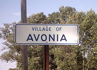
Avonia is an unincorporated community and census-designated place (CDP) in Erie County, Pennsylvania, United States. The population was 1,205 at the 2010 census, down from 1,331 in 2000. It is part of the Erie Metropolitan Statistical Area.

<span class="mw-page-title-main">Northwest Harborcreek, Pennsylvania</span> Census-designated place in Pennsylvania, United States

Northwest Harborcreek is a census-designated place (CDP) in Erie County, Pennsylvania, United States. The population was 8,949 at the 2010 census. It includes the unincorporated communities of Fairfield and Brookside and is part of the Erie Metropolitan Statistical Area.

<span class="mw-page-title-main">East Wheatfield Township, Indiana County, Pennsylvania</span> Township in Pennsylvania, United States

East Wheatfield Township is a township in Indiana County, Pennsylvania, United States. East Wheatfield Township was created when the original Wheatfield Township was divided in 1859 into East and West Wheatfield. It was named for the large unforested areas naturally occurring there which were ideal for growing wheat. The population was 2,161 at the 2020 census, a decline from the figure of 2,366 tabulated in 2010. It includes the communities of Boltz, Cramer, Gas Center, Ninevah, Robindale, Shoupstown, Virginia, and Wheatfield. It surrounds, but does not include, the borough of Armagh.

Davidsville is a census-designated place (CDP) in Somerset County, Pennsylvania, United States. The population was 1,119 at the 2000 census. It is part of the Johnstown, Pennsylvania, Metropolitan Statistical Area. Davidsville is part of the municipality of Conemaugh Township, Somerset County, Pennsylvania, as are the nearby towns of Jerome, Thomas Mills, Tire Hill, Seanor, Hyasota, and part of Holsopple. Davidsville is Area code: 814 Exchange: 479; ZIP Code: 15928.

<span class="mw-page-title-main">Somerset Township, Somerset County, Pennsylvania</span> Township in Pennsylvania, United States

Somerset Township is a township in Somerset County, Pennsylvania, United States. The population was 12,165 at the 2020 census. It is part of the Johnstown, Pennsylvania, Metropolitan Statistical Area and encompasses the census-designated place (CDP) of Friedens.

References

  1. "ArcGIS REST Services Directory". United States Census Bureau. Retrieved October 12, 2022.
  2. "Census Population API". United States Census Bureau. Retrieved October 12, 2022.
  3. "Friedens PA ZIP Code". zipdatamaps.com. 2023. Retrieved May 13, 2023.
  4. "American FactFinder". Archived from the original on May 20, 2011. Retrieved September 4, 2011.
  5. "US Gazetteer files: 2010, 2000, and 1990". United States Census Bureau. February 12, 2011. Retrieved April 23, 2011.
  6. "Census of Population and Housing". Census.gov. Retrieved June 4, 2016.
  7. "U.S. Census website". United States Census Bureau . Retrieved January 31, 2008.