Lower Turkeyfoot Township, Pennsylvania

Last updated

Lower Turkeyfoot Township,
Somerset County, Pennsylvania
Covered Bridge in Confluence.jpg
The Lower Humbert Covered Bridge in Lower Turkeyfoot Township
Map of Somerset County, Pennsylvania highlighting Lower Turkeyfoot Township.PNG
Map of Somerset County, Pennsylvania Highlighting Lower Turkeyfoot Township
Map of Pennsylvania highlighting Somerset County.svg
Map of Somerset County, Pennsylvania
Country United States
State Pennsylvania
County Somerset
Area
[1]
  Total36.26 sq mi (93.91 km2)
  Land35.97 sq mi (93.15 km2)
  Water0.29 sq mi (0.75 km2)
Population
 (2020) [2]
  Total543 Decrease2.svg
  Estimate 
(2021) [2]
538
  Density16.15/sq mi (6.24/km2)
Time zone UTC-5 (Eastern (EST))
  Summer (DST) UTC-4 (EDT)
FIPS code 42-111-45136

Lower Turkeyfoot Township is a township in Somerset County, Pennsylvania, United States. The population was 543 at the 2020 census. [2] It is part of the Johnstown, Pennsylvania, Metropolitan Statistical Area.

Contents

History

1754 map of the Confluence & Turkeyfoot region drawn by George Washington Turkey Foot area map by G Washington.png
1754 map of the Confluence & Turkeyfoot region drawn by George Washington
Upper & Lower Turkeyfoot Townships, Somerset County, Pennsylvania, 1860 Map of Upper & Lower Turkeyfoot Townships, Pennsylvania, from 1860 Somerset County Map by Edward L Walker.jpg
Upper & Lower Turkeyfoot Townships, Somerset County, Pennsylvania, 1860

Turkeyfoot Township was formed from part of Brothersvalley Township in 1773, when both were still part of a larger Bedford County; Somerset County was not formed from the western portion of Bedford County until 1795. [3] Just as new counties were split off from earlier counties, new townships were split off from earlier townships, and the townships of Upper Turkeyfoot & Lower Turkeyfoot took their current shapes in 1848. [3] White settlers arrived in the Turkeyfoot area by the late 1760s, and a group of about 15-20 Baptist families came to the area from New Jersey around 1774. [3]

The Lower Humbert Bridge was added to the National Register of Historic Places in 1980. [4]

Geography

According to the United States Census Bureau, Lower Turkeyfoot Township has a total area of 36.3 square miles (93.9 km2), of which 36.0 square miles (93.2 km2) is land and 0.3 square miles (0.8 km2) (0.80%) is water. The boroughs of Confluence and Ursina are located at the southern end of the township. Lower Turkeyfoot Township is bordered by Upper Turkeyfoot Township to the east, Addison Township to the southeast, and Fayette County to the west. Laurel Hill Creek flows through Lower Turkeyfoot Township, with tributaries such as Cranberry Glade Run, May Run, and Licking Run joining its stream before it enters the Casselman River in Confluence, just before the Casselman River flows into the Youghiogheny River. State Game Lands No. 111 and Cranberry Glade Lake are also located in the township.

Pennsylvania Route 281 passes through Lower Turkeyfoot Township, generally heading northeast from Confluence, passing through Ursina and the southern end of Lower Turkeyfoot Township, and then continuing into Upper Turkeyfoot Township on its way to New Lexington in Middlecreek Township.

Demographics

Historical population
CensusPop.Note
2010 603
2020 543−10.0%
2021 (est.)538 [2] −0.9%
U.S. Decennial Census [5]

As of the census [6] of 2000, there were 672 people, 259 households, and 183 families residing in the township. The population density was 18.7 people per square mile (7.2/km2). There were 444 housing units at an average density of 12.3/sq mi (4.8/km2). The racial makeup of the township was 98.96% White, 0.74% Native American, and 0.30% from two or more races. Hispanic or Latino of any race were 0.89% of the population.

There were 259 households, out of which 25.9% had children under the age of 18 living with them, 59.8% were married couples living together, 6.9% had a female householder with no husband present, and 29.0% were non-families. 27.0% of all households were made up of individuals, and 13.9% had someone living alone who was 65 years of age or older. The average household size was 2.42 and the average family size was 2.91.

In the township the population was spread out, with 20.2% under the age of 18, 8.9% from 18 to 24, 24.9% from 25 to 44, 25.6% from 45 to 64, and 20.4% who were 65 years of age or older. The median age was 42 years. For every 100 females, there were 105.5 males. For every 100 females age 18 and over, there were 102.3 males.

The median income for a household in the township was $27,891, and the median income for a family was $30,789. Males had a median income of $29,643 versus $15,833 for females. The per capita income for the township was $12,812. About 14.6% of families and 18.0% of the population were below the poverty line, including 22.4% of those under age 18 and 14.5% of those age 65 or over.

Related Research Articles

<span class="mw-page-title-main">Somerset County, Pennsylvania</span> County in Pennsylvania, United States

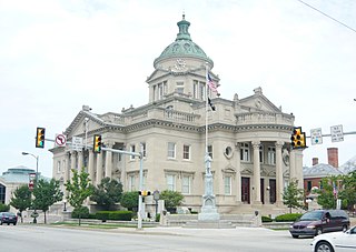
Somerset County is a county in the Commonwealth of Pennsylvania. As of the 2020 census, the population was 74,129. Its county seat is Somerset. The county was created from part of Bedford County on April 17, 1795, and named after the county of Somerset in England.

<span class="mw-page-title-main">Londonderry Township, Bedford County, Pennsylvania</span> Township in Pennsylvania, United States

Londonderry Township is a township in Bedford County, Pennsylvania, United States. It is named after County Londonderry, now in Northern Ireland. The population was 1,635 at the 2020 census.

<span class="mw-page-title-main">Manns Choice, Pennsylvania</span> Borough in Pennsylvania, United States

Manns Choice is a borough in Bedford County, Pennsylvania, United States. The population was 313 at the 2020 census.

<span class="mw-page-title-main">LeBoeuf Township, Erie County, Pennsylvania</span> Township in Pennsylvania, United States

LeBoeuf Township is a township in Erie County, Pennsylvania, United States. The population was 1,657 at the 2020 census, down from 1,698 at the 2010 census.

<span class="mw-page-title-main">Henry Clay Township, Fayette County, Pennsylvania</span> Township in Pennsylvania, United States

Henry Clay Township is a township in Fayette County, Pennsylvania, United States. The population was 1,765 at the 2020 census. The township was created June 9, 1824, from the eastern portion of Wharton Township. It is named for 19th-century American statesman Henry Clay. The northwestern corner of its territory was used to create Stewart Township on November 17, 1855. It is served by the Uniontown Area School District.

<span class="mw-page-title-main">Addison Township, Somerset County, Pennsylvania</span> Township in Pennsylvania, United States

Addison Township is a township in Somerset County, Pennsylvania, United States. The population was 928 at the 2020 census. It is part of the Johnstown, Pennsylvania, Metropolitan Statistical Area. The township is named for Alexander Addison, the first president judge overseeing Somerset County.

<span class="mw-page-title-main">Black Township, Somerset County, Pennsylvania</span> Township in Pennsylvania, United States

Black Township is a township in Somerset County, Pennsylvania, United States. The population was 899 at the 2020 census. It is part of the Johnstown, Pennsylvania, Metropolitan Statistical Area. The township was named for Jeremiah Sullivan Black, a native of Somerset County who became Chief Justice of the Supreme Court of Pennsylvania, U.S. Attorney General, and U.S Secretary of State.

<span class="mw-page-title-main">Casselman, Pennsylvania</span> Borough in Pennsylvania, United States

Casselman is a borough in Somerset County, Pennsylvania, United States.

<span class="mw-page-title-main">Confluence, Pennsylvania</span> Borough in Pennsylvania, United States

Confluence is a borough in Somerset County, Pennsylvania, United States. It is part of the Johnstown, Pennsylvania, Metropolitan Statistical Area. The population was 724 at the 2020 census.

<span class="mw-page-title-main">Garrett, Pennsylvania</span> Borough in Pennsylvania, United States

Garrett is a borough in Somerset County, Pennsylvania, United States. It is part of the Johnstown, Pennsylvania, Metropolitan Statistical Area. The population was 416 at the 2020 census.

<span class="mw-page-title-main">Middlecreek Township, Somerset County, Pennsylvania</span> Township in Pennsylvania, United States

Middlecreek Township is a township in Somerset County, Pennsylvania, United States. The population was 831 at the 2020 census. It is part of the Johnstown, Pennsylvania, Metropolitan Statistical Area.

<span class="mw-page-title-main">Milford Township, Somerset County, Pennsylvania</span> Township in Pennsylvania, United States

Milford Township is a township in Somerset County, Pennsylvania, United States. The population was 1,488 at the 2020 census. It is part of the Johnstown, Pennsylvania, Metropolitan Statistical Area.

<span class="mw-page-title-main">Quemahoning Township, Pennsylvania</span> Township in Pennsylvania, United States

Quemahoning Township is a township in Somerset County, Pennsylvania, United States. The population was 1,838 at the 2020 census. It is part of the Johnstown, Pennsylvania, Metropolitan Statistical Area.

<span class="mw-page-title-main">Rockwood, Pennsylvania</span> Borough in Pennsylvania, United States

Rockwood is a borough in Somerset County, Pennsylvania, United States. The population was 850 at the 2020 census. It is part of the Johnstown, Pennsylvania, Metropolitan Statistical Area, and located due north of Pennsylvania's highest peak, Mount Davis, which significantly constricts land travel routing south of the municipality.

<span class="mw-page-title-main">Somerset Township, Somerset County, Pennsylvania</span> Township in Pennsylvania, United States

Somerset Township is a township in Somerset County, Pennsylvania, United States. The population was 12,165 at the 2020 census. It is part of the Johnstown, Pennsylvania, Metropolitan Statistical Area and encompasses the census-designated place (CDP) of Friedens.

<span class="mw-page-title-main">Summit Township, Somerset County, Pennsylvania</span> Township in Pennsylvania, United States

Summit Township is a township in Somerset County, Pennsylvania, United States. The population was 2,141 at the 2020 census. It is part of the Johnstown, Pennsylvania, Metropolitan Statistical Area.

<span class="mw-page-title-main">Upper Turkeyfoot Township, Pennsylvania</span> Township in Pennsylvania, United States

Upper Turkeyfoot Township is a township in Somerset County, Pennsylvania, United States. The population was 1,063 at the 2020 census. It is part of the Johnstown, Pennsylvania, Metropolitan Statistical Area.

<span class="mw-page-title-main">Ursina, Pennsylvania</span> Borough in Pennsylvania, United States

Ursina is a borough in Somerset County, Pennsylvania, United States. It is part of the Johnstown, Pennsylvania, Metropolitan Statistical Area. The population was 244 at the 2020 census.

<span class="mw-page-title-main">Lower Chanceford Township, Pennsylvania</span> Township in Pennsylvania, United States

Lower Chanceford Township is a township in York County, Pennsylvania, United States. The population was 3,028 at the 2020 United States census|2020 census]].

Laurel Hill Creek is a 39.9-mile-long (64.2 km) tributary of the Casselman River that is located in Somerset County, Pennsylvania, in the United States. It is part of the Youghiogheny River watershed, flowing to the Monongahela River, the Ohio River, and ultimately the Mississippi River.

References

  1. "2016 U.S. Gazetteer Files". United States Census Bureau. Retrieved August 14, 2017.
  2. 1 2 3 4 Bureau, US Census. "City and Town Population Totals: 2020—2021". Census.gov. US Census Bureau. Retrieved July 24, 2022.
  3. 1 2 3 History of Bedford, Somerset and Fulton Counties, Pennsylvania. Chicago: Waterman, Watkins & Co. 1884. pp. 556–566.
  4. "National Register Information System". National Register of Historic Places . National Park Service. July 9, 2010.
  5. "Census of Population and Housing". Census.gov. Retrieved June 4, 2016.
  6. "U.S. Census website". United States Census Bureau . Retrieved January 31, 2008.

39°51′00″N79°20′59″W / 39.85000°N 79.34972°W / 39.85000; -79.34972