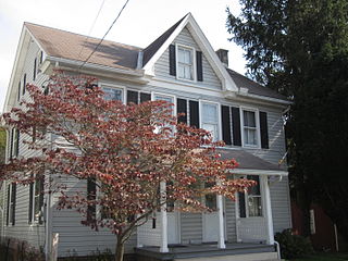
Shade Township is a township in Somerset County, Pennsylvania, United States. The population was 2,452 at the 2020 census. It is part of the Johnstown, Pennsylvania, Metropolitan Statistical Area.

Nottingham is an unincorporated community and census-designated place that is located in West Nottingham Township in Chester County, Pennsylvania, United States.

Falmouth is an unincorporated community and census-designated place (CDP) in Conoy Township, Lancaster County, Pennsylvania, United States. As of the 2010 census the population was 420, but the 2020 census shows that the population has decreased to 397.

Enlow is a census-designated place (CDP) in Allegheny County, Pennsylvania, United States. The community was formerly part of the Imperial-Enlow CDP, which was split into two separate CDPs as of the 2010 census. The population was 1,138 at the 2020 census.
Pardeesville is a census-designated place (CDP) in Hazle Township, Luzerne County, Pennsylvania, United States. The population was 572 at the 2010 census.
Baumstown is a census-designated place in Exeter Township, Berks County, Pennsylvania, United States, located near the borough of Birdsboro. It is located at the junction of U.S. Highway 422 and Pennsylvania Route 345. As of the 2010 census the population of Baumstown was 422 residents.
Blandon is a census-designated place in Maidencreek Township, Berks County, Pennsylvania, United States. It is located at the junction of Pennsylvania Route 73 and Park Road. As of the 2010 census, the population was 7,152 residents.

Mount Aetna is a census-designated place in Tulpehocken Township, Berks County, Pennsylvania, United States. It is located along Pennsylvania Route 501 near the border of Lebanon County. The community is named after the active volcano, Mount Etna, in Sicily. As of the 2010 census, the population was 354 residents.

Cochranville is a census-designated place (CDP) in West Fallowfield Township, Chester County, Pennsylvania, United States. The population was 668 at the 2010 census. It is the hometown of Olympic swimmer Cierra Runge.

Alleghenyville is a census-designated place (CDP) in Brecknock Township, Berks County, Pennsylvania, United States. It is located near the Lancaster County line, and is served by the Governor Mifflin School District. As of the 2010 census the population was 1,134.

Pughtown is an unincorporated community and census-designated place in Chester County, Pennsylvania, United States. The community is located in South Coventry Township on Pennsylvania Route 100, just south of Buckstown. As of 2020, the CDP has a population of 849.

Inkerman is a census-designated place (CDP) in Jenkins Township, Luzerne County, Pennsylvania, United States. The population was 1,819 at the 2010 census.
Hickory Hills is a census-designated place (CDP) in Foster Township, Luzerne County, Pennsylvania, southwest of the borough of White Haven. The CDP population was 562 at the 2010 census.
Hudson is a census-designated place (CDP) in Plains Township, Luzerne County, Pennsylvania, United States. The population was 1,443 at the 2010 census.

Mocanaqua is an unincorporated community and census-designated place (CDP) in Conyngham Township, Luzerne County, Pennsylvania, United States. The population was 646 at the 2010 census.
Pikes Creek is a census-designated place (CDP) in Lake Township, Luzerne County, Pennsylvania, United States. The population was 269 at the 2010 census.

Caln is a census-designated place (CDP) in Caln Township, Chester County, Pennsylvania, United States. The population was 1,519 at the 2010 census. It is located east of the city of Coatesville and lies west of Philadelphia.

New Berlinville is a census-designated place (CDP) in Colebrookdale Township, Berks County, Pennsylvania, United States. It is located along Pennsylvania Route 100, approximately one mile northeast of the borough of Boyertown. As of the 2010 census, the population was 1,368 residents.
New Schaefferstown is a census-designated place in Jefferson Township, Berks County, Pennsylvania. It is located five miles to the west of Bernville. As of the 2010 census, the population was 223 residents.
Blandburg is an unincorporated community and census-designated place (CDP) in Reade Township, Cambria County, Pennsylvania, United States, located along Pennsylvania Route 865 in far northeastern Cambria County. As of the 2010 census, the population was 402 residents.


