Confluence, Pennsylvania

Last updated
Confluence, Pennsylvania
Borough
USACE Youghiogheny Lake and Dam.jpg
Somerset County Pennsylvania Incorporated and Unincorporated areas Confluence Highlighted.svg
Location of Confluence in Somerset County, Pennsylvania.
USA Pennsylvania location map.svg
Red pog.svg
Coordinates: 39°48′36″N79°21′24″W / 39.81000°N 79.35667°W / 39.81000; -79.35667
Country United States
State Pennsylvania
County Somerset
Settled1870
Incorporated1873
Government
  TypeBorough Council
Area
[1]
  Total1.68 sq mi (4.35 km2)
  Land1.60 sq mi (4.14 km2)
  Water0.08 sq mi (0.21 km2)
Population
 (2020) [2]
  Total722
  Density451.25/sq mi (174.19/km2)
Time zone UTC-5 (Eastern (EST))
  Summer (DST) UTC-4 (EDT)
Zip code
15424
Area code 814
FIPS code 42-15680

Confluence is a borough in Somerset County, Pennsylvania, United States. It is part of the Johnstown, Pennsylvania, Metropolitan Statistical Area. The population was 724 at the 2020 census. [3]

Contents

Geography

1754 map of the Confluence & Turkeyfoot region drawn by George Washington Turkey Foot area map by G Washington.png
1754 map of the Confluence & Turkeyfoot region drawn by George Washington

Confluence is at 39°48′36″N79°21′24″W / 39.81000°N 79.35667°W / 39.81000; -79.35667 (39.809997, -79.356692). [4] The borough is located at the southern end of Lower Turkeyfoot Township, and the borough of Ursina sits to its east.

Confluence is named for the juncture of the Casselman River and Laurel Hill Creek with the Youghiogheny River. It therefore provides many opportunities for boating and fishing (and hiking, as Pennsylvania's highest point, Mount Davis, is located nearby).

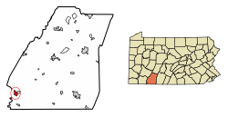
According to the United States Census Bureau, the borough has a total area of 1.6 square miles (4.1 km2), of which 1.6 square miles (4.1 km2) is land and 0.1 square miles (0.26 km2) (3.03%) is water. The borough is bordered to the south by the 2,840-acre (11.5 km2) Youghiogheny River Lake and to the north by the 19,052-acre (77.10 km2) Ohiopyle State Park.

Climate

The climate in this area has mild differences between highs and lows, and there is adequate rainfall year-round. According to the Köppen Climate Classification system, Confluence has a marine west coast climate, abbreviated "Cfb" on climate maps. [5]

Climate data for Confluence 1 SW Dam, Pennsylvania (1991–2020 normals, extremes 1946–present)
MonthJanFebMarAprMayJunJulAugSepOctNovDecYear
Record high °F (°C)76
(24)
78
(26)
85
(29)
92
(33)
93
(34)
98
(37)
104
(40)
101
(38)
99
(37)
91
(33)
80
(27)
79
(26)
104
(40)
Mean daily maximum °F (°C)36.9
(2.7)
40.5
(4.7)
49.5
(9.7)
62.7
(17.1)
72.1
(22.3)
79.8
(26.6)
83.5
(28.6)
82.2
(27.9)
76.1
(24.5)
64.4
(18.0)
51.8
(11.0)
41.2
(5.1)
61.7
(16.5)
Daily mean °F (°C)27.9
(−2.3)
30.3
(−0.9)
38.1
(3.4)
49.5
(9.7)
59.6
(15.3)
67.8
(19.9)
71.6
(22.0)
70.4
(21.3)
63.9
(17.7)
52.3
(11.3)
41.0
(5.0)
32.8
(0.4)
50.4
(10.2)
Mean daily minimum °F (°C)18.8
(−7.3)
20.1
(−6.6)
26.6
(−3.0)
36.4
(2.4)
47.0
(8.3)
55.7
(13.2)
59.7
(15.4)
58.6
(14.8)
51.7
(10.9)
40.1
(4.5)
30.1
(−1.1)
24.4
(−4.2)
39.1
(3.9)
Record low °F (°C)−30
(−34)
−20
(−29)
−10
(−23)
12
(−11)
23
(−5)
29
(−2)
36
(2)
33
(1)
23
(−5)
16
(−9)
4
(−16)
−18
(−28)
−30
(−34)
Average precipitation inches (mm)3.61
(92)
3.41
(87)
3.90
(99)
4.04
(103)
4.92
(125)
4.86
(123)
4.54
(115)
4.02
(102)
3.97
(101)
3.35
(85)
3.07
(78)
3.52
(89)
47.21
(1,199)
Average snowfall inches (cm)18.3
(46)
16.9
(43)
10.3
(26)
0.9
(2.3)
0.0
(0.0)
0.0
(0.0)
0.0
(0.0)
0.0
(0.0)
0.0
(0.0)
0.2
(0.51)
3.7
(9.4)
10.9
(28)
61.2
(155)
Average precipitation days (≥ 0.01 in)17.815.214.615.216.614.613.512.612.012.112.616.0172.8
Average snowy days (≥ 0.1 in)10.28.75.11.00.00.00.00.00.00.12.26.734.0
Source: NOAA [6] [7]

Demographics

Historical population
CensusPop.Note
1880 430
1890 4443.3%
1900 87196.2%
1910 8902.2%
1920 1,03115.8%
1930 989−4.1%
1940 1,0354.7%
1950 1,0370.2%
1960 938−9.5%
1970 9541.7%
1980 9681.5%
1990 873−9.8%
2000 834−4.5%
2010 780−6.5%
2020 724−7.2%
2021 (est.)717 [3] −1.0%
Sources: [8] [9] [10] [11] [2]

At the 2000 census there were 834 people, 349 households, and 211 families residing in the borough. The population density was 522.4 inhabitants per square mile (201.7/km2). There were 404 housing units at an average density of 253.0 per square mile (97.7/km2). The racial makeup of the borough was 99.52% White, 0.24% African American, and 0.24% from two or more races. Hispanic or Latino of any race were 0.24%. [9]

Of the 349 households, 25.8% had children under the age of 18 living with them, 48.4% were married couples living together, 9.2% had a female householder with no husband present, and 39.3% were non-families. 34.4% of households were one person, and 21.8% were one person aged 65 or older. The average household size was 2.26 and the average family size was 2.91.

In the borough the population was spread out, with 20.3% under the age of 18, 7.0% from 18 to 24, 26.9% from 25 to 44, 22.7% from 45 to 64, and 23.3% 65 or older. The median age was 42 years. For every 100 females there were 84.9 males. For every 100 females age 18 and over, there were 79.7 males.

The median household income was $23,462 and the median family income was $31,181. Males had a median income of $26,705 versus $19,750 for females. The per capita income for the borough was $12,129. About 15.0% of families and 21.2% of the population were below the poverty line, including 28.7% of those under age 18 and 20.4% of those age 65 or over.

Related Research Articles

<span class="mw-page-title-main">Liberty, Allegheny County, Pennsylvania</span> Borough in Pennsylvania, United States

Liberty is a borough in Allegheny County, Pennsylvania, United States. The population was 2,355 at the 2020 census.

<span class="mw-page-title-main">Port Vue, Pennsylvania</span> Borough in Pennsylvania, United States

Port Vue is a borough in Allegheny County, Pennsylvania, United States. The population was 3,680 at the 2020 census.

<span class="mw-page-title-main">Versailles, Pennsylvania</span> Borough in Pennsylvania, United States

Versailles is a borough in Allegheny County, Pennsylvania, United States. At the 2020 census, the population was 1,476.

<span class="mw-page-title-main">Darlington, Pennsylvania</span> Borough in Pennsylvania, United States

Darlington is a borough in northwestern Beaver County, Pennsylvania, United States. The population was 248 at the 2020 census. It is a part of the Pittsburgh metropolitan area.

<span class="mw-page-title-main">Connellsville Township, Pennsylvania</span> Township in Pennsylvania, United States

Connellsville Township is a township in Fayette County, Pennsylvania, United States. The population was 2,073 at the 2020 census, a decline from the figure of 2,391 tabulated in 2010.

<span class="mw-page-title-main">Dawson, Pennsylvania</span> Borough in Pennsylvania, United States

Dawson is a borough in Fayette County, Pennsylvania, United States. The population was 352 at the 2020 census, a decline from the figure of 367 tabulated in 2010.

<span class="mw-page-title-main">Dunbar, Pennsylvania</span> Borough in Pennsylvania, United States

Dunbar is a borough in Fayette County, Pennsylvania, United States. The population was 1,013 at the time of the 2020 census, a decline from the figure of 1,042 tabulated in 2010.

<span class="mw-page-title-main">Dunbar Township, Pennsylvania</span> Township in Pennsylvania, United States

Dunbar Township is a township in Fayette County, Pennsylvania, United States. The population was 6,671 at the 2020 census, a decline from the figure of 7,126 tabulated in 2010.

<span class="mw-page-title-main">Everson, Pennsylvania</span> Borough in Pennsylvania, United States

Everson is a borough in Fayette County, Pennsylvania, United States. The population was 768 at the 2020 census. It was incorporated in 1903.

<span class="mw-page-title-main">Henry Clay Township, Fayette County, Pennsylvania</span> Township in Pennsylvania, United States

Henry Clay Township is a township in Fayette County, Pennsylvania, United States. The population was 1,764 at the 2020 census. The township was created June 9, 1824, from the eastern portion of Wharton Township. It is named for 19th-century American statesman Henry Clay. The northwestern corner of its territory was used to create Stewart Township on November 17, 1855. It is served by the Uniontown Area School District.

<span class="mw-page-title-main">Lower Tyrone Township, Pennsylvania</span> Township in Pennsylvania, United States

Lower Tyrone Township is a township in Fayette County, Pennsylvania, United States. The population was 1,069 at the time of the 2020 census.

<span class="mw-page-title-main">Masontown, Pennsylvania</span> Borough in Pennsylvania, United States

Masontown is a borough in Fayette County, Pennsylvania, United States. It is part of the Pittsburgh Metro Area. The population of the borough was 3,274 at the 2020 census. It is served by the Albert Gallatin Area School District. Masontown is a small crossroads for the rural portions of western Fayette County, and it contains a small shopping center and a grocery store within its business district.

<span class="mw-page-title-main">Ohiopyle, Pennsylvania</span> Borough in Pennsylvania, United States

Ohiopyle is a borough in Fayette County, Pennsylvania, United States. The population was 38 at the 2020 census. While Ohiopyle has a tiny year-round population, it is often filled with tourists on the weekend, who come for the outdoor recreation opportunities at the surrounding Ohiopyle State Park, as well as the Great Allegheny Passage bicycle trail which connects with the Chesapeake and Ohio Canal towpath trail to form a continuous 335-mile off-road trail from Pittsburgh, Pennsylvania to Washington, D.C. The borough of Ohiopyle is served by the Uniontown Area School District.

<span class="mw-page-title-main">Point Marion, Pennsylvania</span> Borough in Pennsylvania, United States

Point Marion is a borough in Fayette County, Pennsylvania, United States. The population was 1,152 at the 2020 census, a decline from the figure of 1,159 tabulated in 2010. It is served by the Albert Gallatin Area School District.

<span class="mw-page-title-main">South Connellsville, Pennsylvania</span> Borough in Pennsylvania, United States

South Connellsville is a borough in Fayette County, Pennsylvania, United States. The population was 1,919 at the 2020 census, a decline from the figure of 1,970 tabulated in 2010.

<span class="mw-page-title-main">Stewart Township, Pennsylvania</span> Township in Pennsylvania, United States

Stewart Township is a township in Fayette County, Pennsylvania, United States. It is part of the Pittsburgh metropolitan area. The population was 623 at the 2020 census.

<span class="mw-page-title-main">Lower Turkeyfoot Township, Pennsylvania</span> Township in Pennsylvania, United States

Lower Turkeyfoot Township is a township in Somerset County, Pennsylvania, United States. The population was 543 at the 2020 census. It is part of the Johnstown, Pennsylvania, Metropolitan Statistical Area.

<span class="mw-page-title-main">Ursina, Pennsylvania</span> Borough in Pennsylvania, United States

Ursina is a borough in Somerset County, Pennsylvania, United States. It is part of the Johnstown, Pennsylvania, Metropolitan Statistical Area. The population was 244 at the 2020 census.

<span class="mw-page-title-main">Sutersville, Pennsylvania</span> Borough in Pennsylvania, United States

Sutersville is a borough in Westmoreland County, Pennsylvania, United States. The population was 605 at the 2010 census.

<span class="mw-page-title-main">West Newton, Pennsylvania</span> Borough in Pennsylvania, United States

West Newton, located 24.5 miles (39.4 km) southeast of Pittsburgh, is a borough in Westmoreland County in the U.S. state of Pennsylvania. Formerly, the manufacture of radiators and boilers were the chief industries. The population was 2,633 at the 2010 census.

References

  1. "ArcGIS REST Services Directory". United States Census Bureau. Retrieved October 12, 2022.
  2. 1 2 "Census Population API". United States Census Bureau. Retrieved Oct 12, 2022.
  3. 1 2 Bureau, US Census. "City and Town Population Totals: 2020—2021". Census.gov. US Census Bureau. Retrieved July 24, 2022.
  4. "US Gazetteer files: 2010, 2000, and 1990". United States Census Bureau. 2011-02-12. Retrieved 2011-04-23.
  5. Climate Summary for Confluence, Pennsylvania
  6. "NowData – NOAA Online Weather Data". National Oceanic and Atmospheric Administration. Retrieved August 7, 2021.
  7. "Station: Confluence 1 SW Dam, PA". U.S. Climate Normals 2020: U.S. Monthly Climate Normals (1991-2020). National Oceanic and Atmospheric Administration. Retrieved August 7, 2021.
  8. "Census of Population and Housing". U.S. Census Bureau. Retrieved 11 December 2013.
  9. 1 2 "U.S. Census website". United States Census Bureau . Retrieved 2008-01-31.
  10. "Incorporated Places and Minor Civil Divisions Datasets: Subcounty Resident Population Estimates: April 1, 2010 to July 1, 2012". Population Estimates. U.S. Census Bureau. Archived from the original on 11 June 2013. Retrieved 11 December 2013.
  11. "Census of Population and Housing". Census.gov. Retrieved June 4, 2016.