A locality on the east bank of the Quoich Water close to its confluence with the River Dee.
Altanour Lodge
A ruined hunting lodge (pronounced like Altan Ower), at the head of Glen Ey (southern-end), in a small plantation of spruce and larch.
Named from the nearby stream Alltan Odhar - dun streamlet (Watson 1975).
A four-wheel drive road runs between Altanour Lodge and the public road at Inverey.
Am Beitheachan
A locality (pronounced like be-a-chan) in Glen Quoich upstream of where the Dubh Ghleann joins it near the foot of Beinn a' Bhùird - the little birch place - (Watson 1975).
Although local people always call this E [Glen Quoich as it turns eastward] part the Beitheachan and not the Quoich, all the maps have omitted it.
—Watson (1975)
In Watson (1975) the author is evidently relying on his deep understanding of the local Gaelic for spelling and pronunciation, because in Dixon and Green (1995) (relying of documents) refer to the locality as Beachan - discussing a proposal to put the rental of specific shielings up for public roup (auction):
... and disputes between the tenants of Dalmore and Allanaquoich, led to a proposal in 1727 to put the shielings of Beachan (upper Glen Quoich), Glen Quoich, Glen Lui (recently cleared) [of farmers], Glen Derry, Glen Luibeg and the north side of Glen Dee to public roup (GD 124/1300/4)
—Dixon and Green (1995)
Black Bridge
The bridge in Glen Lui over the Lui Water roughly halfway between Linn of Lui and Derry Wood - see main reference in Glen Lui article.
Bynack Lodge
Along with Derry Lodge, and Geldie Lodge - one of the 'three main' hunting lodges on the estate built in the late nineteenth-century during the rise of hunting on the estate - Dixon and Green (1995).
Chest of Dee
A series of waterfalls and deep pools on the River Dee slightly up-river from White Bridge.
From Ciste Dhe - Watson (1975).
Clach nan Taillear
Clach nan Taillearstone of the tailors - Watson (1975) is a large stone by the Lairig Ghru where:
Three tailors once perished while sheltering in the snow one New Year's Eve. They had wagered that they would dance a reel on the same night in Rothiemurchus and Braemar. Having danced in Speyside, they set out through the Lairig, only to succumb - as usual in these exposure cases - when the worst of the crossing was behind them.
A simple stone building in the Lairig Ghru, at the point below Cairn Toul, used as a Mountain Refuge.
Derry Dam
Derry Dam is a structure - partially surviving in Glen Derry about 1+1⁄2 miles (2.4km) upstream from Derry Lodge and shown on Ordnance Survey maps - according to Watson (1975) it was used to dam the water of the Derry Burn for use floating trees down the glen. He continues:
It was built in the early 19th century by Alexander Davidson, a noted Deeside character who turned to poaching after the timber floating, and whose racy life story you can read in Michie's Deeside Tales
—Watson (1975)
Michie (pronounced like Mickey) is John Grant Michie (1830–1904) a Minister of Dinnet author of Deeside Tales (1872), Loch Kinnord (1877), Logie-Coldstone (1896), and Records of Invercauld (1901) - Wyness (1968).
Derry Lodge
Along with Bynack Lodge, and Geldie Lodge - one of the 'three main' hunting lodges on the estate built in the late nineteenth-century during the rise of hunting on the estate - Dixon and Green (1995).
Located within Derry Wood on the slopes of Derry Cairngorm, it was likely used as temporary accommodation for shooting parties to reduce the need to return to Mar Lodge at night.
Derry Wood
A wooded locality on the slopes of Derry Cairngorm, where Glen Derry, and Glen Luibeg join at the head of Glen Lui - see main reference in Glen Lui article.
Dubh Ghleann
A glen that joins Glen Quoich near the foot of Beinn a Bhuird (pronounced like do glen) - from dark valley - Watson (1975).
Gallows Tree
A tree on the south-bank of the River Dee a short distance west of Victoria Bridge that was used as a gallows.
The date of its last use is not known, but in Wyness (1968) the author recounts the story of a curse against the Farquharsons being fulfilled in 1806 when the "direct male line of Farquharson came to an end". The curse - as he relates - was against a "Farquharson laird" who had sentenced a Lamont of Inverey to death for "cattle-rustling and sheep-steeling".
The tree is dead, supported by wires, and has been since at least 1925.
The Gallows Tree might have remained alive for years, but its roots were undermined by digging of gravel at the roadside, and it fell into the pit. It is now dead, but held in position by wire.
—Gordon (1925)
Geldie Lodge
Along with Bynack Lodge, and Derry Lodge - one of the 'three main' hunting lodges on the estate built in the late nineteenth-century during the rise of hunting on the estate - Dixon and Green (1995).
While describing the course of the River Dee in Anderson (1911) - the author mentions that Geldie Lodge had been tenanted for many years by Lord Farquhar a friend of the estate's owner, the Duke of Fife.
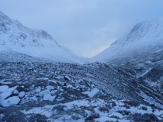
A route and mountain pass that partially lies on Mar Lodge Estate. To its west is The Devil's Point.
Luibeg
A cottage and locality around the Luibeg Burn where it joins with the Derry Burn to create the Lui Water - see main reference in Glen Lui article.
Luibeg Cottage has been home to many of the estate's deer-stalkers or keepers.
March Burn
Is a burn in the Lairig Ghru slightly to the east of the pass summit - the Mar Lodge Estate side.
In the first paragraph of Gordon (1925) the author uses the term 'march' in the old-sense of a boundary:
The Cairngorms rise from the highlands of central Scotland; they stand on the county march between Inverness and Aberdeen, and some of them, as Beinn a' Bhuird and Ben Mac Dhui, are partly in the shire of Banff.
—Gordon (1925) (p1)
He again uses the term in the old-sense when describing a September crossing of the Lairig Ghru where he gives the burn its old as well as its contemporary Anglicised name:
Allt na Criche, or the March Burn, falls in white spray to the Lairig from the northern spur of Ben Mac Dhui. The snow is drifted deeply over this boundary burn, and on this September day a cornice of snow of the past winter still projected half across it.
Literally copse of the robbers - Watson (1975), but colloquially known as Robbers Copse - the wooded locality were the route between Glen Luibeg and the Lairig Ghru crosses the Luibeg Burn.
On the Luibeg side of Preas nam Meirleach - Watson (1975) names the Sands of Lui describing it as a stretch of gravel washed down by the floods in 1829 and 1956.
The flood of 1829 is 'remembered' in Deeside as the Muckle Spate. On the evening of the 2nd of August 1829 it began raining, and continued into the next day when a thunder storm broke in the afternoon over the Cairngorms. The Dee being the main river of the district rose rapidly above its normal level - 15ft (4.6m) in places (27ft at Banchory) carrying away the bridges over the Linn of Dee, and Linn of Quoich - Wyness (1968).
Ruighe Ealasaid
Ruighe Ealasaid – meaning 'Elizabeth's shiel' –Watson and Allen 1984 is a partially ruined house in Glen Geldie close to the confluence of the Bynack Burn with the Geldie Burn.
Like other place names on the estate incorporating 'shiel' - the name probably pre-dates the existing building bearing the name.
Ruigh nan clach
Ruigh nan clach – meaning 'sheil of the stones' –Watson and Allen 1984 is a ruined keeper's house near the bank of the Geldie Burn a short distance upstream from White Bridge.
The name is derived from 'Ruighe nan clach' – and commemorates an earlier sheiling nearby.
St Ninian's Chapel stands immediately adjacent to Mar Lodge and was originally the private chapel of the owners of Mar Lodge. Alexander Duff, 1st Duke of Fife, and his family are buried in the chapel.
Sapper's Bothy
A ruined stone 'bothy' just east of the summit of Ben Macdui built around 1847 by (or for the use of) the survey team from the Ordnance Survey who surveyed the Cairn Gorm / Ben Macdui plateau. This survey settled the argument over whether Ben Macdui or Ben Nevis was the highest mountain in Britain.
In Watson (1975) the author gives its map reference as 991988.
The source of the River Dee, the water rising from a spring on the Braeriach / Einich plateau at about 1,220m (4,000ft) - Watson (1975) - who continues:
After about 2/3 km on the plateau, the infant Dee crashes over the rocky face of Garbh Choire Dhaidh and cascades 150 m to the bed of the corrie below. A large snow bridge often lasts far into summer at the top of the fall; below the stream thunders on down to Glen Dee.
—Watson (1975)
The Ordnance Survey maps name the waterfall the Falls of Dee, the corrie as An Garbh Choire, and the burn as Allt a Gharbh choire. Covering the same ground earlier in the twentieth century - Anderson (1911) records:
Here the stream acquires the name of the Garchary - an Anglicised version of a Gaelic title signifying "The burn of the rough corrie"; and well is the corrie so named. The Garchary Fall proper is about 600 feet (180m) in length, but the stream descends 1,400 feet (430m) farther till it reaches the defile separating Braeriach and Ben Muich Dhui [sic].
The River Dee is a river in Aberdeenshire, Scotland. It rises in the Cairngorms and flows through southern Aberdeenshire to reach the North Sea at Aberdeen. The area it passes through is known as Deeside, or Royal Deeside in the region between Braemar and Banchory because Queen Victoria came for a visit there in 1848 and greatly enjoyed herself. She and her husband, Prince Albert, built Balmoral Castle there which replaced an older castle.
The Cairngorms are a mountain range in the eastern Highlands of Scotland closely associated with the mountain Cairn Gorm. The Cairngorms became part of Scotland's second national park on 1 September 2003. Although the Cairngorms give their name to, and are at the heart of, the Cairngorms National Park, they only form one part of the national park, alongside other hill ranges such as the Angus Glens and the Monadhliath, and lower areas like Strathspey.
The Grampian Mountains is one of the three major mountain ranges in Scotland, that together occupy about half of Scotland. The other two ranges are the Northwest Highlands and the Southern Uplands. The Grampian range extends northeast to southwest between the Highland Boundary Fault and the Great Glen. The range includes many of the highest mountains in the British Isles, including Ben Nevis and Ben Macdui.
In Scottish folklore, Am Fear Liath Mòr is the name for a presence or creature which is said to haunt the summit and passes of Ben Macdui, the highest peak of the Cairngorms and the second highest peak in British Isles after Ben Nevis.
Ben Macdui is the second-highest mountain in Scotland and all of the British Isles, after Ben Nevis, and the highest of the Cairngorm Mountains. The summit is 1,309 metres (4,295 ft) above sea level and it is classed as a Munro. Ben Macdui is situated on the southwestern edge of the Cairngorm plateau, overlooking the Lairig Ghru pass to the west, and Loch Etchachan to the east. It lies on the boundary between the historic counties of Aberdeenshire and Banffshire.
The Lairig Ghru is one of the mountain passes through the Cairngorms of Scotland. The route and mountain pass partially lies on the Mar Lodge Estate.
Cairn Toul is the 4th-highest mountain in Scotland and all of the British Isles, after Ben Nevis, Ben Macdui and Braeriach. The summit is 1,291 metres above sea level. It is in the western massif of the Cairngorms, linked by a bealach at about 1125 m to Braeriach. The mountain towers above the Lairig Ghru pass.
Beinn a' Chaorainn is a Scottish mountain in the heart of the Cairngorms range. It is quite a remote hill, being located roughly 19 kilometres south east of Aviemore and 14 kilometres north west of Braemar. The mountain stands on the border of the Moray and Aberdeenshire council areas. The hill's name used to be spelt as Beinn a' Chaoruinn, but the spelling of the word caorunn was altered to caorann by the Gaelic Orthographic Convention's attempts to standardise spelling.
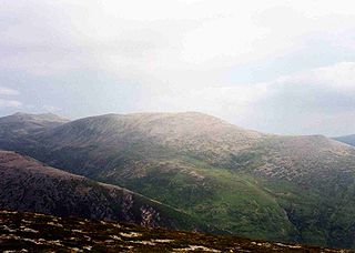
Derry Cairngorm is a Scottish mountain in the Cairngorms range, 14 kilometres (8.7 mi) north west of Braemar in the county of Aberdeenshire.
Càrn a' Mhàim is a Scottish mountain situated in the inner part of the Cairngorms range, some 15 kilometres west of Braemar in the county of Aberdeenshire.
Corrour Bothy is a simple stone building on Mar Lodge Estate, Aberdeenshire, Scotland.
Mar Lodge Estate is a highland estate in western Aberdeenshire, Scotland, which has been owned and managed by the National Trust for Scotland (NTS) since 1995. Its principal building, Mar Lodge, is about 4 miles (6.4 km) west of the village of Braemar. The estate is recognised as one of the most important nature conservation landscapes in the British Isles and occupies nearly 8% of the Cairngorms National Park, covering 29,340 hectares. The natural heritage value of the estate is reflected by the fact that much of it is designated as a Site of Special Scientific Interest (SSSI), a Special Area of Conservation (SAC) and a Special Protection Area (SPA). The entire estate has been classified as a national nature reserve since May 2017, and is designated a Category II protected area by the International Union for Conservation of Nature.
Glen Lui from Gleann Laoigh – calves' glen – Gordon (1925) is one of the major glens on the Mar Lodge Estate, in Aberdeenshire, Scotland.
Beinn a' Bhùird is a Munro in the Cairngorm mountain range of Scotland.
The Cairngorm Club is a mountaineering club, based in Aberdeen, Scotland formed in June 1887.
Beinn Bhreac is a twin-peaked Scottish mountain located above Glen Derry in the Cairngorm Mountains approximately 11 kilometres (7 mi) north-west of Braemar.
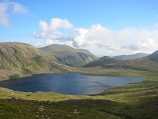
Loch Etchachan is a remote freshwater loch set deep within the central Cairngorms plateau, in the Cairngorms National Park, located in the eastern Highlands of Scotland. It is the highest waterbody of its size in the UK, the surface being 927 metres (3,041 ft) above sea level. However, the highest named bodies of water in the UK are Loch Coire an Lochain, which lies 6km to the west of Loch Etchachan on the opposite side of the Lairig Ghru, and Lochan Buidhe, which lies between Cairn Lochan and Ben Macdui.
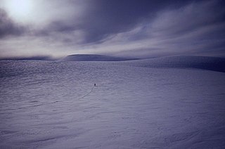
The Cairngorm Plateau disaster, also known as the Feith Buidhe disaster, occurred in November 1971 when six fifteen-year-old Edinburgh school students and their two leaders were on a two-day navigational expedition in a remote area of the Cairngorms in the Scottish Highlands.
The Lairig an Laoigh is a mountain pass through the Highlands of Scotland. In speech and sometimes in writing the name is reduced to "Lairig Laoigh". It is of glacial origin, dissecting the Cairngorm plateau, and it runs roughly north–south from Speyside to Deeside at one time being used as a drove road. Between the public road in the Abernethy Forest and the one at Linn of Dee the trekking distance is 31 kilometres (19 mi).
This article describes the geology of the Cairngorms National Park, an area in the Highlands of Scotland designated as a national park in 2003 and extended in 2010. The Cairngorms National Park extends across a much wider area than the Cairngorms massif itself and hence displays rather more varied geology.
This page is based on this Wikipedia article Text is available under the CC BY-SA 4.0 license; additional terms may apply. Images, videos and audio are available under their respective licenses.