
Blanca is a Statutory Town located in Costilla County, Colorado, United States. The town population was 322 at the 2020 census. Blanca is located in the enormous San Luis Valley.

Las Baulas de Guanacaste Marine National Park is a National Park of Costa Rica and a Ramsar Site. The park is managed by the Tempisque Conservation Area, and covers approximately a 167.3 square kilometres (64.6 sq mi) marine area of the Tamarindo Bay, next to the town of Tamarindo. It supports the largest nesting colony of leatherback sea turtles on the Pacific coast of the Americas. Female leatherbacks often come ashore at Playa Grande between October and May to lay their eggs.
Zapandí Riverine Wetlands, is a nature reserve in Guanacaste Province, northwestern Costa Rica, created by decree 22732-MIRENEM in 1993.
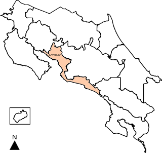
Central Pacific Conservation Area is an administrative area which is managed by SINAC for the purposes of conservation in the southwestern part of Costa Rica, on the Pacific coast. It contains four National Parks, and a number Wildlife refuges and other types of nature reserve.

Reloncaví Sound or Seno de Reloncaví is a body of water immediately south of Puerto Montt, a port city in the Los Lagos Region of Chile. It is the place where the Chilean Central Valley meets the Pacific Ocean.
El Yali National Reserve is a nature reserve of Chile located in the southern portion of the Valparaíso Region. This coastal wetland is a Ramsar site and covers an area of 5.2 km2.

The Bogotá savanna is a montane savanna, located in the southwestern part of the Altiplano Cundiboyacense in the center of Colombia. The Bogotá savanna has an extent of 4,251.6 square kilometres (1,641.6 sq mi) and an average altitude of 2,650 metres (8,690 ft). The savanna is situated in the Eastern Ranges of the Colombian Andes.
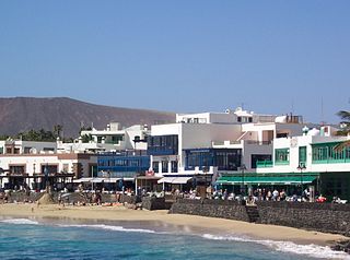
Playa Blanca is the southernmost town of the Spanish island of Lanzarote. It is the newest resort on the island, and is part of the municipality of Yaiza.
Wetlands of Bogotá, Colombia, are important areas of the capital city, and their development has become increasingly important for the area north of the Andes. A reserve for fauna and flora, the wetlands provide for the preservation and reproduction of a wide variety of mammals, reptiles and birds. These include more than 95 species of migratory birds, as well as many endemic plant species. The wetlands are part of the Bogotá River basin. The wetland complex has been designated as a protected Ramsar site since 2018.

Córdoba is a wetland, part of the Wetlands of Bogotá in Bogotá, Colombia. It is situated on the Bogotá savanna in the locality Suba between the Avenida Boyacá and Avenida Córdoba and the streets Calle 127 and Calle 116, close to the TransMilenio stations Av. Suba Calle 116 and namesake station Humedal Córdoba. The wetland covers about 40 hectares.
Protected areas of Panama include:

The Juan Amarillo, Arzobispo, or Salitre River is a river on the Bogotá savanna and a left tributary of the Bogotá River in Colombia. The river originates from various quebradas in the Eastern Hills and flows into the Bogotá River at the largest of the wetlands of Bogotá, Tibabuyes, also called Juan Amarillo Wetland. The total surface area of the Juan Amarillo basin, covering the localities Usaquén, Chapinero, Santa Fe, Suba, Barrios Unidos, Teusaquillo, and Engativá, is 12,892 hectares. Together with the Fucha and Tunjuelo Rivers, the Juan Amarillo River forms part of the left tributaries of the Bogotá River in the Colombian capital.
Cañas River Lacustrine Wetland, is a protected area in Costa Rica, managed under the Tempisque Conservation Area, it was created in 1994 by decree 23075-MIRENEM.
Corral de Piedra Palustrine Wetland, is a protected area in Costa Rica, managed under the Tempisque Conservation Area, it was created in 1994 by decree 22898-MIRENEM.
Madrigal Lake Wetland, is a protected area in Costa Rica, managed under the Arenal Tempisque Conservation Area, it was created in 1994 by decree 23076-MIRENEM.
Paraguas Lake Lacustrine Wetland, is a protected area in Costa Rica, managed under the Pacific La Amistad Conservation Area, it was created in 1994 by decree 22880-MIRENEM.
San Vito Wetland, is a protected area in Costa Rica, managed under the Pacific La Amistad Conservation Area, it was created in 1994 by decree 22879.
Térraba-Sierpe Wetland, is a protected area in Costa Rica, managed under the Osa Conservation Area, it was created in 1994 by decree 22993-MIRENEM. It has been designated as a protected Ramsar site since 1995.
Puntarenas Estuary and Associated Mangrove Swamps Wetland, is a protected area in Costa Rica, managed under the Central Pacific Conservation Area, it was created in 2006 by decree 33327-MINAE.

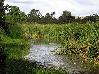
Chamiza Wetland is a marine wetland in Reloncaví Sound in southern Chile. The wetland lies around the outflow of Chamiza River east of the city of Puerto Montt and close to northernmost section of Carretera Austral. The wetland has been the site of various studies of waders and marine invertebrates. Urbanizations and dog attacks on birds have been identified as threats to the ecosystem of the wetland.
