Playa del Rey is an affluent beachside community in the Westside of the city of Los Angeles, California. It has a ZIP code of 90293 and area codes of 310 and 424. As of 2014, the Playa del Rey population was 12,129 people. Since 2000, it has had a population growth of 14.61 percent.

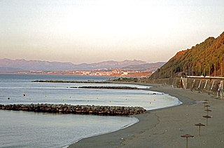
Catalan Bay is a small bay and fishing village in Gibraltar, on the eastern side of The Rock away from the main city.

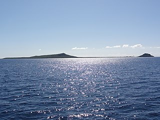
Caja de Muertos is an uninhabited island off the southern coast of Puerto Rico, in the municipality of Ponce. The island is protected by the Reserva Natural Caja de Muertos natural reserve, because of its native turtle traffic. Hikers and beachgoers are often seen in the island, which can be reached by ferry from the La Guancha Boardwalk sector of Ponce Playa. Together with Cardona, Ratones, Morrillito, Isla del Frio, Gatas, and Isla de Jueyes, Caja de Muertos is one of seven islands ascribed to the municipality of Ponce.

Catia La Mar is a city and port in the municipality of Vargas, in the State of Vargas, Venezuela. It is Maiquetia's neighbor to the west.
Playa Vicente is a municipality located in the south zone of the State of Veracruz, about 220 km from state capital Xalapa. It has a surface of 2,122.14 km2. It is located at 17°50′N95°49′W.
La Playa is a bayfront neighborhood in the Point Loma community of San Diego, California. It is bordered by the San Diego Bay on the east, Naval Base Point Loma on the south, the Wooded Area neighborhood to the west and Point Loma Village/Roseville-Fleetridge to the north. It lies across a channel from Shelter Island.

Playa de la Barrosa is a 6 kilometres (3.7 mi) long beach in the municipality of Chiclana de la Frontera, Province of Cádiz, Spain. It was the site of the Battle of Barrosa in 1811. it is separated from the Playa de Sancti Petri by a cliff. The resort of Novo Sancti Petri lies at the south end of Playa de la Barrosa and contains a defensive tower structure called Torre Bermeja. Several pieces of music have been composed about the beach including Isaac Albéniz's Torre Bermeja and Paco de Lucía's La Barrosa.

Playa del Barranco is a beach in the municipality of Algeciras, southeastern Spain. It overlooks the Bay of Algeciras. It is approximately 500 metres in length. To the north is the Playa de El Rinconcillo.

Playa de El Chinarral is a beach in the municipality of Algeciras, southeastern Spain. It overlooks the Bay of Algeciras and the tip of the rock of Gibraltar. It is approximately 250 metres in length and 40 metres wide on average. It is located between Punta de San Garcia and El Rodeo, south of the city.

Playa de Los Ladrillos is a beach in the municipality of Algeciras, southeastern Spain. It overlooks the Bay of Algeciras, next to Playa del Barranco. It is about 200 metres in length.

Playa del Chorillo is a beach of Ceuta, a Spanish city bordering northern Morocco. Like the Playa de la Ribera, it lies to the south of the isthmus. It has a length of about 1200 metres and average width of 30 metres, with black sand.

Playa de la Ribera is a beach of Ceuta, a Spanish city bordering northern Morocco. Like the Playa del Chorillo, it lies to the south of the isthmus, but on the part where it joins the mainland. It is about 405 metres long, with an average width of 40 metres. It is very busy during the summer months.
Playa El Tarajal is a beach of Ceuta, bordering northern Morocco. The beach is about 250 metres in length with an average width of about 15 metres.

The Batería de la Atunara was an artillery battery in La Línea de la Concepción, Spain. Constructed by the Spanish military in 1735, it served as part of the line of defenses in the Gibraltar area. It was built by the Government of Spain in fear that the British Overseas Territory would spread over the isthmus.
Playa de La Hacienda is a beach in the municipality of La Línea de la Concepción, in the Province of Cádiz, Andalusia, Spain. It has a length of about 4.3 kilometres (2.7 mi) and average width of about 90 metres (300 ft). It is a busy beach north of the city and bordered to the south with the Playa de Torrenueva and to the north with the Playa de La Alcaidesa.

Playa de Levante is a beach in the municipality of La Línea de la Concepción, in the Province of Cádiz, Andalusia, Spain, located to the north of Gibraltar. It has a length of about 2.2 kilometres (1.4 mi) and average width of about 30 metres (98 ft). It is a busy beach promenade enclosed by the city and on the south by the Playa de Santa Bárbara and the north of Playa de La Atunara. It has all the basic services required of an urban beach, daily waste collection season, toilets, showers and disabled access and presence of police and local rescue equipment.

Playa de Torrenueva is a beach in the municipality of La Línea de la Concepción, in the Province of Cádiz, Andalusia, Spain, located to the northeast of Gibraltar. It has a length of about 1,250 metres (4,100 ft) and average width of about 120 metres (390 ft). It is a busy little beach north of the city and bordered on the south by the Playa de La Atunara and north by the Playa de La Hacienda. In the vicinity are the remains of the Torre Nueva, a watchtower belonging to coastal surveillance system developed during the sixteenth century. It has all the basic services required of an urban beach, daily waste collection season, toilets and showers as well as the presence of police and local rescue equipment.

Playa de Sobrevela is a beach in the municipality of La Línea de la Concepción, in the Province of Cádiz, Andalusia, Spain. It has a length of about 2.0 kilometres (1.2 mi) and average width of about 150 metres (490 ft). It is a busy beach north of the city and bordered to the south with the Playa de La Atunara and to the north with the Playa de Torrenueva.


