
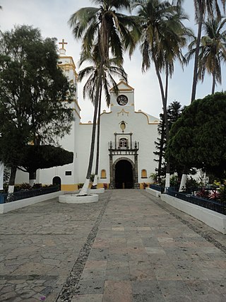
Guadalajara is a metropolis in western Mexico and the capital of the state of Jalisco. According to the 2020 census, the city has a population of 1,385,629 people, making it the 7th most populous city in Mexico, while the Guadalajara metropolitan area has a population of 5,268,642 people, making it the third-largest metropolitan area in the country and the twentieth largest metropolitan area in the Americas Guadalajara has the second-highest population density in Mexico, with over 10,361 people per square kilometer. Within Mexico, Guadalajara is a center of business, arts and culture, technology and tourism; as well as the economic center of the Bajío region. It usually ranks among the 100 most productive and globally competitive cities in the world. It is home to numerous landmarks, including Guadalajara Cathedral, the Teatro Degollado, the Templo Expiatorio, the UNESCO World Heritage site Hospicio Cabañas, and the San Juan de Dios Market—the largest indoor market in Latin America.
Coatlán del Río is a town in the Mexican state of Morelos. It stands at 18°45′N99°26′W, at a mean height of 1,010 metres above sea level.

Temixco is the fourth-largest city in the Mexican state of Morelos. It stands at 18°51′N99°14′W in the west-northwest part of the state.

La Paz is a municipality in the State of Mexico, Mexico, with its municipal seat in the town of Los Reyes Acaquilpan. It is located on the dividing line between Mexico State and the eastern edge of the Federal District and is part of the Greater Mexico City area. The area was part of a region called "Atlicpac" which in Náhuatl means 'above or at the edge of water.' The current city's/municipality's glyph symbolizes water.

Colonia del Valle is a neighborhood in the Benito Juarez borough of Mexico City. It includes "...a great number of parks, vast and tree-lined streets, prestigious shopping malls, and some city landmarks...".

Old Portal de Mercaderes in the historic center of Mexico City was and is the west side of the main plaza. This side of the plaza has been occupied by commercial structures since the Spanish Conquest of the Aztec Empire in 1521. Today the west side of the square is dominated by two sets of buildings with Madero Street dividing them as it runs west from the Zocalo to the Palace of Bellas Artes. The buildings on the north side of Madero is occupied by offices on the upper floors and shops at ground level. The southside buildings are dominated on the ground floor by fine jewelry stores, marking the beginning of the "Centro Joyero Zocalo." This center extends west for two block engulfing Palma Street between Madero and 16 de Septiembre streets. Most of the upper floors of the buildings here are occupied by rooms associated with the Hotel de Ciudad de Mexico and the Hotel Majestic.

The Old Customs Building is located on the east side of Santo Domingo Plaza between Republica de Venezuela and Luis Gonzalez Obregon Streets just to the north of the main plaza of Mexico City. The land here originally belonged to several nobles, including the Marquis of Villamayor. The Royal Customs office was in charge of the regulation of imported merchandise into New Spain and taxing the same, becoming the largest source of revenue for the government. The office originally was on 5 de febrero Street but was moved into the Villamayor house in 1676 because of its location next to Santo Domingo Plaza. Eventually, the government bought the house and rebuilt it in 1730, which is the building that survives today. Eventually, the Customs office in Mexico City closed and it was taken over by the Secretariat of Public Education in the early part of the 20th century. It remains as offices of this government agency.

Tlaxcoaque is a plaza located in the historic center of Mexico City which has given its name to both the 17th-century church that is on it and the blocks that surround it. Historically this plaza and the church that sits on it have marked the southern edge of Mexico City, and today it is on the border of the historic center and Colonia Obrera. The church and plaza are somewhat isolated from the rest of the center due to the construction of wide streets, such as 20 de Noviembre and Fray Servando Teresa de Mier, that separate them from the surrounding buildings. Another notable building in this area is the police surveillance station, which was infamous in the 1970s as a place where detainees were tortured. This stopped after the 1985 Mexico City earthquake exposed handcuffed bodies which had evidence of torture on them. Today, the area around this plaza is semi-deserted outside of work hours and is considered to be a high-crime area. The church itself has experienced break-ins.

The Museo de la Estampa is a museum in Mexico City, dedicated to the history, preservation and promotion of Mexican graphic arts. The word “estampa” means works in the various printmaking techniques which have the quality of being reproducible and include seals, woodcuts, lithography and others. The museum was created in 1986 and located in a 19th-century Neoclassical building located in the Plaza de Santa Veracruz in the historic center of the city. This building was remodeled both to house the museum and to conserve its original look.

Colonia Algarín is a very small working class residential neighborhood located south of the historic center of Mexico City. Its border to the north is Eje 3 Sur José Peón Contreras, to the south Viaducto Miguel Alemán, to the east San Antonio Abad Ave and to the west Eje Central Lázaro Cárdenas. Colonia Algarín is located between colonias Buenos Aires, Álamos (Viaducto), Obrera and Asturias. On the south border, alongside Viaducto Miguel Alemán, flows the Río de la Piedad. This river, just as in the case as many other rivers of the city, is encased in cement.

The Conjunto Urbano Nonoalco Tlatelolco is the largest apartment complex in Mexico, and second largest in North America, after New York's Co-op City. The complex is located in the Cuauhtémoc borough of Mexico City. It was built in the 1960s by architect Mario Pani. Originally, the complex had 102 apartment buildings, with its own schools, hospitals, stores and more, to make it a city within a city. It was also created to be a kind of human habitat and includes artwork such as murals and green spaces such as the Santiago Tlatelolco Garden. Today, the complex is smaller than it was and in a state of deterioration, mostly due to the effects and after effects of the 1985 Mexico City earthquake. This quake caused the immediate collapse of the Nuevo León building with others being demolished in the months afterwards. Further earthquakes in 1993 caused the condemnation of more buildings. In addition to the lost buildings, many residents eventually undersold or abandoned their apartments, as repairs were either never made or made poorly.

Colonia Atlampa is a colonia or neighborhood located in the Cuauhtémoc borough, northwest of the historic center of Mexico City. The boundaries of the area are marked by the following streets: Calzada de Nonoalco or Ricardo Flores Magón Street to the south, Circuito Interior Paseo de las Jacarandas to the north, Avenida Insurgentes Norte to the east and Circuito Interior Instituto Politécnico Industrial to the west. The neighborhood is considered lower class and working class. The name is derived from a Nahuatl phrase meaning "where the water divides."

Colonia Buenavista is a colonia or neighbourhood in the Cuauhtémoc borough located northwest of the historic center of Mexico City. It has historically been a train terminal, and still is as the southern terminal of the Tren Suburbano commuter rail. The colonia is also home to the offices of the Cuauhtémoc borough and the mega José Vasconcelos Library.

Colonia Guerrero is a colonia of Mexico City located just north-northwest of the historic center. Its borders are formed by Ricardo Flores Magón to the north, Eje Central Lazaro Cardenas and Paseo de la Reforma to the east, Eje1 Poniente Guerrero to the west and Avenida Hidalgo to the south. The colonia has a long history, beginning as an indigenous neighborhood in the colonial period called Cuepopan. The origins of the modern colonia begin in the first half of the 19th century, but most of its development occurred as a residential area in the late 19th and early 20th. Over the 20th century, several rail lines and major arteries were built through here, changing its character Cuauhtémoc borough. It is home to two early colonial era churches, the Franz Mayer Museum and one Neo-Gothic church from the Porfirian era.

Colonia Morelos is a colonia located just north of the historic center of Mexico City in the Cuauhtémoc borough. It has been a poor area since Aztec times, with many residents today living in large tenements called vecindades. The area, particularly the Tepito neighborhood, is known for crime, especially the sale of stolen merchandise and drugs. It is home to the very large Tepito tianguis or market, and also has two major places of worship dedicated to Santa Muerte.

Colonia Peralvillo is a colonia located in the Cuauhtémoc borough of Mexico City, just northwest of the city's historic center. It has been a poor area since colonial times, but the modern colonia was not established until the late 19th and early 20th centuries. Although the area has been the setting for a number of literary works and films, today the area is known for violence and crime, especially shootings and the selling of stolen auto parts.

Colonia Tabacalera is a colonia or neighborhood in the Cuauhtémoc borough of Mexico City, on the western border of the city's historic center. It was created in the late 19th century along with other nearby colonias such as Colonia San Rafael and Colonia Santa María la Ribera. From the early 1900s, it became a mixture of mansions and apartment buildings, with major constructions such as the now Monument to the Revolution and the El Moro skyscraper built in the first half of the century. By the 1950s, the area had a bohemian reputation with writers, artists, and exiles living there. These included Fidel Castro and Ernesto “Che” Guevara, who met each other and began planning the Cuban Revolution there. Today, the colonia is in decline with problems such as prostitution, crime, street vending and traffic. However, the area is still home to some of the many traditional Mexican cantinas that populated it in its heyday.

La Romita is a small neighborhood located in the Colonia Roma section of Mexico City. The area began as an independent pre Hispanic village called Aztacalco, later renamed Romita. When the area around the village was redeveloped into housing for the wealthy, the village resisted and remained separate socially although officially part of Colonia Roma. During the 20th century the area had a reputation for being dangerous as it residents were relatively poor. Today, the area is no longer poor or dangerous, but its streets are narrower than the rest of Colonia Roma and its residents still consider themselves distinct.
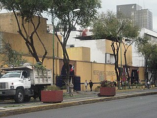
The Ciudadela Market is a traditional style Mexican market which specializes in the sale of Mexican handcrafts and folk art, located in the southwest corner of the historic center of Mexico City. The market is the first of its kind in the country, established just before the 1968 Summer Olympics to promote this aspect of Mexico's cultural heritage. It is home to over 350 vendors, mostly small operators selling to Mexican and foreign tourists.


