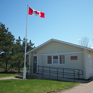
Pleasant Hills is a no longer inhabited, former community in the Canadian province of Nova Scotia, located in Colchester County.
South of Pleasant Hills are the communities of Upper Economy and Little Bass River.
Pleasant Hills is a no longer inhabited, former community in the Canadian province of Nova Scotia, located in Colchester County.
South of Pleasant Hills are the communities of Upper Economy and Little Bass River.
Little Bass River is a sub-community in Colchester County, Nova Scotia, Canada. It forms the western portion the community of Bass River.
Upper Economy is a rural area of approximately 50 residents and 5 km2 located along Trunk 2 in western Colchester County, Nova Scotia. It stretches from along the north shoreline of the western end of Cobequid Bay north into the lower slopes of the Cobequid Mountains. Upper Economy is considered locally to be part of the rural community of Economy. It borders Little Bass River to the west and the former community of Pleasant Hills to the north.
Wentworth is a small Canadian rural community located in the Wentworth Valley of Cumberland County, Nova Scotia. It is named after Sir John Wentworth, a former lieutenant-governor of the province.

Route 207 is a collector road in the Canadian province of Nova Scotia. It is located in the Halifax Regional Municipality and connects Dartmouth to Porters Lake on the Eastern Shore.

The Salmon River is a Canadian river in central Nova Scotia's Colchester County.

Gore is a rural Canadian community in central Hants County, Nova Scotia. It is located just 25 minutes from Elmsdale; 30 minutes from Halifax Stanfield International Airport; and 45 minutes from Truro. It was named after Sir Charles Stephen Gore. The community was settled primarily by the 84th Regiment of Foot.
Brookfield is a Canadian rural community located in southern Colchester County, Nova Scotia, Canada. Brookfield is a growing community in the heart of Nova Scotia, just forty minutes from the provincial capital of Halifax, thirty minutes from the Stanfield International Airport and ten minutes from the Town of Truro. The community hosts both levels of public schools, two churches, restaurants, a bakery, a service station, a sportsplex, an 18 hole golf course, and a volunteer fire service.
Pleasant Point is a community of the Halifax Regional Municipality in the Canadian province of Nova Scotia.
Upper Rawdon is a community in the Canadian province of Nova Scotia, located in the Municipal District of East Hants, which is in Hants County, Nova Scotia. This community was originally part of the Rawdon Township.
Mount Thom is a community in the Canadian province of Nova Scotia, located in Pictou County. It is at an elevation of 200m and is situated on Nova Scotia Trunk 4.

Westchester Station is a community in the Canadian province of Nova Scotia, located in Cumberland County. Eagle Hill Cemetery is located in the community.
Beaver Brook is a small community in the Canadian province of Nova Scotia, located in Colchester County. It is a mainly rural community with one small saw mill. Beaver Brook is located on the 236 Highway just west of the community of Old Barns. The "Beaver Brook" runs through the community's farm fields and finally into the Cobequid Bay at the headwaters of the Bay of Fundy.
Pleasant Valley is a community in the Canadian province of Nova Scotia, located in Colchester County.
Pleasant Valley is a community located in Pictou County in Nova Scotia, Canada.
Folly Mountain is a mountain and a community in the Canadian province of Nova Scotia, located in Colchester County on Trunk 4 in the Cobequid Hills.
Mount Pleasant is a community in the Canadian province of Nova Scotia, located in Cumberland County.
Lower Pleasant Valley is a community in the Canadian province of Nova Scotia, located in Colchester County.
There are various Black Lakes in Nova Scotia, Canada. They vary widely in size, depth and usability. Many counties, such as Cumberland, Halifax, Inverness, and Pictou Counties have more than one Black Lake so named, while other counties mentioned in this article have only one named Black Lake.
The River Philip is a river contained entirely within Cumberland County, Nova Scotia, Canada.
The Stewiacke Valley is a Canadian rural region in central Nova Scotia running from western Pictou County through southern Colchester County to the Shubenacadie River.
45°26′11.5″N63°50′54.31″W / 45.436528°N 63.8484194°W