
County Donegal is a county of Ireland in the province of Ulster. It is named after the town of Donegal in the south of the county. It has also been known as County Tyrconnell, after the historic territory of the same name, on which it was based. Donegal County Council is the local council and Lifford the county town.
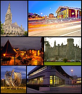
Letterkenny, nicknamed "the Cathedral Town", is the largest and most populous town in County Donegal, Ireland. It lies on the River Swilly in East Donegal and has a population of 19,274. It is the 36th largest settlement in all of Ireland by population and is the 15th largest settlement by population in the historic province of Ulster. Along with the nearby city of Derry, Letterkenny is considered a regional economic gateway for the north-west of Ireland. Letterkenny acts as an urban gateway to the Ulster Gaeltacht, similar to Galway's relationship to the Connemara Gaeltacht.

Glenties is a town in County Donegal, Ireland. It is situated where two glens meet, north-west of the Bluestack Mountains, near the confluence of two rivers. Glenties is the largest centre of population in the parish of Iniskeel. Glenties has won the Irish Tidy Towns Competition five times in 1958, 1959, 1960, 1962 and 1995 and has won a medal many other times. As of 2016, the population is 805.

Lifford is the county town of County Donegal, Ireland. It is the administrative capital of the county and the seat of Donegal County Council, although the town of Letterkenny is often mistaken for fulfilling this role.

Inishowen is a peninsula in the north of County Donegal in Ireland. Inishowen is the largest peninsula on the island of Ireland.

Árainn Mhór is an island off the west coast of County Donegal, Ireland. Arranmore is the largest inhabited island of County Donegal, with a population of 469 in 2016, down from 514 in 2011, 528 in 2006, 543 in 2002, and over 600 in 1996. The island is part of the Donegal Gaeltacht, with most of the inhabitants speaking Ulster Irish.

An Clochán Liath is a town in County Donegal, Ireland. It is the main town in The Rosses and the largest in the Donegal Gaeltacht. Dungloe developed as a town in the middle of the 18th century, and now serves as the administrative and retail centre for the west of County Donegal, and in particular The Rosses, with the only mainland secondary school for the area.

Slane Castle is located in the village of Slane, within the Boyne Valley of County Meath, Ireland. The castle has been the family seat of the Conyngham family since it was built in the late 18th century, on land first purchased in 1703 by Brig.-Gen. Henry Conyngham.

Tory Island, or simply Tory, is an island 14.5 kilometres off the north-west coast of County Donegal, Ireland, and is the most remote inhabited island of Ireland. It is also known in Irish as Oileán Thoraí or, historically, Oileán Thúr Rí. The word Tory comes from the Middle Irish word Tóraidhe which means bandit.

Ballintra is a village in the parish of Drumholm in the south of County Donegal, Ireland, just off the N15 between Donegal town and Ballyshannon. Ballintra lies on the northern bank of the Blackwater river.. The river rises in the hills that lie inland from the town, and flows through a number of small lakes before spilling over a small waterfall in a gorge behind the village.

Raphoe is a historical town in County Donegal, Ireland. It is the main town in the fertile district of east Donegal known as the Laggan, as well as giving its name to the barony of Raphoe, which was later divided into the baronies of Raphoe North and Raphoe South, as well as to the Roman Catholic Diocese of Raphoe and the Church of Ireland (Anglican) Diocese of Derry and Raphoe.

Durrus is a village and civil parish in West Cork in Ireland. It is situated six miles (9.7 km) from Bantry in County Cork, at the head of the Sheep's Head and the Mizen Head peninsulas.

Termon is a village and townland in the north of County Donegal, Ireland.
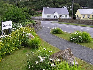
Croithlí or Croichshlí is a village in the Gaeltacht parishes of Gweedore and The Rosses in the west of County Donegal, Ireland. The two parishes are separated by the Crolly River. It has one convenience shop/restaurant and petrol station and one public house, Páidí Óg's.

Porthall is a village in County Donegal in Ulster, the northern province in Ireland. The village is located on the west bank of the River Foyle, in The Laggan district of East Donegal, on the R265 linked to the R236 regional road. Its nearest town is Lifford, the county town of County Donegal.
Kilclooney More is a townland in the northwest of Ireland in coastal County Donegal. It is situated halfway between Narin and Ardara at the R261 on the Loughrea Peninsula.

Inishkeel is a small tidal island and a townland off the coast of County Donegal, Ireland. The closest village on the mainland is Narin.

The R249 road is a regional road in Ireland, located in County Donegal.
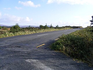
The R259 road is a regional road in Ireland, located in County Donegal. It is a scenic route around the coast of The Rosses.

An election to Donegal County Council took place on 24 May 2019 as part of the Irish local elections. 37 councillors were elected for a five-year term of office from 7 local electoral areas (LEAs) by single transferable vote.
