Related Research Articles

The South Province is one of three administrative subdivisions in New Caledonia. It corresponds to the southern and southwestern portion of the New Caledonian mainland.

The Roman Catholic Archdiocese of Nouméa is a Metropolitan Archdiocese in New Caledonia. It is responsible for the suffragan dioceses of Port-Vila and Wallis et Futuna.

Šanac is a municipality where the town of Kruševac is located. It is situated along the left bank of the river Zapadna Morava. A typical megalopolis of Serbian Pomoravlje, mostly stretched along the main road, expanding into the valley and, in some places, into the hill above.
Pirogues River is a major river of southwestern New Caledonia. It flows into the sea at Pirogues Bay. It is noted for its ophiolite reserves.
The Ouenghi River is a river of New Caledonia. It has a catchment area of 270 square kilometres. Bouloupais lies near the river at the foot of Mount Ouitchambo. It enters the Saint Vincent Bay to the west of the village of Tomo.
The Tontouta River is a river of New Caledonia. It has a catchment area of 476 square kilometres.
The La Coulée River is a river of New Caledonia. It has a catchment area of 92 square kilometres.
The Dumbéa River is a river of New Caledonia. It has a catchment area of 233 square kilometres. It is a beautiful river, and flows from the Diahot River.
The Yaté River is a river of New Caledonia. It has a catchment area of 450 square kilometres. A major mining area, the Yaté Dam lies near the mouth and the town of Yaté.
The Pourina River is a river of New Caledonia. It has a catchment area of 98 square kilometres.
The Ouinné River is a river of New Caledonia. It has a catchment area of 146 square kilometres.
The Kouakoué River is a river of New Caledonia. It has a catchment area of 77 square kilometres.
The Nimbo (Mba) River is a river of New Caledonia. It has a catchment area of 85 square kilometres.
The Thio River is a river of New Caledonia. It has a catchment area of 404 square kilometres.
The Nakéty River is a river of New Caledonia. It has a catchment area of 106 square kilometres.
Stade Rivière Salée is a football stadium located in Noumea, New Caledonia. The stadium has a capacity of 3,000. It hosts the home games of a number of local football teams, including AS Kirikitr, as well as serving as a host venue for the 2011 Pacific Games men's football tournament. The stadium hosted every Group "A" match at this tournament from 27 August 2011 to 5 September 2011. In hosting Group "A" matches, the Stade Rivière Salée held the games of American Samoa, Guam, Solomon Islands, Tuvalu and Vanuatu.
Stade Boewa is a sports stadium in Boulari Bay, New Caledonia that is primarily used for association football. The stadium is home to a number of local clubs and was also a venue used in the men's football tournament at the 2011 Pacific Games. As such, Stade Boewa was the venue of the 2011 Pacific Games' biggest victories, namely Papua New Guinea's 17-1 win over Kiribati on 3 September 2011 and Tahiti's 17-1 win over Kiribati on 5 September 2011.

Pigeon Springs is a place in Cowlitz County, Washington. Pigeon Springs is located east of the city of Kalama and along the Kalama River. Pigeon Springs is reached by traveling 16.8 miles (27.0 km) east on Kalama River Road from exit 32 of Interstate 5. The springs were a source of bottled mineral water.
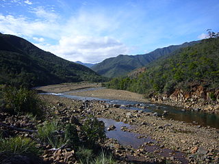
The Blue River Provincial Park is a nature reserve in Yaté Commune, South Province, New Caledonia.
References
- ↑ "A late Quaternary record of environmental change and human impact from New Caledonia" (PDF). Australian National University . Retrieved 9 June 2011.CS1 maint: discouraged parameter (link)
| | This New Caledonian location article is a stub. You can help Wikipedia by expanding it. |
Coordinates: 22°16′31″S166°37′26″E / 22.27528°S 166.62389°E