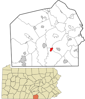
Lake Heritage is a census-designated place (CDP) in Adams County, Pennsylvania, United States. Its population was 1,333 at the 2010 census.
Emden is an unincorporated community in eastern Shelby County, Missouri, United States. It is located on Route 168 approximately nine miles east of Shelbyville.
Spring Creek is a 25.2-mile-long (40.6 km) tributary of Bald Eagle Creek in Centre County, Pennsylvania in the United States.
Little Conococheague Creek is a 12.4-mile-long (20.0 km) tributary stream of the Potomac River in the U.S. states of Maryland and Pennsylvania. The stream rises on Two Top Mountain, west of the Whitetail Ski Resort in Franklin County, Pennsylvania, and proceeds south into Washington County, Maryland. It empties into the Potomac about 2 miles (3 km) southeast of Big Spring, Maryland. The watershed of the creek is 18 square miles (47 km2) and includes Indian Springs Wildlife Management Area. Tributaries include Toms Run.

Ocurí is a small town in the Bolivian Potosí Department.

Raka is a village in Danga Township in Saga County in the Shigatse Prefecture of the Tibet Autonomous Region of China. It lies along the G219 road near the junction with the northern heading S206 road on the road to Qierexiang, roughly 50 kilometres (31 mi) east of Saga at an altitude of 5,565 metres (18,258 ft). Historically it lay in the province of Tsang. Raka is very well connected, connected by provincial highway 206 to Coqen in the north, Saga in the southwest and Lhatse, Shigatse and Lhasa to the east. Several kilometres to the east is the village of Kyêrdo. An "enormous tributary" called the Raka Tsanpo flows nearby and the saline lake of Raka Lake is also located in the vicinity.

All Saints' Episcopal Church, is an historic Carpenter Gothic church built in 1892 on Simpson Avenue in Round Lake, New York. It is a contributing property in the Round Lake Historic District.

Huétor-Tájar is a municipality and town located in the province of Granada (Andalusia), in the southern Spain. It is situated 43 km west of the city of Granada, and its population in 2007 was 9,467. The municipality's extension is close to 40 km². Huétor-Tájar lies within the fertile Genil river valley, a part of the Granada depression.
Broad Run is a tributary stream of the Potomac River in Montgomery County, Maryland. The headwaters of the stream originate west of the town of Poolesville, and the creek flows southward for 8.9 miles (14.3 km) to the Potomac River. The Broad Run and its watershed are almost entirely within the Montgomery County Agricultural Reserve.
Holman is an unincorporated community in southeastern Fayette County, Texas, United States. Holman has a population of approximately 100 people. It lies 15 miles southeast of La Grange, Texas.

Muddy Branch is a tributary stream of the Potomac River in Montgomery County, Maryland, United States, located about 14 miles (23 km) northwest of Washington, D.C.

CIAU-FM is a French-language community radio station that operates at 103.1 FM in Radisson, Quebec, Canada.

Conotton Creek is a tributary of the Tuscarawas River, 38.7 miles (62.3 km) long, in eastern Ohio in the United States. Via the Tuscarawas, Muskingum and Ohio Rivers, it is part of the watershed of the Mississippi River, draining an area of 286 square miles (741 km²) in Carroll, Harrison and Tuscarawas County, Ohio. The source is at 1240 feet and the mouth is at 874 feet. Dover Dam, downstream on the Tuscarawas river, is normally dry, but can impound a reservoir on Conotton and tributaries to a pool elevation of 916 feet for downstream flood control by the Corp of Engineers. From its source in eastern Harrison County, Ohio the creek flows west northwest through Jewitt, Scio, Conotton, Bowerston, Leesville, Sherrodsville, New Cumberland and Somerdale before reaching its mouth in central Tuscarawas County, Ohio. The Wheeling and Lake Erie Railway is situated in the valley. Ohio State Route 151 runs in the valley from near the source to Bowerston. Ohio State Route 212 run along the valley from Bowerston to the mouth. The Conotton Creek Trail runs from Bowerston to Jewett.

Mountain Creek is a 20.9-mile-long (33.6 km) tributary of Yellow Breeches Creek in Cumberland County, Pennsylvania.

Occoquan Reservoir is a 2,100-acre (850 ha) reservoir in northeast Virginia, southwest of Washington, D.C., straddling part of the boundary between Fairfax County and Prince William County, west of Alexandria. It is formed by the Occoquan Dam on the Occoquan River.

Willoughby Run is a tributary of Marsh Creek in Adams County, Pennsylvania in the United States.
White Run is a Pennsylvania stream which flows along the Gettysburg National Military Park and is an eponym of the Rock Creek-White Run hospital complex for field hospitals of the Battle of Gettysburg. The run's mouth is at Rock Creek near the Trostle Farm along the Sachs Road, site of a hospital east of Round Top, Pennsylvania.
Cortsville is an unincorporated community in Clark County, in the U.S. state of Ohio.
Adonis is an unincorporated community in northern Polk County, in the U.S. state of Missouri.

The Pennsylvania State Game Lands Number 25 are Pennsylvania State Game Lands in Elk County in Pennsylvania in the United States providing hunting, bird watching, and other activities.


