Savalyapuram is a village in Guntur district of the Indian state of Andhra Pradesh.

Hwagok Station is a station on Seoul Subway Line 5 in Gangseo-gu, Seoul.

Słotwina is a village in the administrative district of Gmina Świdnica, within Świdnica County, Lower Silesian Voivodeship, in south-western Poland. Prior to 1945 it was in Germany.
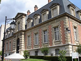
The Musée Pasteur is a museum dedicated to scientist Louis Pasteur. It is located within the Institut Pasteur at 25 Rue du Docteur Roux, Paris, France, in the 15th arrondissement, and open daily in the warmer months; an admission fee is charged.

Shirakavan is a village in the Shirak Province of Armenia.
Miechowice Duże is a village in the administrative district of Gmina Brześć Kujawski, within Włocławek County, Kuyavian-Pomeranian Voivodeship, in north-central Poland.
Stare Zalesie is a village in the administrative district of Gmina Wyszki, within Bielsk County, Podlaskie Voivodeship, in north-eastern Poland. It lies approximately 26 kilometres (16 mi) west of Bielsk Podlaski and 38 km (24 mi) south-west of the regional capital Białystok.

Aşağı Yemişcan is a village in the Khojali Rayon of Azerbaijan.
Rożniatów-Kolonia is a village in the administrative district of Gmina Uniejów, within Poddębice County, Łódź Voivodeship, in central Poland. It lies approximately 10 kilometres (6 mi) north of Uniejów, 19 km (12 mi) north-west of Poddębice, and 53 km (33 mi) north-west of the regional capital Łódź.
Mysłów is a village in the administrative district of Gmina Wola Mysłowska, within Łuków County, Lublin Voivodeship, in eastern Poland. It lies approximately 3 kilometres (2 mi) south-east of Wola Mysłowska, 30 km (19 mi) west of Łuków, and 78 km (48 mi) north-west of the regional capital Lublin.
Bogusławice is a village in the administrative district of Gmina Sadowie, within Opatów County, Świętokrzyskie Voivodeship, in south-central Poland. It lies approximately 4 kilometres (2 mi) east of Sadowie, 4 km (2 mi) north of Opatów, and 57 km (35 mi) east of the regional capital Kielce.
Roztylice is a village in the administrative district of Gmina Waśniów, within Ostrowiec County, Świętokrzyskie Voivodeship, in south-central Poland. It lies approximately 7 kilometres (4 mi) south of Waśniów, 17 km (11 mi) south-west of Ostrowiec Świętokrzyski, and 43 km (27 mi) east of the regional capital Kielce.

Shuangjiang Lahu, Va, Blang and Dai Autonomous County is a county in the southwest of Yunnan province, China. It is under the administration of the prefecture-level city of Lincang.
Wólka Turowska is a village in the administrative district of Gmina Grójec, within Grójec County, Masovian Voivodeship, in east-central Poland.
Gutkowo is a village in the administrative district of Gmina Siemiątkowo, within Żuromin County, Masovian Voivodeship, in east-central Poland. It lies approximately 8 kilometres (5 mi) south-east of Siemiątkowo, 29 km (18 mi) south-east of Żuromin, and 92 km (57 mi) north-west of Warsaw.
Strachomino is a village in the administrative district of Gmina Będzino, within Koszalin County, West Pomeranian Voivodeship, in north-western Poland. It lies approximately 11 kilometres (7 mi) south-west of Będzino, 23 km (14 mi) west of Koszalin, and 118 km (73 mi) north-east of the regional capital Szczecin.
Miłkowo is a settlement in the administrative district of Gmina Biały Bór, within Szczecinek County, West Pomeranian Voivodeship, in north-western Poland. It lies approximately 10 kilometres (6 mi) north of Biały Bór, 32 km (20 mi) north of Szczecinek, and 162 km (101 mi) north-east of the regional capital Szczecin.
Großer Stein is a mountain of Saxony, southeastern Germany.

Khemissa is a town and commune in Souk Ahras Province in north-eastern Algeria. It is the location of Thubursicum Numidarum, a well-preserved Roman theater.
Starbrick is a census-designated place located in Conewango Township, Warren County in the state of Pennsylvania. The community is located along the famous U.S. Route 6, just to the west of the city of Warren. As of the 2010 census the population was 522 residents.


